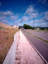


countryside

icone_mesure
slug
countryside

Measurement_2e33258b-1abb-4097-ba67-44027412b5d7

Measured radiation

0.077 µSv/h
geolocalisation :

48.5952167, 1.980049

Ground level
filgif
Date de la mesure :
Latitude :
48.5952167
Longitude :
1.980049
Altitude (M) :
193.0
Measurement time :
4 minutes 30 secondes
Distance travelled :
184.21m
Measurement speed :
Measurement Environment :
En campagne countryside
Weather :
Tags :
Description :
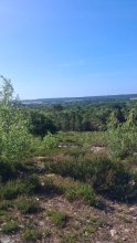
measurment image
Temperature :
22.0°C
Hits number :
60
Mesure UUID :
2e33258b-1abb-4097-ba67-44027412b5d7
Manual Reporting :
No
Sensor / ID :
3d1c8d76
Sensor / Firmware version :
RiumGM BLE -b
Sensor / Type :
Sensor / Tube type :
J305γβ
Smartphone / UUID :
5aa693882a0da8b1
Smartphone / Platform :
android
Smartphone / Model :
SM-A266B
Smartphone / OS Version :
16
Position acurracy :
4.0
Measurement height above the ground (in meters) :
1.00
Altitude accuracy :
4.0
Mean qualification :
Ground level
Software version :
OpenRadiation app 3.1.1
Measured value :
0.077 µSv/h

Measurement_2fa61132-dd89-4d0c-9641-369f9e15148a

Measured radiation

0.073 µSv/h
geolocalisation :

48.2807783, 7.6053125

Ground level
f4htb
Date de la mesure :
Latitude :
48.2807783
Longitude :
7.6053125
Altitude (M) :
215.0
Measurement time :
5 minutes
Distance travelled :
Measurement speed :
Measurement Environment :
En campagne countryside
Weather :
Tags :
Description :
Temperature :
20.0°C
Hits number :
98
Mesure UUID :
2fa61132-dd89-4d0c-9641-369f9e15148a
Manual Reporting :
No
Sensor / ID :
00132
Sensor / Firmware version :
OpengKIT72
Sensor / Type :
Sensor / Tube type :
SBM-20
Smartphone / UUID :
Smartphone / Platform :
Smartphone / Model :
Smartphone / OS Version :
Position acurracy :
Measurement height above the ground (in meters) :
Altitude accuracy :
Mean qualification :
Ground level
Software version :
openradiation_pythonbridge_v1
Measured value :
0.073 µSv/h

Measurement_ff044970-b88e-4e44-a90d-c61442391264

Measured radiation

0.147 µSv/h
geolocalisation :

48.697945, 2.1708983333333

Ground level
Fanche
Date de la mesure :
Latitude :
48.697945
Longitude :
2.1708983333333
Altitude (M) :
43.0
Measurement time :
1 minutes 5 secondes
Distance travelled :
6.38m
Measurement speed :
Measurement Environment :
En campagne countryside
Weather :
Tags :
Description :
Temperature :
Hits number :
49
Mesure UUID :
ff044970-b88e-4e44-a90d-c61442391264
Manual Reporting :
No
Sensor / ID :
safecast_id 2344
Sensor / Firmware version :
$BNRDD
Sensor / Type :
Sensor / Tube type :
Smartphone / UUID :
Smartphone / Platform :
Smartphone / Model :
Smartphone / OS Version :
Position acurracy :
5.0
Measurement height above the ground (in meters) :
1.00
Altitude accuracy :
5.0
Mean qualification :
Ground level
Software version :
openradiation.net/upload v0.9
Measured value :
0.147 µSv/h

Measurement_7bd152b4-3990-4d03-9cfa-0bc46c41888e

Measured radiation

0.048 µSv/h
geolocalisation :

48.7162259, 1.9189548

Ground level
Emma
Date de la mesure :
Latitude :
48.7162259
Longitude :
1.9189548
Altitude (M) :
210.0
Measurement time :
5 minutes 1 secondes
Distance travelled :
835.43m
Measurement speed :
Measurement Environment :
En campagne countryside
Weather :
Tags :
Description :
Vtt
Temperature :
35.0°C
Hits number :
79
Mesure UUID :
7bd152b4-3990-4d03-9cfa-0bc46c41888e
Manual Reporting :
No
Sensor / ID :
00169
Sensor / Firmware version :
OpengKIT71
Sensor / Type :
Sensor / Tube type :
SBM-20
Smartphone / UUID :
deb5dbd4c1a7d5c3
Smartphone / Platform :
android
Smartphone / Model :
REA-NX9
Smartphone / OS Version :
15
Position acurracy :
3.8
Measurement height above the ground (in meters) :
1.00
Altitude accuracy :
3.8
Mean qualification :
Ground level
Software version :
OpenRadiation app 3.1.1
Measured value :
0.048 µSv/h

Measurement_5b06320e-bc1e-46ba-893e-975b094e93dd

Measured radiation

0.116 µSv/h
geolocalisation :

46.8427033, -0.9155901

Ground level
F5ZV
Date de la mesure :
Latitude :
46.8427033
Longitude :
-0.9155901
Altitude (M) :
312.0
Measurement time :
3 minutes 12 secondes
Distance travelled :
0.00m
Measurement speed :
Measurement Environment :
En campagne countryside
Weather :
Tags :
Description :
Temperature :
28.0°C
Hits number :
67
Mesure UUID :
5b06320e-bc1e-46ba-893e-975b094e93dd
Manual Reporting :
No
Sensor / ID :
00074
Sensor / Firmware version :
OpengKIT72
Sensor / Type :
Sensor / Tube type :
Smartphone / UUID :
907d856f31bb1cb4
Smartphone / Platform :
android
Smartphone / Model :
Action-X5
Smartphone / OS Version :
12
Position acurracy :
3.8
Measurement height above the ground (in meters) :
1.00
Altitude accuracy :
3.8
Mean qualification :
Ground level
Software version :
OpenRadiation app 3.1.1
Measured value :
0.116 µSv/h

Measurement_32c6d7cd-1e34-41ad-80c6-1d29500573e7

Measured radiation

0.220 µSv/h
geolocalisation :

45.9606863, 3.7498792

Ground level
PTFCJB
ATYPICAL MEASURE
Date de la mesure :
Latitude :
45.9606863
Longitude :
3.7498792
Altitude (M) :
749.0
Measurement time :
3 minutes
Distance travelled :
Measurement speed :
Measurement Environment :
En campagne countryside
Weather :
Tags :
Description :
Temperature :
Hits number :
Mesure UUID :
32c6d7cd-1e34-41ad-80c6-1d29500573e7
Manual Reporting :
Yes
Sensor / ID :
Sensor / Firmware version :
Sensor / Type :
Sensor / Tube type :
Smartphone / UUID :
ACA0F7CE-767E-48DA-AAD9-84C5935EDDE9
Smartphone / Platform :
iOS
Smartphone / Model :
iPhone8,4
Smartphone / OS Version :
11.2.5
Position acurracy :
5005.0
Measurement height above the ground (in meters) :
1.00
Altitude accuracy :
5005.0
Mean qualification :
Ground level
Software version :
OpenRadiation app 1.0.0
Measured value :
0.220 µSv/h

Measurement_592b2724-bba8-4be7-855e-ae12c6704fbf

Measured radiation

0.102 µSv/h
geolocalisation :

44.620054388872, 4.7461186669984

Ground level
Date de la mesure :
Latitude :
44.620054388872
Longitude :
4.7461186669984
Altitude (M) :
74.0
Measurement time :
2 minutes 25 secondes
Distance travelled :
0.00m
Measurement speed :
Measurement Environment :
En campagne countryside
Weather :
rainy day Pluie
Tags :
Description :
Temperature :
14.0°C
Hits number :
58
Mesure UUID :
592b2724-bba8-4be7-855e-ae12c6704fbf
Manual Reporting :
No
Sensor / ID :
00193
Sensor / Firmware version :
OpengKIT71
Sensor / Type :
Sensor / Tube type :
SBM-20
Smartphone / UUID :
78B035B2-14E3-48A1-8F11-841EA591211D
Smartphone / Platform :
iOS
Smartphone / Model :
iPhone9,3
Smartphone / OS Version :
13.3
Position acurracy :
6.0
Measurement height above the ground (in meters) :
0.00
Altitude accuracy :
6.0
Mean qualification :
Ground level
Software version :
OpenRadiation app 2.3.1
Measured value :
0.102 µSv/h

Measurement_188fe3fc-c778-412a-b786-30d5c9818478

Measured radiation

0.089 µSv/h
geolocalisation :

47.360881, 5.0317327

Ground level
suzon-21
Date de la mesure :
Latitude :
47.360881
Longitude :
5.0317327
Altitude (M) :
318.0
Measurement time :
5 minutes
Distance travelled :
0.00m
Measurement speed :
Measurement Environment :
En campagne countryside
Weather :
Tags :
Description :
Ahuy, route de Dijon.
Radiacode 102. +-19%
measurment image
Temperature :
22.0°C
Hits number :
Mesure UUID :
188fe3fc-c778-412a-b786-30d5c9818478
Manual Reporting :
Yes
Sensor / ID :
Sensor / Firmware version :
Sensor / Type :
Sensor / Tube type :
Smartphone / UUID :
4eef54416c0db30e
Smartphone / Platform :
android
Smartphone / Model :
P50T_E_ROW
Smartphone / OS Version :
16
Position acurracy :
0.5
Measurement height above the ground (in meters) :
1.00
Altitude accuracy :
0.5
Mean qualification :
Ground level
Software version :
OpenRadiation app 3.1.1
Measured value :
0.089 µSv/h

Measurement_921f6188-32c3-4014-badd-83544cba1ce8

Measured radiation

0.048 µSv/h
geolocalisation :

48.2807783, 7.6053125

Ground level
f4htb
Date de la mesure :
Latitude :
48.2807783
Longitude :
7.6053125
Altitude (M) :
215.0
Measurement time :
5 minutes
Distance travelled :
Measurement speed :
Measurement Environment :
En campagne countryside
Weather :
Tags :
Description :
Temperature :
17.0°C
Hits number :
79
Mesure UUID :
921f6188-32c3-4014-badd-83544cba1ce8
Manual Reporting :
No
Sensor / ID :
00132
Sensor / Firmware version :
OpengKIT72
Sensor / Type :
Sensor / Tube type :
SBM-20
Smartphone / UUID :
Smartphone / Platform :
Smartphone / Model :
Smartphone / OS Version :
Position acurracy :
Measurement height above the ground (in meters) :
Altitude accuracy :
Mean qualification :
Ground level
Software version :
openradiation_pythonbridge_v1
Measured value :
0.048 µSv/h

Measurement_65303faa-b0f1-4290-836a-0222d5b7e710

Measured radiation

0.178 µSv/h
geolocalisation :

46.481994831218, 0.52337547492148

Ground level
Radiation Civaux
Date de la mesure :
Latitude :
46.481994831218
Longitude :
0.52337547492148
Altitude (M) :
131.0
Measurement time :
1 minutes 59 secondes
Distance travelled :
11.39m
Measurement speed :
Measurement Environment :
En campagne countryside
Weather :
Tags :
Description :
Temperature :
24.0°C
Hits number :
51
Mesure UUID :
65303faa-b0f1-4290-836a-0222d5b7e710
Manual Reporting :
No
Sensor / ID :
Sensor / Firmware version :
Bertin RadConnect v1.0.1969
Sensor / Type :
Sensor / Tube type :
J305γβ
Smartphone / UUID :
9FFD4694-AFF5-4983-BA79-2B58187A388C
Smartphone / Platform :
ios
Smartphone / Model :
iPhone13,2
Smartphone / OS Version :
26.2.1
Position acurracy :
8.9
Measurement height above the ground (in meters) :
1.00
Altitude accuracy :
8.9
Mean qualification :
Ground level
Software version :
OpenRadiation app 3.1.1
Measured value :
0.178 µSv/h