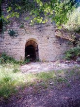


countryside

icone_mesure
slug
countryside

Measurement_5bc33e9e-f938-458b-a93f-a1f43548ba46

Measured radiation

0.156 µSv/h
geolocalisation :

46.475938560928, 0.5267881067354

Ground level
Radiation Civaux
Date de la mesure :
Latitude :
46.475938560928
Longitude :
0.5267881067354
Altitude (M) :
134.0
Measurement time :
2 minutes 13 secondes
Distance travelled :
184.60m
Measurement speed :
Measurement Environment :
En campagne countryside
Weather :
Tags :
Description :
CLI8626
Temperature :
24.0°C
Hits number :
51
Mesure UUID :
5bc33e9e-f938-458b-a93f-a1f43548ba46
Manual Reporting :
No
Sensor / ID :
Sensor / Firmware version :
Bertin RadConnect v1.0.1969
Sensor / Type :
Sensor / Tube type :
J305γβ
Smartphone / UUID :
9FFD4694-AFF5-4983-BA79-2B58187A388C
Smartphone / Platform :
ios
Smartphone / Model :
iPhone13,2
Smartphone / OS Version :
26.2.1
Position acurracy :
3.0
Measurement height above the ground (in meters) :
1.00
Altitude accuracy :
3.0
Mean qualification :
Ground level
Software version :
OpenRadiation app 3.1.1
Measured value :
0.156 µSv/h
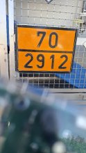
Measurement_b37823c3-41ce-4891-b269-8c7538df6f77

Measured radiation

0.149 µSv/h
geolocalisation :

46.5366586, 0.5758766

Ground level
G@louf86
Date de la mesure :
Latitude :
46.5366586
Longitude :
0.5758766
Altitude (M) :
149.0
Measurement time :
17 minutes 52 secondes
Distance travelled :
16.50m
Measurement speed :
Measurement Environment :
En campagne countryside
Weather :
Tags :
Description :
Chemin accès grange.
Temperature :
28.0°C
Hits number :
396
Mesure UUID :
b37823c3-41ce-4891-b269-8c7538df6f77
Manual Reporting :
No
Sensor / ID :
Sensor / Firmware version :
Bertin RadConnect v1.0.1969
Sensor / Type :
Sensor / Tube type :
J305γβ
Smartphone / UUID :
d5c99a581300879b
Smartphone / Platform :
android
Smartphone / Model :
SM-A530F
Smartphone / OS Version :
9
Position acurracy :
5.0
Measurement height above the ground (in meters) :
1.00
Altitude accuracy :
5.0
Mean qualification :
Ground level
Software version :
OpenRadiation app 3.1.1
Measured value :
0.149 µSv/h

Measurement_6f084ca6-feb1-425c-99b4-51b885f13a04

Measured radiation

0.162 µSv/h
geolocalisation :

46.481307118752, 0.52298151103381

Ground level
Radiation Civaux
Date de la mesure :
Latitude :
46.481307118752
Longitude :
0.52298151103381
Altitude (M) :
132.0
Measurement time :
2 minutes 9 secondes
Distance travelled :
162.80m
Measurement speed :
Measurement Environment :
En campagne countryside
Weather :
Tags :
Description :
CLI8626
Temperature :
24.0°C
Hits number :
51
Mesure UUID :
6f084ca6-feb1-425c-99b4-51b885f13a04
Manual Reporting :
No
Sensor / ID :
Sensor / Firmware version :
Bertin RadConnect v1.0.1969
Sensor / Type :
Sensor / Tube type :
J305γβ
Smartphone / UUID :
9FFD4694-AFF5-4983-BA79-2B58187A388C
Smartphone / Platform :
ios
Smartphone / Model :
iPhone13,2
Smartphone / OS Version :
26.2.1
Position acurracy :
4.4
Measurement height above the ground (in meters) :
1.00
Altitude accuracy :
4.4
Mean qualification :
Ground level
Software version :
OpenRadiation app 3.1.1
Measured value :
0.162 µSv/h

Measurement_73b750c4-5487-4e26-919a-86000c501565

Measured radiation

0.850 µSv/h
geolocalisation :

44.1366836, 4.70901

Ground level
luestpartie
ATYPICAL MEASURE
Date de la mesure :
Latitude :
44.1366836
Longitude :
4.70901
Altitude (M) :
90.0
Measurement time :
42 secondes
Distance travelled :
0.00m
Measurement speed :
Measurement Environment :
En campagne countryside
Weather :
Tags :
Description :
measurment image
Temperature :
31.0°C
Hits number :
81
Mesure UUID :
73b750c4-5487-4e26-919a-86000c501565
Manual Reporting :
No
Sensor / ID :
00233
Sensor / Firmware version :
OpengKIT72
Sensor / Type :
Sensor / Tube type :
Smartphone / UUID :
be59b8b8012c1d1e
Smartphone / Platform :
android
Smartphone / Model :
SM-A556B
Smartphone / OS Version :
14
Position acurracy :
3.0
Measurement height above the ground (in meters) :
1.00
Altitude accuracy :
3.0
Mean qualification :
Ground level
Software version :
OpenRadiation app 3.1.1
Measured value :
0.850 µSv/h

Measurement_74f3c449-8213-4725-97d3-043a0a1a58d9

Measured radiation

0.505 µSv/h
geolocalisation :

44.1365033, 4.709068

Ground level
luestpartie
ATYPICAL MEASURE
Date de la mesure :
Latitude :
44.1365033
Longitude :
4.709068
Altitude (M) :
91.0
Measurement time :
43 secondes
Distance travelled :
20.60m
Measurement speed :
Measurement Environment :
En campagne countryside
Weather :
Tags :
Description :
measurment image
Temperature :
31.0°C
Hits number :
51
Mesure UUID :
74f3c449-8213-4725-97d3-043a0a1a58d9
Manual Reporting :
No
Sensor / ID :
00233
Sensor / Firmware version :
OpengKIT72
Sensor / Type :
Sensor / Tube type :
Smartphone / UUID :
be59b8b8012c1d1e
Smartphone / Platform :
android
Smartphone / Model :
SM-A556B
Smartphone / OS Version :
14
Position acurracy :
8.5
Measurement height above the ground (in meters) :
1.00
Altitude accuracy :
8.5
Mean qualification :
Ground level
Software version :
OpenRadiation app 3.1.1
Measured value :
0.505 µSv/h

Measurement_1fae3d8d-18a0-43a1-a35f-2cc865a5e09e

Measured radiation

0.117 µSv/h
geolocalisation :

46.544163963706, 0.45458023208022

Ground level
Daim
Date de la mesure :
Latitude :
46.544163963706
Longitude :
0.45458023208022
Altitude (M) :
117.0
Measurement time :
2 minutes 47 secondes
Distance travelled :
142.70m
Measurement speed :
Measurement Environment :
En campagne countryside
Weather :
Tags :
Description :
Temperature :
25.0°C
Hits number :
51
Mesure UUID :
1fae3d8d-18a0-43a1-a35f-2cc865a5e09e
Manual Reporting :
No
Sensor / ID :
Sensor / Firmware version :
Bertin RadConnect v1.0.1969
Sensor / Type :
Sensor / Tube type :
J305γβ
Smartphone / UUID :
FF593142-6E2C-492E-A2FC-8B8B6A24981E
Smartphone / Platform :
ios
Smartphone / Model :
iPhone18,5
Smartphone / OS Version :
26.3
Position acurracy :
2.7
Measurement height above the ground (in meters) :
0.00
Altitude accuracy :
2.7
Mean qualification :
Ground level
Software version :
OpenRadiation app 3.1.1
Measured value :
0.117 µSv/h

Measurement_a5fe7930-a0bf-4885-95ea-99bc2defaf8d

Measured radiation

0.045 µSv/h
geolocalisation :

47.3703228, 5.0131195

Ground level
suzon-21
Date de la mesure :
Latitude :
47.3703228
Longitude :
5.0131195
Altitude (M) :
340.0
Measurement time :
5 minutes
Distance travelled :
0.00m
Measurement speed :
Measurement Environment :
En campagne countryside
Weather :
Tags :
Description :
Ahuy, sentier des combes, four à chaux.
Radiacode 102. +- 27%
measurment image
Temperature :
27.0°C
Hits number :
Mesure UUID :
a5fe7930-a0bf-4885-95ea-99bc2defaf8d
Manual Reporting :
Yes
Sensor / ID :
Sensor / Firmware version :
Sensor / Type :
Sensor / Tube type :
Smartphone / UUID :
4eef54416c0db30e
Smartphone / Platform :
android
Smartphone / Model :
P50T_E_ROW
Smartphone / OS Version :
16
Position acurracy :
2.6
Measurement height above the ground (in meters) :
1.00
Altitude accuracy :
2.6
Mean qualification :
Ground level
Software version :
OpenRadiation app 3.1.1
Measured value :
0.045 µSv/h

Measurement_43240402-260b-4293-9f8d-fc55d659cc67

Measured radiation

0.201 µSv/h
geolocalisation :

49.529755514742, -1.8661001229325

Ground level
Hobert
ATYPICAL MEASURE
Date de la mesure :
Latitude :
49.529755514742
Longitude :
-1.8661001229325
Altitude (M) :
76.0
Measurement time :
1 minutes 49 secondes
Distance travelled :
20.43m
Measurement speed :
Measurement Environment :
En campagne countryside
Weather :
Tags :
Description :
Temperature :
21.0°C
Hits number :
52
Mesure UUID :
43240402-260b-4293-9f8d-fc55d659cc67
Manual Reporting :
No
Sensor / ID :
bab43ae7
Sensor / Firmware version :
RiumGM BLE -b
Sensor / Type :
Sensor / Tube type :
J305γβ
Smartphone / UUID :
1A7F9C77-CFAF-4201-AA6C-BA0C76542E37
Smartphone / Platform :
ios
Smartphone / Model :
iPhone10,4
Smartphone / OS Version :
16.7.12
Position acurracy :
6.0
Measurement height above the ground (in meters) :
1.00
Altitude accuracy :
6.0
Mean qualification :
Ground level
Software version :
OpenRadiation app 3.1.1
Measured value :
0.201 µSv/h

Measurement_005bd09e-c959-499c-9951-c2fb842efde1

Measured radiation

0.070 µSv/h
geolocalisation :

43.317135770447, 5.542534844777

Ground level
Neutrino_S2
Date de la mesure :
Latitude :
43.317135770447
Longitude :
5.542534844777
Altitude (M) :
303.0
Measurement time :
3 minutes 24 secondes
Distance travelled :
249.98m
Measurement speed :
Measurement Environment :
En campagne countryside
Weather :
Tags :
Description :
course à pied
Temperature :
34.0°C
Hits number :
51
Mesure UUID :
005bd09e-c959-499c-9951-c2fb842efde1
Manual Reporting :
No
Sensor / ID :
Sensor / Firmware version :
OpengKIT72
Sensor / Type :
Sensor / Tube type :
Smartphone / UUID :
2D42AAC1-8F58-4460-AECD-4E4A3B17BB22
Smartphone / Platform :
ios
Smartphone / Model :
iPhone15,2
Smartphone / OS Version :
18.7.1
Position acurracy :
2.5
Measurement height above the ground (in meters) :
1.00
Altitude accuracy :
2.5
Mean qualification :
Ground level
Software version :
OpenRadiation app 3.1.1
Measured value :
0.070 µSv/h

Measurement_0bc738cf-ad46-48c7-83d1-b8f289cabcc7

Measured radiation

0.076 µSv/h
geolocalisation :

48.2807783, 7.6053125

Ground level
f4htb
Date de la mesure :
Latitude :
48.2807783
Longitude :
7.6053125
Altitude (M) :
215.0
Measurement time :
5 minutes 1 secondes
Distance travelled :
Measurement speed :
Measurement Environment :
En campagne countryside
Weather :
Tags :
Description :
Temperature :
28.0°C
Hits number :
101
Mesure UUID :
0bc738cf-ad46-48c7-83d1-b8f289cabcc7
Manual Reporting :
No
Sensor / ID :
00132
Sensor / Firmware version :
OpengKIT72
Sensor / Type :
Sensor / Tube type :
SBM-20
Smartphone / UUID :
Smartphone / Platform :
Smartphone / Model :
Smartphone / OS Version :
Position acurracy :
Measurement height above the ground (in meters) :
Altitude accuracy :
Mean qualification :
Ground level
Software version :
openradiation_pythonbridge_v1
Measured value :
0.076 µSv/h