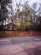


countryside

icone_mesure
slug
countryside

Measurement_4ee507f6-6bc9-4fb3-90eb-f3f23db02cbc

Measured radiation

0.046 µSv/h
geolocalisation :

47.3686053, 5.0157045

Ground level
suzon-21
Date de la mesure :
Latitude :
47.3686053
Longitude :
5.0157045
Altitude (M) :
352.0
Measurement time :
5 minutes
Distance travelled :
0.00m
Measurement speed :
Measurement Environment :
En campagne countryside
Weather :
Tags :
Description :
Ahuy, route d'Hauteville,
Radiacode 102 +- 27%
measurment image
Temperature :
14.0°C
Hits number :
Mesure UUID :
4ee507f6-6bc9-4fb3-90eb-f3f23db02cbc
Manual Reporting :
Yes
Sensor / ID :
Sensor / Firmware version :
Sensor / Type :
Sensor / Tube type :
Smartphone / UUID :
4eef54416c0db30e
Smartphone / Platform :
android
Smartphone / Model :
P50T_E_ROW
Smartphone / OS Version :
16
Position acurracy :
2.2
Measurement height above the ground (in meters) :
1.00
Altitude accuracy :
2.2
Mean qualification :
Ground level
Software version :
OpenRadiation app 3.1
Measured value :
0.046 µSv/h

Measurement_5e012769-373f-4bfb-902b-e4073616338d

Measured radiation

0.412 µSv/h
geolocalisation :

37.409369225162, 140.98649703968

Ground level
npofd06
ATYPICAL MEASURE
Date de la mesure :
Latitude :
37.409369225162
Longitude :
140.98649703968
Altitude (M) :
76.0
Measurement time :
5 minutes
Distance travelled :
149.39m
Measurement speed :
Measurement Environment :
En campagne countryside
Weather :
Tags :
Description :
Temperature :
31.0°C
Hits number :
271
Mesure UUID :
5e012769-373f-4bfb-902b-e4073616338d
Manual Reporting :
No
Sensor / ID :
Sensor / Firmware version :
Bertin RadConnect v1.0.1969
Sensor / Type :
Sensor / Tube type :
J305γβ
Smartphone / UUID :
9139EB80-437B-496F-9E3F-9A4A4F00D061
Smartphone / Platform :
ios
Smartphone / Model :
iPhone15,4
Smartphone / OS Version :
26.6.1
Position acurracy :
4.7
Measurement height above the ground (in meters) :
Altitude accuracy :
4.7
Mean qualification :
Ground level
Software version :
OpenRadiation app 3.1.1
Measured value :
0.412 µSv/h

Measurement_66e8ac47-9aa8-4c7e-8e92-99cdd2d40e36

Measured radiation

0.476 µSv/h
geolocalisation :

37.407827925194, 140.98584319604

Ground level
npofd06
ATYPICAL MEASURE
Date de la mesure :
Latitude :
37.407827925194
Longitude :
140.98584319604
Altitude (M) :
67.0
Measurement time :
5 minutes
Distance travelled :
181.06m
Measurement speed :
Measurement Environment :
En campagne countryside
Weather :
Tags :
Description :
Temperature :
30.0°C
Hits number :
310
Mesure UUID :
66e8ac47-9aa8-4c7e-8e92-99cdd2d40e36
Manual Reporting :
No
Sensor / ID :
Sensor / Firmware version :
Bertin RadConnect v1.0.1969
Sensor / Type :
Sensor / Tube type :
J305γβ
Smartphone / UUID :
9139EB80-437B-496F-9E3F-9A4A4F00D061
Smartphone / Platform :
ios
Smartphone / Model :
iPhone15,4
Smartphone / OS Version :
26.6.1
Position acurracy :
4.7
Measurement height above the ground (in meters) :
Altitude accuracy :
4.7
Mean qualification :
Ground level
Software version :
OpenRadiation app 3.1.1
Measured value :
0.476 µSv/h

Measurement_6f792a6c-2b57-49c7-b019-9d576a05af57

Measured radiation

0.368 µSv/h
geolocalisation :

45.9960035, 3.601721

Ground level
Atomic Tessoss
ATYPICAL MEASURE
Date de la mesure :
Latitude :
45.9960035
Longitude :
3.601721
Altitude (M) :
688.0
Measurement time :
57 secondes
Distance travelled :
61.01m
Measurement speed :
Measurement Environment :
En campagne countryside
Weather :
Tags :
Description :
Temperature :
15.0°C
Hits number :
51
Mesure UUID :
6f792a6c-2b57-49c7-b019-9d576a05af57
Manual Reporting :
No
Sensor / ID :
6C:30:2A:3F:22:F2
Sensor / Firmware version :
AtomTag
Sensor / Type :
Sensor / Tube type :
SBM-20
Smartphone / UUID :
2355096de2553836
Smartphone / Platform :
android
Smartphone / Model :
2311DRK48G
Smartphone / OS Version :
14
Position acurracy :
3.0
Measurement height above the ground (in meters) :
1.00
Altitude accuracy :
3.0
Mean qualification :
Ground level
Software version :
OpenRadiation app 3.1
Measured value :
0.368 µSv/h

Measurement_95eb8224-d10c-4467-a626-b4ef4ae5193b

Measured radiation

0.315 µSv/h
geolocalisation :

45.9965204, 3.6014588

Ground level
Atomic Tessoss
ATYPICAL MEASURE
Date de la mesure :
Latitude :
45.9965204
Longitude :
3.6014588
Altitude (M) :
684.0
Measurement time :
1 minutes 8 secondes
Distance travelled :
100.31m
Measurement speed :
Measurement Environment :
En campagne countryside
Weather :
Tags :
Description :
Temperature :
15.0°C
Hits number :
52
Mesure UUID :
95eb8224-d10c-4467-a626-b4ef4ae5193b
Manual Reporting :
No
Sensor / ID :
6C:30:2A:3F:22:F2
Sensor / Firmware version :
AtomTag
Sensor / Type :
Sensor / Tube type :
SBM-20
Smartphone / UUID :
2355096de2553836
Smartphone / Platform :
android
Smartphone / Model :
2311DRK48G
Smartphone / OS Version :
14
Position acurracy :
3.0
Measurement height above the ground (in meters) :
1.00
Altitude accuracy :
3.0
Mean qualification :
Ground level
Software version :
OpenRadiation app 3.1
Measured value :
0.315 µSv/h

Measurement_3f720fc9-2d23-45c7-9631-100f3155c8f5

Measured radiation

0.364 µSv/h
geolocalisation :

45.9976832, 3.6008991

Ground level
Atomic Tessoss
ATYPICAL MEASURE
Date de la mesure :
Latitude :
45.9976832
Longitude :
3.6008991
Altitude (M) :
684.0
Measurement time :
1 minutes 2 secondes
Distance travelled :
60.40m
Measurement speed :
Measurement Environment :
En campagne countryside
Weather :
Tags :
Description :
Temperature :
14.0°C
Hits number :
54
Mesure UUID :
3f720fc9-2d23-45c7-9631-100f3155c8f5
Manual Reporting :
No
Sensor / ID :
6C:30:2A:3F:22:F2
Sensor / Firmware version :
AtomTag
Sensor / Type :
Sensor / Tube type :
SBM-20
Smartphone / UUID :
2355096de2553836
Smartphone / Platform :
android
Smartphone / Model :
2311DRK48G
Smartphone / OS Version :
14
Position acurracy :
3.0
Measurement height above the ground (in meters) :
1.00
Altitude accuracy :
3.0
Mean qualification :
Ground level
Software version :
OpenRadiation app 3.1
Measured value :
0.364 µSv/h

Measurement_2f576501-a54d-4a20-82cf-cb465e4d2979

Measured radiation

0.318 µSv/h
geolocalisation :

45.9992555, 3.5995253

Ground level
Atomic Tessoss
ATYPICAL MEASURE
Date de la mesure :
Latitude :
45.9992555
Longitude :
3.5995253
Altitude (M) :
661.0
Measurement time :
1 minutes 6 secondes
Distance travelled :
0.00m
Measurement speed :
Measurement Environment :
En campagne countryside
Weather :
Tags :
Description :
Temperature :
13.0°C
Hits number :
51
Mesure UUID :
2f576501-a54d-4a20-82cf-cb465e4d2979
Manual Reporting :
No
Sensor / ID :
6C:30:2A:3F:22:F2
Sensor / Firmware version :
AtomTag
Sensor / Type :
Sensor / Tube type :
SBM-20
Smartphone / UUID :
2355096de2553836
Smartphone / Platform :
android
Smartphone / Model :
2311DRK48G
Smartphone / OS Version :
14
Position acurracy :
3.0
Measurement height above the ground (in meters) :
1.00
Altitude accuracy :
3.0
Mean qualification :
Ground level
Software version :
OpenRadiation app 3.1
Measured value :
0.318 µSv/h

Measurement_5c3e4a69-df8a-4f64-b035-20e680ec0694

Measured radiation

0.362 µSv/h
geolocalisation :

45.9993255, 3.6007721

Ground level
Atomic Tessoss
ATYPICAL MEASURE
Date de la mesure :
Latitude :
45.9993255
Longitude :
3.6007721
Altitude (M) :
667.0
Measurement time :
59 secondes
Distance travelled :
39.98m
Measurement speed :
Measurement Environment :
En campagne countryside
Weather :
Tags :
Description :
Temperature :
12.0°C
Hits number :
52
Mesure UUID :
5c3e4a69-df8a-4f64-b035-20e680ec0694
Manual Reporting :
No
Sensor / ID :
6C:30:2A:3F:22:F2
Sensor / Firmware version :
AtomTag
Sensor / Type :
Sensor / Tube type :
SBM-20
Smartphone / UUID :
2355096de2553836
Smartphone / Platform :
android
Smartphone / Model :
2311DRK48G
Smartphone / OS Version :
14
Position acurracy :
3.0
Measurement height above the ground (in meters) :
1.00
Altitude accuracy :
3.0
Mean qualification :
Ground level
Software version :
OpenRadiation app 3.1
Measured value :
0.362 µSv/h

Measurement_240b493e-9391-40e9-9a83-4e2d4f7d6fb4

Measured radiation

0.821 µSv/h
geolocalisation :

37.404571621266, 140.97841465704

Ground level
npofd06
ATYPICAL MEASURE
Date de la mesure :
Latitude :
37.404571621266
Longitude :
140.97841465704
Altitude (M) :
67.0
Measurement time :
5 minutes
Distance travelled :
204.74m
Measurement speed :
Measurement Environment :
En campagne countryside
Weather :
Tags :
Description :
Temperature :
26.0°C
Hits number :
520
Mesure UUID :
240b493e-9391-40e9-9a83-4e2d4f7d6fb4
Manual Reporting :
No
Sensor / ID :
Sensor / Firmware version :
Bertin RadConnect v1.0.1969
Sensor / Type :
Sensor / Tube type :
J305γβ
Smartphone / UUID :
9139EB80-437B-496F-9E3F-9A4A4F00D061
Smartphone / Platform :
ios
Smartphone / Model :
iPhone15,4
Smartphone / OS Version :
26.5.2
Position acurracy :
4.7
Measurement height above the ground (in meters) :
1.00
Altitude accuracy :
4.7
Mean qualification :
Ground level
Software version :
OpenRadiation app 3.1.1
Measured value :
0.821 µSv/h

Measurement_8f0eea38-6431-47d0-8bb6-1a1fdb7dfc24

Measured radiation

0.528 µSv/h
geolocalisation :

37.405481529802, 140.97640253203

Ground level
npofd06
ATYPICAL MEASURE
Date de la mesure :
Latitude :
37.405481529802
Longitude :
140.97640253203
Altitude (M) :
66.0
Measurement time :
5 minutes
Distance travelled :
114.92m
Measurement speed :
Measurement Environment :
En campagne countryside
Weather :
Tags :
Description :
Temperature :
26.0°C
Hits number :
342
Mesure UUID :
8f0eea38-6431-47d0-8bb6-1a1fdb7dfc24
Manual Reporting :
No
Sensor / ID :
Sensor / Firmware version :
Bertin RadConnect v1.0.1969
Sensor / Type :
Sensor / Tube type :
J305γβ
Smartphone / UUID :
9139EB80-437B-496F-9E3F-9A4A4F00D061
Smartphone / Platform :
ios
Smartphone / Model :
iPhone15,4
Smartphone / OS Version :
26.5.2
Position acurracy :
4.7
Measurement height above the ground (in meters) :
1.00
Altitude accuracy :
4.7
Mean qualification :
Ground level
Software version :
OpenRadiation app 3.1.1
Measured value :
0.528 µSv/h