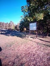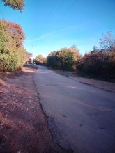


countryside

icone_mesure
slug
countryside

Measurement_fdf5d53b-aaa0-4923-92e4-9429b924ea86

Measured radiation

0.184 µSv/h
geolocalisation :

37.409152958953, 140.9834106095

Ground level
npofd06
Date de la mesure :
Latitude :
37.409152958953
Longitude :
140.9834106095
Altitude (M) :
67.0
Measurement time :
5 minutes
Distance travelled :
60.53m
Measurement speed :
Measurement Environment :
En campagne countryside
Weather :
Tags :
Description :
Temperature :
26.0°C
Hits number :
132
Mesure UUID :
fdf5d53b-aaa0-4923-92e4-9429b924ea86
Manual Reporting :
No
Sensor / ID :
Sensor / Firmware version :
Bertin RadConnect v1.0.1969
Sensor / Type :
Sensor / Tube type :
J305γβ
Smartphone / UUID :
9139EB80-437B-496F-9E3F-9A4A4F00D061
Smartphone / Platform :
ios
Smartphone / Model :
iPhone15,4
Smartphone / OS Version :
26.5.2
Position acurracy :
4.7
Measurement height above the ground (in meters) :
1.00
Altitude accuracy :
4.7
Mean qualification :
Ground level
Software version :
OpenRadiation app 3.1.1
Measured value :
0.184 µSv/h
Measurement_b6cf7965-76e2-4d7d-8269-9b6893a8e957

Measured radiation

0.484 µSv/h
geolocalisation :

45.9982258, 3.6008943

Ground level
Atomic Tessoss
ATYPICAL MEASURE
Date de la mesure :
Latitude :
45.9982258
Longitude :
3.6008943
Altitude (M) :
671.0
Measurement time :
46 secondes
Distance travelled :
61.36m
Measurement speed :
Measurement Environment :
En campagne countryside
Weather :
Tags :
Description :
Temperature :
14.0°C
Hits number :
52
Mesure UUID :
b6cf7965-76e2-4d7d-8269-9b6893a8e957
Manual Reporting :
No
Sensor / ID :
6C:30:2A:3F:22:F2
Sensor / Firmware version :
AtomTag
Sensor / Type :
Sensor / Tube type :
SBM-20
Smartphone / UUID :
2355096de2553836
Smartphone / Platform :
android
Smartphone / Model :
2311DRK48G
Smartphone / OS Version :
14
Position acurracy :
3.0
Measurement height above the ground (in meters) :
1.00
Altitude accuracy :
3.0
Mean qualification :
Ground level
Software version :
OpenRadiation app 3.1
Measured value :
0.484 µSv/h

Measurement_7ee34b3d-4fa5-4ad8-a44c-97c8bfcfae66

Measured radiation

0.150 µSv/h
geolocalisation :

46.0013597, 3.581647

Ground level
Htide
Date de la mesure :
Latitude :
46.0013597
Longitude :
3.581647
Altitude (M) :
374.0
Measurement time :
2 minutes 3 secondes
Distance travelled :
161.53m
Measurement speed :
Measurement Environment :
En campagne countryside
Weather :
Tags :
Description :
Temperature :
25.0°C
Hits number :
52
Mesure UUID :
7ee34b3d-4fa5-4ad8-a44c-97c8bfcfae66
Manual Reporting :
No
Sensor / ID :
00282
Sensor / Firmware version :
OpengKIT72
Sensor / Type :
Sensor / Tube type :
Smartphone / UUID :
6e47eb1f6a509769
Smartphone / Platform :
android
Smartphone / Model :
CPH2359
Smartphone / OS Version :
13
Position acurracy :
3.0
Measurement height above the ground (in meters) :
1.00
Altitude accuracy :
3.0
Mean qualification :
Ground level
Software version :
OpenRadiation app 3.1
Measured value :
0.150 µSv/h

Measurement_f3e4190c-1324-41a0-9c4f-90a73abf095c

Measured radiation

0.308 µSv/h
geolocalisation :

45.9989674, 3.6007329

Ground level
Atomic Tessoss
ATYPICAL MEASURE
Date de la mesure :
Latitude :
45.9989674
Longitude :
3.6007329
Altitude (M) :
666.0
Measurement time :
1 minutes 8 secondes
Distance travelled :
100.01m
Measurement speed :
Measurement Environment :
En campagne countryside
Weather :
Tags :
Description :
Temperature :
12.0°C
Hits number :
51
Mesure UUID :
f3e4190c-1324-41a0-9c4f-90a73abf095c
Manual Reporting :
No
Sensor / ID :
6C:30:2A:3F:22:F2
Sensor / Firmware version :
AtomTag
Sensor / Type :
Sensor / Tube type :
SBM-20
Smartphone / UUID :
2355096de2553836
Smartphone / Platform :
android
Smartphone / Model :
2311DRK48G
Smartphone / OS Version :
14
Position acurracy :
3.0
Measurement height above the ground (in meters) :
1.00
Altitude accuracy :
3.0
Mean qualification :
Ground level
Software version :
OpenRadiation app 3.1
Measured value :
0.308 µSv/h

Measurement_7e046d0b-0751-4780-9f59-51c99631713b

Measured radiation

0.325 µSv/h
geolocalisation :

45.9971823, 3.6007857

Ground level
Atomic Tessoss
ATYPICAL MEASURE
Date de la mesure :
Latitude :
45.9971823
Longitude :
3.6007857
Altitude (M) :
684.0
Measurement time :
1 minutes 5 secondes
Distance travelled :
59.77m
Measurement speed :
Measurement Environment :
En campagne countryside
Weather :
Tags :
Description :
Temperature :
12.0°C
Hits number :
52
Mesure UUID :
7e046d0b-0751-4780-9f59-51c99631713b
Manual Reporting :
No
Sensor / ID :
6C:30:2A:3F:22:F2
Sensor / Firmware version :
AtomTag
Sensor / Type :
Sensor / Tube type :
SBM-20
Smartphone / UUID :
2355096de2553836
Smartphone / Platform :
android
Smartphone / Model :
2311DRK48G
Smartphone / OS Version :
14
Position acurracy :
3.0
Measurement height above the ground (in meters) :
1.00
Altitude accuracy :
3.0
Mean qualification :
Ground level
Software version :
OpenRadiation app 3.1
Measured value :
0.325 µSv/h

Measurement_46286292-854b-4123-9e1c-defb94a369bb

Measured radiation

0.213 µSv/h
geolocalisation :

45.9950564, 3.5941571

Ground level
Tek
ATYPICAL MEASURE
Date de la mesure :
Latitude :
45.9950564
Longitude :
3.5941571
Altitude (M) :
710.0
Measurement time :
1 minutes 35 secondes
Distance travelled :
49.63m
Measurement speed :
Measurement Environment :
En campagne countryside
Weather :
Tags :
Description :
Temperature :
32.0°C
Hits number :
53
Mesure UUID :
46286292-854b-4123-9e1c-defb94a369bb
Manual Reporting :
No
Sensor / ID :
00284
Sensor / Firmware version :
OpengKIT72
Sensor / Type :
Sensor / Tube type :
Smartphone / UUID :
2af126301525c649
Smartphone / Platform :
android
Smartphone / Model :
SM-A165F
Smartphone / OS Version :
16
Position acurracy :
9.8
Measurement height above the ground (in meters) :
1.00
Altitude accuracy :
9.8
Mean qualification :
Ground level
Software version :
OpenRadiation app 3.1
Measured value :
0.213 µSv/h

Measurement_c83fe84e-5aee-4fc7-a859-720caf55f102

Measured radiation

0.045 µSv/h
geolocalisation :

47.3778433, 5.0168382

Ground level
suzon-21
Date de la mesure :
Latitude :
47.3778433
Longitude :
5.0168382
Altitude (M) :
376.0
Measurement time :
6 minutes
Distance travelled :
0.00m
Measurement speed :
Measurement Environment :
En campagne countryside
Weather :
Tags :
Description :
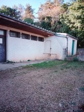
Ahuy, vestiaires stade.
Radiacode 102 +- 27%
measurment image
Temperature :
16.0°C
Hits number :
Mesure UUID :
c83fe84e-5aee-4fc7-a859-720caf55f102
Manual Reporting :
Yes
Sensor / ID :
Sensor / Firmware version :
Sensor / Type :
Sensor / Tube type :
Smartphone / UUID :
4eef54416c0db30e
Smartphone / Platform :
android
Smartphone / Model :
P50T_E_ROW
Smartphone / OS Version :
16
Position acurracy :
1.5
Measurement height above the ground (in meters) :
1.00
Altitude accuracy :
1.5
Mean qualification :
Ground level
Software version :
OpenRadiation app 3.1
Measured value :
0.045 µSv/h

Measurement_dd052594-107a-48d1-ac05-12c425811d84

Measured radiation

0.052 µSv/h
geolocalisation :

47.3785096, 5.0167293

Ground level
suzon-21
Date de la mesure :
Latitude :
47.3785096
Longitude :
5.0167293
Altitude (M) :
368.0
Measurement time :
5 minutes
Distance travelled :
0.00m
Measurement speed :
Measurement Environment :
En campagne countryside
Weather :
Tags :
Description :
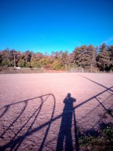
Ahuy, terrain de foot.
Radiacode 102 +- 26%
measurment image
Temperature :
17.0°C
Hits number :
Mesure UUID :
dd052594-107a-48d1-ac05-12c425811d84
Manual Reporting :
Yes
Sensor / ID :
Sensor / Firmware version :
Sensor / Type :
Sensor / Tube type :
Smartphone / UUID :
4eef54416c0db30e
Smartphone / Platform :
android
Smartphone / Model :
P50T_E_ROW
Smartphone / OS Version :
16
Position acurracy :
1.4
Measurement height above the ground (in meters) :
1.00
Altitude accuracy :
1.4
Mean qualification :
Ground level
Software version :
OpenRadiation app 3.1
Measured value :
0.052 µSv/h

Measurement_d76c949f-73b6-4a35-8714-1de6589ee0d9

Measured radiation

0.050 µSv/h
geolocalisation :

47.3785189, 5.0169598

Ground level
suzon-21
Date de la mesure :
Latitude :
47.3785189
Longitude :
5.0169598
Altitude (M) :
392.0
Measurement time :
5 minutes
Distance travelled :
0.00m
Measurement speed :
Measurement Environment :
En campagne countryside
Weather :
Tags :
Description :
Ahuy, stade.
Radiacode 102 +- 22%
measurment image
Temperature :
16.0°C
Hits number :
Mesure UUID :
d76c949f-73b6-4a35-8714-1de6589ee0d9
Manual Reporting :
Yes
Sensor / ID :
Sensor / Firmware version :
Sensor / Type :
Sensor / Tube type :
Smartphone / UUID :
4eef54416c0db30e
Smartphone / Platform :
android
Smartphone / Model :
P50T_E_ROW
Smartphone / OS Version :
16
Position acurracy :
1.4
Measurement height above the ground (in meters) :
1.00
Altitude accuracy :
1.4
Mean qualification :
Ground level
Software version :
OpenRadiation app 3.1
Measured value :
0.050 µSv/h

Measurement_8d8f2c55-d8b6-4a5b-b95e-28b390934c34

Measured radiation

0.046 µSv/h
geolocalisation :

47.3756976, 5.0191795

Ground level
suzon-21
Date de la mesure :
Latitude :
47.3756976
Longitude :
5.0191795
Altitude (M) :
392.0
Measurement time :
5 minutes
Distance travelled :
0.00m
Measurement speed :
Measurement Environment :
En campagne countryside
Weather :
Tags :
Description :
Ahuy, chemin du stade.
Radiacode 102 +- 27%
measurment image
Temperature :
15.0°C
Hits number :
Mesure UUID :
8d8f2c55-d8b6-4a5b-b95e-28b390934c34
Manual Reporting :
Yes
Sensor / ID :
Sensor / Firmware version :
Sensor / Type :
Sensor / Tube type :
Smartphone / UUID :
4eef54416c0db30e
Smartphone / Platform :
android
Smartphone / Model :
P50T_E_ROW
Smartphone / OS Version :
16
Position acurracy :
3.0
Measurement height above the ground (in meters) :
1.00
Altitude accuracy :
3.0
Mean qualification :
Ground level
Software version :
OpenRadiation app 3.1
Measured value :
0.046 µSv/h