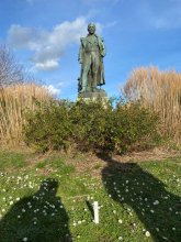


Ground level

slug
groundlevel

Measurement_05176133-7c99-4d12-b4d2-3beb0a823aae

Measured radiation

0.227 µSv/h
geolocalisation :

42.670059910009, 9.4413260125627

Ground level
NSI-SIN_Vincensini
ATYPICAL MEASURE
Date de la mesure :
Latitude :
42.67005991001
Longitude :
9.4413260125627
Altitude (M) :
26.0
Measurement time :
2 minutes
Distance travelled :
Measurement speed :
Measurement Environment :
En ville city
Weather :
Tags :
Description :
Temperature :
23.0°C
Hits number :
57
Mesure UUID :
05176133-7c99-4d12-b4d2-3beb0a823aae
Manual Reporting :
No
Sensor / ID :
Sensor / Firmware version :
Libelium Radiation Sensor Board - North Optic Geiger-Müller Tube
Sensor / Type :
Sensor / Tube type :
North Optic Geiger-Müller Tube J305ß
Smartphone / UUID :
Smartphone / Platform :
Smartphone / Model :
Smartphone / OS Version :
Position acurracy :
Measurement height above the ground (in meters) :
3.00
Altitude accuracy :
Mean qualification :
Ground level
Software version :
Firmware_V1.0
Measured value :
0.227 µSv/h

Measurement_f2b4b840-ab1b-4224-b3ce-ccfa74831db2

Measured radiation

0.093 µSv/h
geolocalisation :

45.0529376, 5.0951738

Ground level
Fanche
Date de la mesure :
Latitude :
45.0529376
Longitude :
5.0951738
Altitude (M) :
227.0
Measurement time :
3 minutes 4 secondes
Distance travelled :
170.66m
Measurement speed :
Measurement Environment :
Sur la route ontheroad
Weather :
Tags :
Description :
Temperature :
2.0°C
Hits number :
53
Mesure UUID :
f2b4b840-ab1b-4224-b3ce-ccfa74831db2
Manual Reporting :
No
Sensor / ID :
20:C3:8F:D1:EE:70
Sensor / Firmware version :
AtomTag v.1.0.3
Sensor / Type :
Sensor / Tube type :
SBM-20
Smartphone / UUID :
d404f9b3128dc3f5
Smartphone / Platform :
Android
Smartphone / Model :
SM-J330FN
Smartphone / OS Version :
8.0.0
Position acurracy :
4.0
Measurement height above the ground (in meters) :
Altitude accuracy :
4.0
Mean qualification :
Ground level
Software version :
OpenRadiation app 2.1.0
Measured value :
0.093 µSv/h

Measurement_5aebe420-c116-43a2-bea9-2454a7338478

Measured radiation

0.175 µSv/h
geolocalisation :

43.154705367091, 2.9678881634054

Ground level
cyber11120
Date de la mesure :
Latitude :
43.154705367091
Longitude :
2.9678881634054
Altitude (M) :
53.0
Measurement time :
3 minutes 49 secondes
Distance travelled :
0.00m
Measurement speed :
Measurement Environment :
À l'intérieur inside
Weather :
Tags :
Description :
Temperature :
27.0°C
Hits number :
97
Mesure UUID :
5aebe420-c116-43a2-bea9-2454a7338478
Manual Reporting :
No
Sensor / ID :
6e1551c3
Sensor / Firmware version :
RiumGM BLE -b
Sensor / Type :
Sensor / Tube type :
J305γβ
Smartphone / UUID :
83F0EA2E-0159-46C5-9145-EC02A92D870A
Smartphone / Platform :
iOS
Smartphone / Model :
iPhone14,3
Smartphone / OS Version :
17.4.1
Position acurracy :
11.5
Measurement height above the ground (in meters) :
1.00
Altitude accuracy :
11.5
Mean qualification :
Ground level
Software version :
OpenRadiation app 2.3.4
Measured value :
0.175 µSv/h

Measurement_8b952549-3324-4180-821f-f97032c2c199

Measured radiation

0.105 µSv/h
geolocalisation :

48.392416710362, 4.5280689936885

Ground level
domlo
Date de la mesure :
Latitude :
48.392416710362
Longitude :
4.5280689936885
Altitude (M) :
126.0
Measurement time :
3 minutes 20 secondes
Distance travelled :
16.50m
Measurement speed :
Measurement Environment :
En ville city
Weather :
Tags :
Description :
centre de Brienne le Chateau
measurment image
Temperature :
24.0°C
Hits number :
56
Mesure UUID :
8b952549-3324-4180-821f-f97032c2c199
Manual Reporting :
No
Sensor / ID :
751f70e7
Sensor / Firmware version :
RiumGM BLE -b
Sensor / Type :
Sensor / Tube type :
J305γβ
Smartphone / UUID :
37C525FD-5749-4F9D-AC22-87318DD67A00
Smartphone / Platform :
iOS
Smartphone / Model :
iPhone12,1
Smartphone / OS Version :
17.3.1
Position acurracy :
12.0
Measurement height above the ground (in meters) :
0.00
Altitude accuracy :
12.0
Mean qualification :
Ground level
Software version :
OpenRadiation app 2.3.4
Measured value :
0.105 µSv/h

Measurement_c44cca36-2654-4a60-b191-5c11cb0aad5a

Measured radiation

0.070 µSv/h
geolocalisation :

47.3657256, 5.0213825

Ground level
suzon-21
Date de la mesure :
Latitude :
47.3657256
Longitude :
5.0213825
Altitude (M) :
332.0
Measurement time :
5 minutes
Distance travelled :
0.00m
Measurement speed :
Measurement Environment :
En ville city
Weather :
Tags :
Description :
compteur br-9b tube j 321
Temperature :
Hits number :
Mesure UUID :
c44cca36-2654-4a60-b191-5c11cb0aad5a
Manual Reporting :
Yes
Sensor / ID :
Sensor / Firmware version :
Sensor / Type :
Sensor / Tube type :
Smartphone / UUID :
02748f5609387157
Smartphone / Platform :
Android
Smartphone / Model :
ARCHOS T96 3G_EEA
Smartphone / OS Version :
11
Position acurracy :
13.9
Measurement height above the ground (in meters) :
1.00
Altitude accuracy :
13.9
Mean qualification :
Ground level
Software version :
OpenRadiation app 2.3.5
Measured value :
0.070 µSv/h

Measurement_2d680ed2-0e3b-42b2-83c5-a045b80d3f39

Measured radiation

0.260 µSv/h
geolocalisation :

42.670059910009, 9.4413260125627

Ground level
NSI-SIN_Vincensini
ATYPICAL MEASURE
Date de la mesure :
Latitude :
42.67005991001
Longitude :
9.4413260125627
Altitude (M) :
26.0
Measurement time :
2 minutes
Distance travelled :
Measurement speed :
Measurement Environment :
En ville city
Weather :
Tags :
Description :
Temperature :
21.0°C
Hits number :
65
Mesure UUID :
2d680ed2-0e3b-42b2-83c5-a045b80d3f39
Manual Reporting :
No
Sensor / ID :
Sensor / Firmware version :
Libelium Radiation Sensor Board - North Optic Geiger-Müller Tube
Sensor / Type :
Sensor / Tube type :
North Optic Geiger-Müller Tube J305ß
Smartphone / UUID :
Smartphone / Platform :
Smartphone / Model :
Smartphone / OS Version :
Position acurracy :
Measurement height above the ground (in meters) :
3.00
Altitude accuracy :
Mean qualification :
Ground level
Software version :
Firmware_V1.0
Measured value :
0.260 µSv/h

Measurement_cd79218a-24fe-4eee-a307-a9532fad28a2

Measured radiation

5.386 µSv/h
geolocalisation :

49.103408264973, 6.6943399887594

Ground level
Eric57
ATYPICAL MEASURE
Date de la mesure :
Latitude :
49.103408264973
Longitude :
6.6943399887594
Altitude (M) :
242.0
Measurement time :
2 minutes 6 secondes
Distance travelled :
11.31m
Measurement speed :
Measurement Environment :
Weather :
Tags :
Description :
Temperature :
14.0°C
Hits number :
1387
Mesure UUID :
cd79218a-24fe-4eee-a307-a9532fad28a2
Manual Reporting :
No
Sensor / ID :
b4011397
Sensor / Firmware version :
RiumGM BLE -b
Sensor / Type :
Sensor / Tube type :
J305γβ
Smartphone / UUID :
48DA54EA-4E32-4EAF-8F1B-713CFA612E1A
Smartphone / Platform :
iOS
Smartphone / Model :
iPhone15,5
Smartphone / OS Version :
17.4.1
Position acurracy :
4.5
Measurement height above the ground (in meters) :
Altitude accuracy :
4.5
Mean qualification :
Ground level
Software version :
OpenRadiation app 2.3.4
Measured value :
5.386 µSv/h

Measurement_3d521545-96a3-45ed-a5b1-50481fa13b1c

Measured radiation

0.551 µSv/h
geolocalisation :

49.103394225286, 6.6944008413765

Ground level
Eric57
ATYPICAL MEASURE
Date de la mesure :
Latitude :
49.103394225286
Longitude :
6.6944008413765
Altitude (M) :
240.0
Measurement time :
2 minutes 7 secondes
Distance travelled :
3.42m
Measurement speed :
Measurement Environment :
En ville city
Weather :
Tags :
Description :
tests GM rium
Temperature :
13.0°C
Hits number :
151
Mesure UUID :
3d521545-96a3-45ed-a5b1-50481fa13b1c
Manual Reporting :
No
Sensor / ID :
b4011397
Sensor / Firmware version :
RiumGM BLE -b
Sensor / Type :
Sensor / Tube type :
J305γβ
Smartphone / UUID :
48DA54EA-4E32-4EAF-8F1B-713CFA612E1A
Smartphone / Platform :
iOS
Smartphone / Model :
iPhone15,5
Smartphone / OS Version :
17.4.1
Position acurracy :
5.3
Measurement height above the ground (in meters) :
1.00
Altitude accuracy :
5.3
Mean qualification :
Ground level
Software version :
OpenRadiation app 2.3.4
Measured value :
0.551 µSv/h

Measurement_ffa81558-7f67-4699-a042-541683812979

Measured radiation

7.638 µSv/h
geolocalisation :

46.259773333333, 6.056

Ground level
Fanche
ATYPICAL MEASURE
Date de la mesure :
Latitude :
46.259773333333
Longitude :
6.056
Altitude (M) :
530.0
Measurement time :
1 minutes 1 secondes
Distance travelled :
78.49m
Measurement speed :
Measurement Environment :
À l'intérieur inside
Weather :
Tags :
Description :
Etalonnage au CERN/CERF
Temperature :
Hits number :
2551
Mesure UUID :
ffa81558-7f67-4699-a042-541683812979
Manual Reporting :
No
Sensor / ID :
safecast_id 3289
Sensor / Firmware version :
$BNRDD
Sensor / Type :
Sensor / Tube type :
Smartphone / UUID :
Smartphone / Platform :
Smartphone / Model :
Smartphone / OS Version :
Position acurracy :
6.0
Measurement height above the ground (in meters) :
1.00
Altitude accuracy :
6.0
Mean qualification :
Ground level
Software version :
openradiation.net/upload v0.9
Measured value :
7.638 µSv/h

Measurement_f809affe-1b24-49ae-8b4c-dc19e6d73ece

Measured radiation

0.070 µSv/h
geolocalisation :

48.398834228516, 4.6703120613553

Ground level
domlo
Date de la mesure :
Latitude :
48.398834228516
Longitude :
4.6703120613553
Altitude (M) :
143.0
Measurement time :
4 minutes 4 secondes
Distance travelled :
0.00m
Measurement speed :
Measurement Environment :
En campagne countryside
Weather :
Tags :
Description :
csa
Temperature :
22.0°C
Hits number :
51
Mesure UUID :
f809affe-1b24-49ae-8b4c-dc19e6d73ece
Manual Reporting :
No
Sensor / ID :
751f70e7
Sensor / Firmware version :
RiumGM BLE -b
Sensor / Type :
Sensor / Tube type :
J305γβ
Smartphone / UUID :
37C525FD-5749-4F9D-AC22-87318DD67A00
Smartphone / Platform :
iOS
Smartphone / Model :
iPhone12,1
Smartphone / OS Version :
17.3.1
Position acurracy :
40.0
Measurement height above the ground (in meters) :
1.00
Altitude accuracy :
40.0
Mean qualification :
Ground level
Software version :
OpenRadiation app 2.3.4
Measured value :
0.070 µSv/h