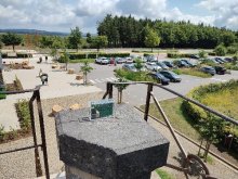
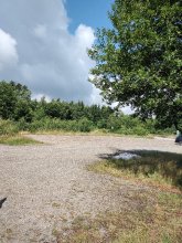
Ground level

slug
groundlevel

Measurement_b5c52bb3-8548-4232-a607-485ebdad5f19

Measured radiation

0.138 µSv/h
geolocalisation :

4.891232, -52.5039085

Ground level
JRWAGITINYWA
Measurement date :
Latitude :
4.891232
Longitude :
-52.5039085
Altitude (M) :
-25.0
Measurement time :
2 minutes 24 secondes
Distance travelled :
0.00m
Measurement speed :
Measurement Environment :
En campagne countryside
Weather :
Tags :
Description :
Temperature :
29.0°C
Hits number :
50
Mesure UUID :
b5c52bb3-8548-4232-a607-485ebdad5f19
Manual Reporting :
No
Sensor / ID :
dfbafb65
Sensor / Firmware version :
RiumGM BLE -b
Sensor / Type :
Sensor / Tube type :
J305γβ
Smartphone / UUID :
d80f873aff6780b7
Smartphone / Platform :
android
Smartphone / Model :
SM-S918B
Smartphone / OS Version :
15
Position acurracy :
20.0
Measurement height above the ground (in meters) :
1.00
Altitude accuracy :
20.0
Mean qualification :
Ground level
Software version :
OpenRadiation app 3.1
Measured value :
0.138 µSv/h

Measurement_9246ac81-c43e-425e-b271-cae3f0a36b78

Measured radiation

0.078 µSv/h
geolocalisation :

48.793893, 2.2765437

Ground level
ghis
Measurement date :
Latitude :
48.793893
Longitude :
2.2765437
Altitude (M) :
218.0
Measurement time :
3 minutes 47 secondes
Distance travelled :
0.00m
Measurement speed :
Measurement Environment :
À l'intérieur inside
Weather :
Tags :
Description :
Temperature :
25.0°C
Hits number :
51
Mesure UUID :
9246ac81-c43e-425e-b271-cae3f0a36b78
Manual Reporting :
No
Sensor / ID :
Sensor / Firmware version :
RiumGm
Sensor / Type :
Sensor / Tube type :
J305γβ
Smartphone / UUID :
1faf220991dac006
Smartphone / Platform :
android
Smartphone / Model :
SM-A566B
Smartphone / OS Version :
15
Position acurracy :
14.9
Measurement height above the ground (in meters) :
Altitude accuracy :
14.9
Mean qualification :
Ground level
Software version :
OpenRadiation app 3.1
Measured value :
0.078 µSv/h

Measurement_10041f78-4418-4e6f-bb8a-5ff832c64b14

Measured radiation

0.085 µSv/h
geolocalisation :

-16.8208725, -150.9834227

Ground level
ASNR_LESE
Measurement date :
Latitude :
-16.8208725
Longitude :
-150.9834227
Altitude (M) :
14.0
Measurement time :
3 minutes 33 secondes
Distance travelled :
0.00m
Measurement speed :
Measurement Environment :
En campagne countryside
Weather :
Tags :
Description :
measurment image
Temperature :
28.0°C
Hits number :
51
Mesure UUID :
10041f78-4418-4e6f-bb8a-5ff832c64b14
Manual Reporting :
No
Sensor / ID :
3d4ec6c0
Sensor / Firmware version :
RiumGM BLE -b
Sensor / Type :
Sensor / Tube type :
J305γβ
Smartphone / UUID :
99e38b0a34f3b58a
Smartphone / Platform :
android
Smartphone / Model :
SM-G736B
Smartphone / OS Version :
15
Position acurracy :
4.6
Measurement height above the ground (in meters) :
1.00
Altitude accuracy :
4.6
Mean qualification :
Ground level
Software version :
OpenRadiation app 3.1
Measured value :
0.085 µSv/h

Measurement_cf5247f2-95c1-4777-95af-f336f6c8a75a

Measured radiation

0.102 µSv/h
geolocalisation :

50.5012444, 6.0931213

Ground level
rcroitor
Measurement date :
Latitude :
50.5012444
Longitude :
6.0931213
Altitude (M) :
741.0
Measurement time :
2 minutes 40 secondes
Distance travelled :
74.96m
Measurement speed :
Measurement Environment :
En campagne countryside
Weather :
Tags :
Description :
measurment image
Temperature :
34.0°C
Hits number :
51
Mesure UUID :
cf5247f2-95c1-4777-95af-f336f6c8a75a
Manual Reporting :
No
Sensor / ID :
00078
Sensor / Firmware version :
OpengKIT72
Sensor / Type :
Sensor / Tube type :
Smartphone / UUID :
8ce825cdb0e1ba83
Smartphone / Platform :
android
Smartphone / Model :
motorola edge 20 pro
Smartphone / OS Version :
13
Position acurracy :
3.8
Measurement height above the ground (in meters) :
1.00
Altitude accuracy :
3.8
Mean qualification :
Ground level
Software version :
OpenRadiation app 3.1
Measured value :
0.102 µSv/h

Measurement_eb3b7b4b-24c0-4964-841e-c8bbe7ce0972

Measured radiation

0.147 µSv/h
geolocalisation :

50.5480066, 6.0573204

Ground level
rcroitor
Measurement date :
Latitude :
50.5480066
Longitude :
6.0573204
Altitude (M) :
554.0
Measurement time :
2 minutes 1 secondes
Distance travelled :
0.00m
Measurement speed :
Measurement Environment :
En campagne countryside
Weather :
Tags :
Description :
measurment image
Temperature :
37.0°C
Hits number :
50
Mesure UUID :
eb3b7b4b-24c0-4964-841e-c8bbe7ce0972
Manual Reporting :
No
Sensor / ID :
00078
Sensor / Firmware version :
OpengKIT72
Sensor / Type :
Sensor / Tube type :
Smartphone / UUID :
8ce825cdb0e1ba83
Smartphone / Platform :
android
Smartphone / Model :
motorola edge 20 pro
Smartphone / OS Version :
13
Position acurracy :
10.0
Measurement height above the ground (in meters) :
0.00
Altitude accuracy :
10.0
Mean qualification :
Ground level
Software version :
OpenRadiation app 3.1
Measured value :
0.147 µSv/h

Measurement_ff48d229-d641-4a6d-afef-381750715744

Measured radiation

1.512 µSv/h
geolocalisation :

20.97701, -89.62397

Ground level
Fanche
ATYPICAL MEASURE
Measurement date :
Latitude :
20.97701
Longitude :
-89.62397
Altitude (M) :
7.0
Measurement time :
1 minutes
Distance travelled :
201.51m
Measurement speed :
Measurement Environment :
Sur la route ontheroad
Weather :
Tags :
Description :
Temperature :
Hits number :
505
Mesure UUID :
ff48d229-d641-4a6d-afef-381750715744
Manual Reporting :
No
Sensor / ID :
safecast_id 1223
Sensor / Firmware version :
$BNRDD
Sensor / Type :
Sensor / Tube type :
Smartphone / UUID :
Smartphone / Platform :
Smartphone / Model :
Smartphone / OS Version :
Position acurracy :
7.0
Measurement height above the ground (in meters) :
1.00
Altitude accuracy :
7.0
Mean qualification :
Ground level
Software version :
openradiation.net/upload v0.9
Measured value :
1.512 µSv/h

Measurement_ffb2876f-e0a4-49bd-afaf-631750799031

Measured radiation

0.584 µSv/h
geolocalisation :

20.623766666667, -88.43102

Ground level
Fanche
ATYPICAL MEASURE
Measurement date :
Latitude :
20.623766666667
Longitude :
-88.43102
Altitude (M) :
63.0
Measurement time :
1 minutes 1 secondes
Distance travelled :
980.21m
Measurement speed :
Measurement Environment :
Sur la route ontheroad
Weather :
Tags :
Description :
Temperature :
Hits number :
195
Mesure UUID :
ffb2876f-e0a4-49bd-afaf-631750799031
Manual Reporting :
No
Sensor / ID :
safecast_id 1223
Sensor / Firmware version :
$BNRDD
Sensor / Type :
Sensor / Tube type :
Smartphone / UUID :
Smartphone / Platform :
Smartphone / Model :
Smartphone / OS Version :
Position acurracy :
8.0
Measurement height above the ground (in meters) :
1.00
Altitude accuracy :
8.0
Mean qualification :
Ground level
Software version :
openradiation.net/upload v0.9
Measured value :
0.584 µSv/h

Measurement_bf544c51-2063-43fa-8b29-e0e543f82304

Measured radiation

0.210 µSv/h
geolocalisation :

48.834295906126, -1.6010050289333

Ground level
ATYPICAL MEASURE
Measurement date :
Latitude :
48.834295906126
Longitude :
-1.6010050289333
Altitude (M) :
13.0
Measurement time :
2 minutes 14 secondes
Distance travelled :
Measurement speed :
Measurement Environment :
À l'intérieur inside
Weather :
Tags :
Description :
Temperature :
19.0°C
Hits number :
51
Mesure UUID :
bf544c51-2063-43fa-8b29-e0e543f82304
Manual Reporting :
No
Sensor / ID :
E1-3C
Sensor / Firmware version :
RiumGM
Sensor / Type :
Sensor / Tube type :
J305γβ
Smartphone / UUID :
Smartphone / Platform :
Android
Smartphone / Model :
samsung SM-A202F
Smartphone / OS Version :
11.0
Position acurracy :
Measurement height above the ground (in meters) :
1.00
Altitude accuracy :
Mean qualification :
Ground level
Software version :
RiumApp 3.2.11
Measured value :
0.210 µSv/h

Measurement_6cf75d91-e06d-49da-9666-6cfa9d4f9ff9

Measured radiation

0.060 µSv/h
geolocalisation :

46.6927114, 4.8429291

Ground level
NicoLex
Measurement date :
Latitude :
46.6927114
Longitude :
4.8429291
Altitude (M) :
239.0
Measurement time :
Distance travelled :
0.00m
Measurement speed :
Measurement Environment :
À l'intérieur inside
Weather :
Tags :
Description :
Temperature :
Hits number :
Mesure UUID :
6cf75d91-e06d-49da-9666-6cfa9d4f9ff9
Manual Reporting :
Yes
Sensor / ID :
Sensor / Firmware version :
Sensor / Type :
Sensor / Tube type :
Smartphone / UUID :
96294b6a0cec6792
Smartphone / Platform :
android
Smartphone / Model :
M2101K7BNY
Smartphone / OS Version :
13
Position acurracy :
4.2
Measurement height above the ground (in meters) :
1.00
Altitude accuracy :
4.2
Mean qualification :
Ground level
Software version :
OpenRadiation app 3.1
Measured value :
0.060 µSv/h

Measurement_1fa71162-2c22-4e1f-9fe2-1bd4c2c96901

Measured radiation

0.144 µSv/h
geolocalisation :

43.568663343522, 1.4572802537095

Ground level
Measurement date :
Latitude :
43.568663343522
Longitude :
1.4572802537095
Altitude (M) :
154.0
Measurement time :
8 minutes 52 secondes
Distance travelled :
20.39m
Measurement speed :
Measurement Environment :
À l'intérieur inside
Weather :
Tags :
Description :
Temperature :
24.0°C
Hits number :
191
Mesure UUID :
1fa71162-2c22-4e1f-9fe2-1bd4c2c96901
Manual Reporting :
No
Sensor / ID :
828d3b58
Sensor / Firmware version :
RiumGM BLE -b
Sensor / Type :
Sensor / Tube type :
J305γβ
Smartphone / UUID :
53D75278-CA91-4AB6-A144-C10239D9B21D
Smartphone / Platform :
ios
Smartphone / Model :
iPhone11,8
Smartphone / OS Version :
18.4.1
Position acurracy :
9.0
Measurement height above the ground (in meters) :
1.00
Altitude accuracy :
9.0
Mean qualification :
Ground level
Software version :
OpenRadiation app 3.0
Measured value :
0.144 µSv/h