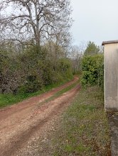


countryside

icone_mesure
slug
countryside

Measurement_03aa65ef-eabe-47b2-9d03-20d092e1c70f

Measured radiation

0.051 µSv/h
geolocalisation :

48.2807783, 7.6053125

Ground level
f4htb
Date de la mesure :
Latitude :
48.2807783
Longitude :
7.6053125
Altitude (M) :
215.0
Measurement time :
5 minutes
Distance travelled :
Measurement speed :
Measurement Environment :
En campagne countryside
Weather :
Tags :
Description :
Temperature :
10.0°C
Hits number :
81
Mesure UUID :
03aa65ef-eabe-47b2-9d03-20d092e1c70f
Manual Reporting :
No
Sensor / ID :
00132
Sensor / Firmware version :
OpengKIT72
Sensor / Type :
Sensor / Tube type :
SBM-20
Smartphone / UUID :
Smartphone / Platform :
Smartphone / Model :
Smartphone / OS Version :
Position acurracy :
Measurement height above the ground (in meters) :
Altitude accuracy :
Mean qualification :
Ground level
Software version :
openradiation_pythonbridge_v1
Measured value :
0.051 µSv/h

Measurement_8ca285a3-8b8b-4cfe-9258-f7b679749847

Measured radiation

0.062 µSv/h
geolocalisation :

48.2807783, 7.6053125

Ground level
f4htb
Date de la mesure :
Latitude :
48.2807783
Longitude :
7.6053125
Altitude (M) :
215.0
Measurement time :
5 minutes
Distance travelled :
Measurement speed :
Measurement Environment :
En campagne countryside
Weather :
Tags :
Description :
Temperature :
11.0°C
Hits number :
90
Mesure UUID :
8ca285a3-8b8b-4cfe-9258-f7b679749847
Manual Reporting :
No
Sensor / ID :
00132
Sensor / Firmware version :
OpengKIT72
Sensor / Type :
Sensor / Tube type :
SBM-20
Smartphone / UUID :
Smartphone / Platform :
Smartphone / Model :
Smartphone / OS Version :
Position acurracy :
Measurement height above the ground (in meters) :
Altitude accuracy :
Mean qualification :
Ground level
Software version :
openradiation_pythonbridge_v1
Measured value :
0.062 µSv/h

Measurement_6006ba31-506b-4020-9eda-b15c573a1d9a

Measured radiation

0.056 µSv/h
geolocalisation :

48.2807783, 7.6053125

Ground level
f4htb
Date de la mesure :
Latitude :
48.2807783
Longitude :
7.6053125
Altitude (M) :
215.0
Measurement time :
5 minutes
Distance travelled :
Measurement speed :
Measurement Environment :
En campagne countryside
Weather :
Tags :
Description :
Temperature :
10.0°C
Hits number :
85
Mesure UUID :
6006ba31-506b-4020-9eda-b15c573a1d9a
Manual Reporting :
No
Sensor / ID :
00132
Sensor / Firmware version :
OpengKIT72
Sensor / Type :
Sensor / Tube type :
SBM-20
Smartphone / UUID :
Smartphone / Platform :
Smartphone / Model :
Smartphone / OS Version :
Position acurracy :
Measurement height above the ground (in meters) :
Altitude accuracy :
Mean qualification :
Ground level
Software version :
openradiation_pythonbridge_v1
Measured value :
0.056 µSv/h

Measurement_232c42fa-112d-4742-adff-927ba9cbdb1f

Measured radiation

0.062 µSv/h
geolocalisation :

48.2807783, 7.6053125

Ground level
f4htb
Date de la mesure :
Latitude :
48.2807783
Longitude :
7.6053125
Altitude (M) :
215.0
Measurement time :
5 minutes
Distance travelled :
Measurement speed :
Measurement Environment :
En campagne countryside
Weather :
Tags :
Description :
Temperature :
10.0°C
Hits number :
90
Mesure UUID :
232c42fa-112d-4742-adff-927ba9cbdb1f
Manual Reporting :
No
Sensor / ID :
00132
Sensor / Firmware version :
OpengKIT72
Sensor / Type :
Sensor / Tube type :
SBM-20
Smartphone / UUID :
Smartphone / Platform :
Smartphone / Model :
Smartphone / OS Version :
Position acurracy :
Measurement height above the ground (in meters) :
Altitude accuracy :
Mean qualification :
Ground level
Software version :
openradiation_pythonbridge_v1
Measured value :
0.062 µSv/h

Measurement_04897d9a-3e6c-430a-9e4b-56533bb4ac97

Measured radiation

0.061 µSv/h
geolocalisation :

48.2807783, 7.6053125

Ground level
f4htb
Date de la mesure :
Latitude :
48.2807783
Longitude :
7.6053125
Altitude (M) :
215.0
Measurement time :
5 minutes 1 secondes
Distance travelled :
Measurement speed :
Measurement Environment :
En campagne countryside
Weather :
Tags :
Description :
Temperature :
6.0°C
Hits number :
89
Mesure UUID :
04897d9a-3e6c-430a-9e4b-56533bb4ac97
Manual Reporting :
No
Sensor / ID :
00132
Sensor / Firmware version :
OpengKIT72
Sensor / Type :
Sensor / Tube type :
SBM-20
Smartphone / UUID :
Smartphone / Platform :
Smartphone / Model :
Smartphone / OS Version :
Position acurracy :
Measurement height above the ground (in meters) :
Altitude accuracy :
Mean qualification :
Ground level
Software version :
openradiation_pythonbridge_v1
Measured value :
0.061 µSv/h

Measurement_355673d5-3a39-49b8-92c4-7c7d5c5a8443

Measured radiation

0.056 µSv/h
geolocalisation :

48.2807783, 7.6053125

Ground level
f4htb
Date de la mesure :
Latitude :
48.2807783
Longitude :
7.6053125
Altitude (M) :
215.0
Measurement time :
5 minutes
Distance travelled :
Measurement speed :
Measurement Environment :
En campagne countryside
Weather :
Tags :
Description :
Temperature :
17.0°C
Hits number :
85
Mesure UUID :
355673d5-3a39-49b8-92c4-7c7d5c5a8443
Manual Reporting :
No
Sensor / ID :
00132
Sensor / Firmware version :
OpengKIT72
Sensor / Type :
Sensor / Tube type :
SBM-20
Smartphone / UUID :
Smartphone / Platform :
Smartphone / Model :
Smartphone / OS Version :
Position acurracy :
Measurement height above the ground (in meters) :
Altitude accuracy :
Mean qualification :
Ground level
Software version :
openradiation_pythonbridge_v1
Measured value :
0.056 µSv/h

Measurement_2902faa6-1ef7-4efd-8f92-6f116648adfc

Measured radiation

0.072 µSv/h
geolocalisation :

48.2807783, 7.6053125

Ground level
f4htb
Date de la mesure :
Latitude :
48.2807783
Longitude :
7.6053125
Altitude (M) :
215.0
Measurement time :
5 minutes
Distance travelled :
Measurement speed :
Measurement Environment :
En campagne countryside
Weather :
Tags :
Description :
Temperature :
14.0°C
Hits number :
97
Mesure UUID :
2902faa6-1ef7-4efd-8f92-6f116648adfc
Manual Reporting :
No
Sensor / ID :
00132
Sensor / Firmware version :
OpengKIT72
Sensor / Type :
Sensor / Tube type :
SBM-20
Smartphone / UUID :
Smartphone / Platform :
Smartphone / Model :
Smartphone / OS Version :
Position acurracy :
Measurement height above the ground (in meters) :
Altitude accuracy :
Mean qualification :
Ground level
Software version :
openradiation_pythonbridge_v1
Measured value :
0.072 µSv/h

Measurement_ff4021e1-18ea-48d5-a5db-9d1441718303

Measured radiation

0.228 µSv/h
geolocalisation :

49.91429, 2.2424283333333

Ground level
Fanche
ATYPICAL MEASURE
Date de la mesure :
Latitude :
49.91429
Longitude :
2.2424283333333
Altitude (M) :
22.0
Measurement time :
1 minutes 1 secondes
Distance travelled :
1973.01m
Measurement speed :
Measurement Environment :
En campagne countryside
Weather :
Tags :
Description :
Temperature :
Hits number :
76
Mesure UUID :
ff4021e1-18ea-48d5-a5db-9d1441718303
Manual Reporting :
No
Sensor / ID :
safecast_id 2344
Sensor / Firmware version :
$BNRDD
Sensor / Type :
Sensor / Tube type :
Smartphone / UUID :
Smartphone / Platform :
Smartphone / Model :
Smartphone / OS Version :
Position acurracy :
12.0
Measurement height above the ground (in meters) :
1.00
Altitude accuracy :
12.0
Mean qualification :
Ground level
Software version :
openradiation.net/upload v0.9
Measured value :
0.228 µSv/h

Measurement_6cdaa69e-8615-4d5e-a3db-f6ecc88d36e4

Measured radiation

0.044 µSv/h
geolocalisation :

47.3675367, 5.01516

Ground level
suzon-21
Date de la mesure :
Latitude :
47.3675367
Longitude :
5.01516
Altitude (M) :
351.0
Measurement time :
5 minutes
Distance travelled :
0.00m
Measurement speed :
Measurement Environment :
En campagne countryside
Weather :
rainy day Pluie
Tags :
Description :
Ahuy, route d'Hauteville.
Radiacode 102 précision+-25%.
measurment image
Temperature :
18.0°C
Hits number :
Mesure UUID :
6cdaa69e-8615-4d5e-a3db-f6ecc88d36e4
Manual Reporting :
Yes
Sensor / ID :
Sensor / Firmware version :
Sensor / Type :
Sensor / Tube type :
Smartphone / UUID :
40f15d6de1d2300e
Smartphone / Platform :
android
Smartphone / Model :
22011119UY
Smartphone / OS Version :
12
Position acurracy :
9.7
Measurement height above the ground (in meters) :
1.00
Altitude accuracy :
9.7
Mean qualification :
Ground level
Software version :
OpenRadiation app 3.1.1
Measured value :
0.044 µSv/h

Measurement_7d44fa7c-83c3-4968-8bc3-d162abf240b6

Measured radiation

7.758 µSv/h
geolocalisation :

37.413386118886, 140.98561433943

Ground level
sirse31
ATYPICAL MEASURE
Date de la mesure :
Latitude :
37.413386118886
Longitude :
140.98561433943
Altitude (M) :
74.0
Measurement time :
11 secondes
Distance travelled :
0.00m
Measurement speed :
Measurement Environment :
En campagne countryside
Weather :
Tags :
Description :
site G fukushima
Temperature :
31.0°C
Hits number :
183
Mesure UUID :
7d44fa7c-83c3-4968-8bc3-d162abf240b6
Manual Reporting :
No
Sensor / ID :
00170
Sensor / Firmware version :
OpengKIT71
Sensor / Type :
Sensor / Tube type :
SBM-20
Smartphone / UUID :
383B87B9-BE22-43ED-AEDF-1FAC257116B1
Smartphone / Platform :
iOS
Smartphone / Model :
iPhone10,5
Smartphone / OS Version :
13.1.2
Position acurracy :
6.0
Measurement height above the ground (in meters) :
1.00
Altitude accuracy :
6.0
Mean qualification :
Ground level
Software version :
OpenRadiation app 2.3.1
Measured value :
7.758 µSv/h