


countryside

icone_mesure
slug
countryside

Measurement_d12396ec-0cf1-4b74-89e7-f8d795a34337

Measured radiation

0.121 µSv/h
geolocalisation :

42.977778, 1.1497047

Ground level
MSKMPO
Date de la mesure :
Latitude :
42.977778
Longitude :
1.1497047
Altitude (M) :
453.0
Measurement time :
3 minutes 28 secondes
Distance travelled :
31.25m
Measurement speed :
Measurement Environment :
En campagne countryside
Weather :
Tags :
Description :
Saint-Girons cité scolaire du Couserans sol
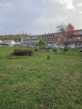
measurment image
Temperature :
19.0°C
Hits number :
65
Mesure UUID :
d12396ec-0cf1-4b74-89e7-f8d795a34337
Manual Reporting :
No
Sensor / ID :
1991002590
Sensor / Firmware version :
RiumGm
Sensor / Type :
Sensor / Tube type :
J305γβ
Smartphone / UUID :
927c1528b6ac9f45
Smartphone / Platform :
android
Smartphone / Model :
SM-S918B
Smartphone / OS Version :
14
Position acurracy :
46.7
Measurement height above the ground (in meters) :
0.00
Altitude accuracy :
46.7
Mean qualification :
Ground level
Software version :
OpenRadiation app 3.0
Measured value :
0.121 µSv/h

Measurement_e3ab5afe-1465-43cc-9a7a-cb553ced4d95

Measured radiation

0.208 µSv/h
geolocalisation :

45.2391289, 1.7508898

Ground level
yperrot
ATYPICAL MEASURE
Date de la mesure :
Latitude :
45.2391289
Longitude :
1.7508898
Altitude (M) :
392.0
Measurement time :
1 minutes 44 secondes
Distance travelled :
10.93m
Measurement speed :
Measurement Environment :
En campagne countryside
Weather :
rainy day Pluie
Tags :
Description :
Temperature :
20.0°C
Hits number :
51
Mesure UUID :
e3ab5afe-1465-43cc-9a7a-cb553ced4d95
Manual Reporting :
No
Sensor / ID :
1035879533
Sensor / Firmware version :
RiumGm
Sensor / Type :
Sensor / Tube type :
J305γβ
Smartphone / UUID :
346c111ee4ab55c7
Smartphone / Platform :
Android
Smartphone / Model :
moto g(7) plus
Smartphone / OS Version :
10
Position acurracy :
116.1
Measurement height above the ground (in meters) :
1.00
Altitude accuracy :
116.1
Mean qualification :
Ground level
Software version :
OpenRadiation app 2.3.4
Measured value :
0.208 µSv/h

Measurement_0ff28d2c-81a9-4479-88c3-2321ec5cb43f

Measured radiation

0.064 µSv/h
geolocalisation :

48.2807783, 7.6053125

Ground level
f4htb
Date de la mesure :
Latitude :
48.2807783
Longitude :
7.6053125
Altitude (M) :
215.0
Measurement time :
5 minutes
Distance travelled :
Measurement speed :
Measurement Environment :
En campagne countryside
Weather :
Tags :
Description :
Temperature :
27.0°C
Hits number :
91
Mesure UUID :
0ff28d2c-81a9-4479-88c3-2321ec5cb43f
Manual Reporting :
No
Sensor / ID :
00132
Sensor / Firmware version :
OpengKIT72
Sensor / Type :
Sensor / Tube type :
SBM-20
Smartphone / UUID :
Smartphone / Platform :
Smartphone / Model :
Smartphone / OS Version :
Position acurracy :
Measurement height above the ground (in meters) :
Altitude accuracy :
Mean qualification :
Ground level
Software version :
openradiation_pythonbridge_v1
Measured value :
0.064 µSv/h

Measurement_fdb305a2-104f-4fa5-9bdd-3f8bc31d8993

Measured radiation

0.077 µSv/h
geolocalisation :

48.2807783, 7.6053125

Ground level
f4htb
Date de la mesure :
Latitude :
48.2807783
Longitude :
7.6053125
Altitude (M) :
215.0
Measurement time :
5 minutes
Distance travelled :
Measurement speed :
Measurement Environment :
En campagne countryside
Weather :
Tags :
Description :
Temperature :
27.0°C
Hits number :
101
Mesure UUID :
fdb305a2-104f-4fa5-9bdd-3f8bc31d8993
Manual Reporting :
No
Sensor / ID :
00132
Sensor / Firmware version :
OpengKIT72
Sensor / Type :
Sensor / Tube type :
SBM-20
Smartphone / UUID :
Smartphone / Platform :
Smartphone / Model :
Smartphone / OS Version :
Position acurracy :
Measurement height above the ground (in meters) :
Altitude accuracy :
Mean qualification :
Ground level
Software version :
openradiation_pythonbridge_v1
Measured value :
0.077 µSv/h

Measurement_95a6974b-1bc5-4b54-aad7-9d2a129f93cd

Measured radiation

0.056 µSv/h
geolocalisation :

48.2807783, 7.6053125

Ground level
f4htb
Date de la mesure :
Latitude :
48.2807783
Longitude :
7.6053125
Altitude (M) :
215.0
Measurement time :
5 minutes
Distance travelled :
Measurement speed :
Measurement Environment :
En campagne countryside
Weather :
Tags :
Description :
Temperature :
23.0°C
Hits number :
85
Mesure UUID :
95a6974b-1bc5-4b54-aad7-9d2a129f93cd
Manual Reporting :
No
Sensor / ID :
00132
Sensor / Firmware version :
OpengKIT72
Sensor / Type :
Sensor / Tube type :
SBM-20
Smartphone / UUID :
Smartphone / Platform :
Smartphone / Model :
Smartphone / OS Version :
Position acurracy :
Measurement height above the ground (in meters) :
Altitude accuracy :
Mean qualification :
Ground level
Software version :
openradiation_pythonbridge_v1
Measured value :
0.056 µSv/h

Measurement_8d3a9371-1900-4269-ad03-671115750c28

Measured radiation

0.058 µSv/h
geolocalisation :

49.677316710318, -1.939189265348

Ground level
domlo
Date de la mesure :
Latitude :
49.677316710318
Longitude :
-1.939189265348
Altitude (M) :
112.0
Measurement time :
2 minutes 57 secondes
Distance travelled :
183.60m
Measurement speed :
Measurement Environment :
En campagne countryside
Weather :
Tags :
Description :
nez de Jobourg
Temperature :
35.0°C
Hits number :
51
Mesure UUID :
8d3a9371-1900-4269-ad03-671115750c28
Manual Reporting :
No
Sensor / ID :
Sensor / Firmware version :
OpengKIT71
Sensor / Type :
Sensor / Tube type :
SBM-20
Smartphone / UUID :
49460829-7EFB-42C6-ACC5-1C00E1C5C9FD
Smartphone / Platform :
ios
Smartphone / Model :
iPhone17,5
Smartphone / OS Version :
26.4.2
Position acurracy :
2.7
Measurement height above the ground (in meters) :
1.00
Altitude accuracy :
2.7
Mean qualification :
Ground level
Software version :
OpenRadiation app 3.1.1
Measured value :
0.058 µSv/h

Measurement_1c067d4d-ddbb-4a9e-afbc-e358ab020092

Measured radiation

0.089 µSv/h
geolocalisation :

43.646272388328, 1.661627143623

Ground level
rbmk17
Date de la mesure :
Latitude :
43.646272388328
Longitude :
1.661627143623
Altitude (M) :
175.0
Measurement time :
2 minutes 30 secondes
Distance travelled :
22.78m
Measurement speed :
Measurement Environment :
En campagne countryside
Weather :
Tags :
Description :
Temperature :
35.0°C
Hits number :
55
Mesure UUID :
1c067d4d-ddbb-4a9e-afbc-e358ab020092
Manual Reporting :
No
Sensor / ID :
00201
Sensor / Firmware version :
OpengKIT71
Sensor / Type :
Sensor / Tube type :
SBM-20
Smartphone / UUID :
B1470E59-311F-46CF-8704-206D8F960FE5
Smartphone / Platform :
iOS
Smartphone / Model :
iPhone8,2
Smartphone / OS Version :
12.3.1
Position acurracy :
5.0
Measurement height above the ground (in meters) :
1.00
Altitude accuracy :
5.0
Mean qualification :
Ground level
Software version :
OpenRadiation app 2.3.0
Measured value :
0.089 µSv/h

Measurement_459401cb-f537-4663-a0d3-57d730371ebc

Measured radiation

0.072 µSv/h
geolocalisation :

48.2807783, 7.6053125

Ground level
f4htb
Date de la mesure :
Latitude :
48.2807783
Longitude :
7.6053125
Altitude (M) :
215.0
Measurement time :
5 minutes
Distance travelled :
Measurement speed :
Measurement Environment :
En campagne countryside
Weather :
Tags :
Description :
Temperature :
23.0°C
Hits number :
97
Mesure UUID :
459401cb-f537-4663-a0d3-57d730371ebc
Manual Reporting :
No
Sensor / ID :
00132
Sensor / Firmware version :
OpengKIT72
Sensor / Type :
Sensor / Tube type :
SBM-20
Smartphone / UUID :
Smartphone / Platform :
Smartphone / Model :
Smartphone / OS Version :
Position acurracy :
Measurement height above the ground (in meters) :
Altitude accuracy :
Mean qualification :
Ground level
Software version :
openradiation_pythonbridge_v1
Measured value :
0.072 µSv/h

Measurement_ffd331e7-6343-439b-a3a1-921436954012

Measured radiation

0.069 µSv/h
geolocalisation :

46.774708333333, 1.6343233333333

Ground level
Fanche
Date de la mesure :
Latitude :
46.774708333333
Longitude :
1.6343233333333
Altitude (M) :
155.0
Measurement time :
1 minutes 1 secondes
Distance travelled :
2191.34m
Measurement speed :
Measurement Environment :
En campagne countryside
Weather :
Tags :
Description :
Temperature :
Hits number :
23
Mesure UUID :
ffd331e7-6343-439b-a3a1-921436954012
Manual Reporting :
No
Sensor / ID :
safecast_id 2344
Sensor / Firmware version :
$BNRDD
Sensor / Type :
Sensor / Tube type :
Smartphone / UUID :
Smartphone / Platform :
Smartphone / Model :
Smartphone / OS Version :
Position acurracy :
8.0
Measurement height above the ground (in meters) :
1.00
Altitude accuracy :
8.0
Mean qualification :
Ground level
Software version :
openradiation.net/upload v0.9
Measured value :
0.069 µSv/h

Measurement_ff731314-dc6c-4270-a2b6-dd1507284440

Measured radiation

3.120 µSv/h
geolocalisation :

48.895095, 2.387545

Ground level
carbone
ATYPICAL MEASURE
Date de la mesure :
Latitude :
48.895095
Longitude :
2.387545
Altitude (M) :
27.0
Measurement time :
1 minutes
Distance travelled :
Measurement speed :
Measurement Environment :
En campagne countryside
Weather :
Tags :
Description :
route du morvan
Temperature :
Hits number :
1029
Mesure UUID :
ff731314-dc6c-4270-a2b6-dd1507284440
Manual Reporting :
No
Sensor / ID :
safecast_id 1153
Sensor / Firmware version :
$BNRDD
Sensor / Type :
Sensor / Tube type :
Smartphone / UUID :
Smartphone / Platform :
Smartphone / Model :
Smartphone / OS Version :
Position acurracy :
11.0
Measurement height above the ground (in meters) :
1.00
Altitude accuracy :
11.0
Mean qualification :
Ground level
Software version :
openradiation.net/upload v0.2.0
Measured value :
3.120 µSv/h