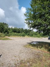


countryside

icone_mesure
slug
countryside

Measurement_7ea97b9c-87b4-4bee-9e91-7ca83401cea0

Measured radiation

0.068 µSv/h
geolocalisation :

42.518741665448, 3.1151546817302

Ground level
ClaireG
Date de la mesure :
Latitude :
42.518741665448
Longitude :
3.1151546817302
Altitude (M) :
20.0
Measurement time :
2 minutes 49 secondes
Distance travelled :
31.62m
Measurement speed :
Measurement Environment :
En campagne countryside
Weather :
Tags :
Description :
Temperature :
42.0°C
Hits number :
53
Mesure UUID :
7ea97b9c-87b4-4bee-9e91-7ca83401cea0
Manual Reporting :
No
Sensor / ID :
00176
Sensor / Firmware version :
OpengKIT71
Sensor / Type :
Sensor / Tube type :
SBM-20
Smartphone / UUID :
A11C3259-CB85-4860-AEFB-7476815277ED
Smartphone / Platform :
iOS
Smartphone / Model :
iPhone8,4
Smartphone / OS Version :
11.4.1
Position acurracy :
5.0
Measurement height above the ground (in meters) :
1.00
Altitude accuracy :
5.0
Mean qualification :
Ground level
Software version :
OpenRadiation app 2.1.0
Measured value :
0.068 µSv/h

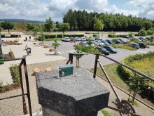
Measurement_ff0bb6df-758a-4ed5-a209-5b1752078723

Measured radiation

0.554 µSv/h
geolocalisation :

48.794491666667, 2.2742316666667

Ground level
Fanche
ATYPICAL MEASURE
Date de la mesure :
Latitude :
48.794491666667
Longitude :
2.2742316666667
Altitude (M) :
177.0
Measurement time :
1 minutes
Distance travelled :
0.31m
Measurement speed :
Measurement Environment :
En campagne countryside
Weather :
Tags :
Description :
Temperature :
Hits number :
185
Mesure UUID :
ff0bb6df-758a-4ed5-a209-5b1752078723
Manual Reporting :
No
Sensor / ID :
safecast_id 1223
Sensor / Firmware version :
$BNRDD
Sensor / Type :
Sensor / Tube type :
Smartphone / UUID :
Smartphone / Platform :
Smartphone / Model :
Smartphone / OS Version :
Position acurracy :
8.0
Measurement height above the ground (in meters) :
1.00
Altitude accuracy :
8.0
Mean qualification :
Ground level
Software version :
openradiation.net/upload v0.9
Measured value :
0.554 µSv/h

Measurement_ff142831-ece5-44a2-a327-b01751997152

Measured radiation

0.317 µSv/h
geolocalisation :

48.795596666667, 2.2778083333333

Ground level
Fanche
ATYPICAL MEASURE
Date de la mesure :
Latitude :
48.795596666667
Longitude :
2.2778083333333
Altitude (M) :
166.0
Measurement time :
1 minutes 1 secondes
Distance travelled :
83.08m
Measurement speed :
Measurement Environment :
En campagne countryside
Weather :
Tags :
Description :
Temperature :
Hits number :
106
Mesure UUID :
ff142831-ece5-44a2-a327-b01751997152
Manual Reporting :
No
Sensor / ID :
safecast_id 1223
Sensor / Firmware version :
$BNRDD
Sensor / Type :
Sensor / Tube type :
Smartphone / UUID :
Smartphone / Platform :
Smartphone / Model :
Smartphone / OS Version :
Position acurracy :
5.0
Measurement height above the ground (in meters) :
1.00
Altitude accuracy :
5.0
Mean qualification :
Ground level
Software version :
openradiation.net/upload v0.9
Measured value :
0.317 µSv/h

Measurement_b5c52bb3-8548-4232-a607-485ebdad5f19

Measured radiation

0.138 µSv/h
geolocalisation :

4.891232, -52.5039085

Ground level
JRWAGITINYWA
Date de la mesure :
Latitude :
4.891232
Longitude :
-52.5039085
Altitude (M) :
-25.0
Measurement time :
2 minutes 24 secondes
Distance travelled :
0.00m
Measurement speed :
Measurement Environment :
En campagne countryside
Weather :
Tags :
Description :
Temperature :
29.0°C
Hits number :
50
Mesure UUID :
b5c52bb3-8548-4232-a607-485ebdad5f19
Manual Reporting :
No
Sensor / ID :
dfbafb65
Sensor / Firmware version :
RiumGM BLE -b
Sensor / Type :
Sensor / Tube type :
J305γβ
Smartphone / UUID :
d80f873aff6780b7
Smartphone / Platform :
android
Smartphone / Model :
SM-S918B
Smartphone / OS Version :
15
Position acurracy :
20.0
Measurement height above the ground (in meters) :
1.00
Altitude accuracy :
20.0
Mean qualification :
Ground level
Software version :
OpenRadiation app 3.1
Measured value :
0.138 µSv/h

Measurement_10041f78-4418-4e6f-bb8a-5ff832c64b14

Measured radiation

0.085 µSv/h
geolocalisation :

-16.8208725, -150.9834227

Ground level
ASNR_LESE
Date de la mesure :
Latitude :
-16.8208725
Longitude :
-150.9834227
Altitude (M) :
14.0
Measurement time :
3 minutes 33 secondes
Distance travelled :
0.00m
Measurement speed :
Measurement Environment :
En campagne countryside
Weather :
Tags :
Description :
measurment image
Temperature :
28.0°C
Hits number :
51
Mesure UUID :
10041f78-4418-4e6f-bb8a-5ff832c64b14
Manual Reporting :
No
Sensor / ID :
3d4ec6c0
Sensor / Firmware version :
RiumGM BLE -b
Sensor / Type :
Sensor / Tube type :
J305γβ
Smartphone / UUID :
99e38b0a34f3b58a
Smartphone / Platform :
android
Smartphone / Model :
SM-G736B
Smartphone / OS Version :
15
Position acurracy :
4.6
Measurement height above the ground (in meters) :
1.00
Altitude accuracy :
4.6
Mean qualification :
Ground level
Software version :
OpenRadiation app 3.1
Measured value :
0.085 µSv/h

Measurement_cf5247f2-95c1-4777-95af-f336f6c8a75a

Measured radiation

0.102 µSv/h
geolocalisation :

50.5012444, 6.0931213

Ground level
rcroitor
Date de la mesure :
Latitude :
50.5012444
Longitude :
6.0931213
Altitude (M) :
741.0
Measurement time :
2 minutes 40 secondes
Distance travelled :
74.96m
Measurement speed :
Measurement Environment :
En campagne countryside
Weather :
Tags :
Description :
measurment image
Temperature :
34.0°C
Hits number :
51
Mesure UUID :
cf5247f2-95c1-4777-95af-f336f6c8a75a
Manual Reporting :
No
Sensor / ID :
00078
Sensor / Firmware version :
OpengKIT72
Sensor / Type :
Sensor / Tube type :
Smartphone / UUID :
8ce825cdb0e1ba83
Smartphone / Platform :
android
Smartphone / Model :
motorola edge 20 pro
Smartphone / OS Version :
13
Position acurracy :
3.8
Measurement height above the ground (in meters) :
1.00
Altitude accuracy :
3.8
Mean qualification :
Ground level
Software version :
OpenRadiation app 3.1
Measured value :
0.102 µSv/h

Measurement_eb3b7b4b-24c0-4964-841e-c8bbe7ce0972

Measured radiation

0.147 µSv/h
geolocalisation :

50.5480066, 6.0573204

Ground level
rcroitor
Date de la mesure :
Latitude :
50.5480066
Longitude :
6.0573204
Altitude (M) :
554.0
Measurement time :
2 minutes 1 secondes
Distance travelled :
0.00m
Measurement speed :
Measurement Environment :
En campagne countryside
Weather :
Tags :
Description :
measurment image
Temperature :
37.0°C
Hits number :
50
Mesure UUID :
eb3b7b4b-24c0-4964-841e-c8bbe7ce0972
Manual Reporting :
No
Sensor / ID :
00078
Sensor / Firmware version :
OpengKIT72
Sensor / Type :
Sensor / Tube type :
Smartphone / UUID :
8ce825cdb0e1ba83
Smartphone / Platform :
android
Smartphone / Model :
motorola edge 20 pro
Smartphone / OS Version :
13
Position acurracy :
10.0
Measurement height above the ground (in meters) :
0.00
Altitude accuracy :
10.0
Mean qualification :
Ground level
Software version :
OpenRadiation app 3.1
Measured value :
0.147 µSv/h

Measurement_ff3e5a89-b3cd-493e-a775-151517762655

Measured radiation

0.130 µSv/h
geolocalisation :

43.291651666667, 3.194225

Ground level
Jean-Maximilien
Date de la mesure :
Latitude :
43.291651666667
Longitude :
3.194225
Altitude (M) :
31.0
Measurement time :
1 minutes
Distance travelled :
Measurement speed :
Measurement Environment :
En campagne countryside
Weather :
Tags :
Description :
Temperature :
Hits number :
43
Mesure UUID :
ff3e5a89-b3cd-493e-a775-151517762655
Manual Reporting :
No
Sensor / ID :
safecast_id 2936
Sensor / Firmware version :
$BNRDD
Sensor / Type :
Sensor / Tube type :
Smartphone / UUID :
Smartphone / Platform :
Smartphone / Model :
Smartphone / OS Version :
Position acurracy :
11.0
Measurement height above the ground (in meters) :
1.00
Altitude accuracy :
11.0
Mean qualification :
Ground level
Software version :
openradiation.net/upload v0.2.0
Measured value :
0.130 µSv/h

Measurement_3a23fbca-60b6-46bd-b088-37383c9ea2ae

Measured radiation

0.101 µSv/h
geolocalisation :

47.3719577, 5.024412

Ground level
suzon-21
Date de la mesure :
Latitude :
47.3719577
Longitude :
5.024412
Altitude (M) :
326.0
Measurement time :
5 minutes 2 secondes
Distance travelled :
0.00m
Measurement speed :
Measurement Environment :
En campagne countryside
Weather :
Tags :
Description :
Temperature :
29.0°C
Hits number :
96
Mesure UUID :
3a23fbca-60b6-46bd-b088-37383c9ea2ae
Manual Reporting :
No
Sensor / ID :
00153
Sensor / Firmware version :
OpengKIT72
Sensor / Type :
Sensor / Tube type :
Smartphone / UUID :
40f15d6de1d2300e
Smartphone / Platform :
android
Smartphone / Model :
22011119UY
Smartphone / OS Version :
12
Position acurracy :
7.9
Measurement height above the ground (in meters) :
0.00
Altitude accuracy :
7.9
Mean qualification :
Ground level
Software version :
OpenRadiation app 3.1
Measured value :
0.101 µSv/h

Measurement_e15ea872-a8e5-4231-8d02-dd3ac5f3715e

Measured radiation

0.090 µSv/h
geolocalisation :

48.8043512, 5.035795

Ground level
NicoLex
Date de la mesure :
Latitude :
48.8043512
Longitude :
5.035795
Altitude (M) :
240.0
Measurement time :
Distance travelled :
0.00m
Measurement speed :
Measurement Environment :
En campagne countryside
Weather :
Tags :
Description :
Temperature :
Hits number :
Mesure UUID :
e15ea872-a8e5-4231-8d02-dd3ac5f3715e
Manual Reporting :
Yes
Sensor / ID :
Sensor / Firmware version :
Sensor / Type :
Sensor / Tube type :
Smartphone / UUID :
96294b6a0cec6792
Smartphone / Platform :
android
Smartphone / Model :
M2101K7BNY
Smartphone / OS Version :
13
Position acurracy :
1.6
Measurement height above the ground (in meters) :
1.00
Altitude accuracy :
1.6
Mean qualification :
Ground level
Software version :
OpenRadiation app 3.1
Measured value :
0.090 µSv/h