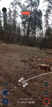


Ground level

slug
groundlevel

Measurement_4a8da3d6-9770-4a00-9ac4-a1925a8b76cf

Measured radiation

0.056 µSv/h
geolocalisation :

60.257845147409, 22.160324737922

Ground level
Orion44
Date de la mesure :
Latitude :
60.257845147409
Longitude :
22.160324737922
Altitude (M) :
21.0
Measurement time :
5 minutes 1 secondes
Distance travelled :
2792.78m
Measurement speed :
Measurement Environment :
Sur la route ontheroad
Weather :
Tags :
Description :
Temperature :
21.0°C
Hits number :
63
Mesure UUID :
4a8da3d6-9770-4a00-9ac4-a1925a8b76cf
Manual Reporting :
No
Sensor / ID :
AFD4C285-E267-0C1D-9DB9-604BA25926E4
Sensor / Firmware version :
AtomTag v.1.0.3
Sensor / Type :
Sensor / Tube type :
SBM-20
Smartphone / UUID :
9C8D5624-B9DA-4F35-8122-60FA98E821B9
Smartphone / Platform :
iOS
Smartphone / Model :
iPhone10,5
Smartphone / OS Version :
15.6.1
Position acurracy :
4751.5
Measurement height above the ground (in meters) :
1.00
Altitude accuracy :
4751.5
Mean qualification :
Ground level
Software version :
OpenRadiation app 2.3.4
Measured value :
0.056 µSv/h

Measurement_d27a1e8c-5f44-433b-913c-29361dcbad89

Measured radiation

0.088 µSv/h
geolocalisation :

43.7393221, 7.3644905

Ground level
Naoise
Date de la mesure :
Latitude :
43.7393221
Longitude :
7.3644905
Altitude (M) :
749.0
Measurement time :
5 minutes 1 secondes
Distance travelled :
328.25m
Measurement speed :
Measurement Environment :
En campagne countryside
Weather :
Tags :
Description :
Temperature :
21.0°C
Hits number :
74
Mesure UUID :
d27a1e8c-5f44-433b-913c-29361dcbad89
Manual Reporting :
No
Sensor / ID :
fe499cc4
Sensor / Firmware version :
RiumGM BLE -b
Sensor / Type :
Sensor / Tube type :
J305γβ
Smartphone / UUID :
8a7748cd79e856d1
Smartphone / Platform :
android
Smartphone / Model :
SM-G991B
Smartphone / OS Version :
14
Position acurracy :
8.0
Measurement height above the ground (in meters) :
1.00
Altitude accuracy :
8.0
Mean qualification :
Ground level
Software version :
OpenRadiation app 3.0
Measured value :
0.088 µSv/h

Measurement_a3565b06-6aba-4def-81e5-c8d797c1037a

Measured radiation

0.169 µSv/h
geolocalisation :

41.4475227, 9.2059287

Ground level
ghis
Date de la mesure :
Latitude :
41.4475227
Longitude :
9.2059287
Altitude (M) :
67.0
Measurement time :
2 minutes 4 secondes
Distance travelled :
2695.88m
Measurement speed :
Measurement Environment :
Sur la route ontheroad
Weather :
Tags :
Description :
Temperature :
29.0°C
Hits number :
51
Mesure UUID :
a3565b06-6aba-4def-81e5-c8d797c1037a
Manual Reporting :
No
Sensor / ID :
3772bf4e
Sensor / Firmware version :
RiumGM BLE -b
Sensor / Type :
Sensor / Tube type :
J305γβ
Smartphone / UUID :
bae2f0ab6269bbe2
Smartphone / Platform :
Android
Smartphone / Model :
DIG-L21HN
Smartphone / OS Version :
6.0
Position acurracy :
37.5
Measurement height above the ground (in meters) :
1.00
Altitude accuracy :
37.5
Mean qualification :
Ground level
Software version :
OpenRadiation app 2.3.4
Measured value :
0.169 µSv/h

Measurement_dd887835-2928-4b0c-9154-bc89d7b7fcca

Measured radiation

0.037 µSv/h
geolocalisation :

42.6745492, 10.0248352

Ground level
giocante_1
Date de la mesure :
Latitude :
42.6745492
Longitude :
10.0248352
Altitude (M) :
501.0
Measurement time :
5 minutes 57 secondes
Distance travelled :
19718.23m
Measurement speed :
Measurement Environment :
Sur la route ontheroad
Weather :
Tags :
Description :
Temperature :
29.0°C
Hits number :
51
Mesure UUID :
dd887835-2928-4b0c-9154-bc89d7b7fcca
Manual Reporting :
No
Sensor / ID :
3021143173
Sensor / Firmware version :
RiumGm
Sensor / Type :
Sensor / Tube type :
J305γβ
Smartphone / UUID :
25eac9e9f708ad66
Smartphone / Platform :
android
Smartphone / Model :
SM-S901B
Smartphone / OS Version :
14
Position acurracy :
2.5
Measurement height above the ground (in meters) :
1.00
Altitude accuracy :
2.5
Mean qualification :
Ground level
Software version :
OpenRadiation app 3.0
Measured value :
0.037 µSv/h

Measurement_afe8ff08-bc72-48c8-89a2-0b497296984f

Measured radiation

0.312 µSv/h
geolocalisation :

37.4670768, 126.433775

Ground level
Fanche
ATYPICAL MEASURE
Date de la mesure :
Latitude :
37.4670768
Longitude :
126.433775
Altitude (M) :
45.0
Measurement time :
5 minutes 46 secondes
Distance travelled :
19.65m
Measurement speed :
Measurement Environment :
Weather :
Tags :
Description :
Temperature :
17.0°C
Hits number :
264
Mesure UUID :
afe8ff08-bc72-48c8-89a2-0b497296984f
Manual Reporting :
No
Sensor / ID :
0C:1C:57:B5:C3:BB
Sensor / Firmware version :
AtomTag
Sensor / Type :
Sensor / Tube type :
SBM-20
Smartphone / UUID :
f15368685e92af51
Smartphone / Platform :
android
Smartphone / Model :
SM-G991B
Smartphone / OS Version :
13
Position acurracy :
19.8
Measurement height above the ground (in meters) :
Altitude accuracy :
19.8
Mean qualification :
Ground level
Software version :
OpenRadiation app 3.0
Measured value :
0.312 µSv/h

Measurement_776ae9ec-15b5-406b-a1c1-1c5bed914e9f

Measured radiation

0.039 µSv/h
geolocalisation :

51.0937342, 40.0439011

Ground level
VKQANDAserver
Date de la mesure :
Latitude :
51.0937342
Longitude :
40.0439011
Altitude (M) :
155.0
Measurement time :
18 heures 5 minutes
Distance travelled :
0.00m
Measurement speed :
Measurement Environment :
À l'intérieur inside
Weather :
rainy day Pluie
Tags :
Description :
малая доза радиации
measurment image
Temperature :
21.0°C
Hits number :
125
Mesure UUID :
776ae9ec-15b5-406b-a1c1-1c5bed914e9f
Manual Reporting :
Yes
Sensor / ID :
Sensor / Firmware version :
Sensor / Type :
Sensor / Tube type :
Smartphone / UUID :
ab0facf81b85eab6
Smartphone / Platform :
android
Smartphone / Model :
M2003J15SC
Smartphone / OS Version :
11
Position acurracy :
20.0
Measurement height above the ground (in meters) :
Altitude accuracy :
20.0
Mean qualification :
Ground level
Software version :
OpenRadiation app 3.0
Measured value :
0.039 µSv/h

Measurement_0514e4af-2543-4bf3-aedf-6ee9017dc019

Measured radiation

0.135 µSv/h
geolocalisation :

48.514458987724, -2.7638179878666

Ground level
domlo
Date de la mesure :
Latitude :
48.514458987724
Longitude :
-2.7638179878666
Altitude (M) :
74.0
Measurement time :
7 minutes 45 secondes
Distance travelled :
76.98m
Measurement speed :
Measurement Environment :
En campagne countryside
Weather :
Tags :
Description :
Temperature :
19.0°C
Hits number :
159
Mesure UUID :
0514e4af-2543-4bf3-aedf-6ee9017dc019
Manual Reporting :
No
Sensor / ID :
41007bbe
Sensor / Firmware version :
RiumGM BLE -b
Sensor / Type :
Sensor / Tube type :
J305γβ
Smartphone / UUID :
F2F0E7EB-7961-450A-A274-5E99CBD951C1
Smartphone / Platform :
ios
Smartphone / Model :
iPhone12,1
Smartphone / OS Version :
18.1.1
Position acurracy :
8.3
Measurement height above the ground (in meters) :
1.00
Altitude accuracy :
8.3
Mean qualification :
Ground level
Software version :
OpenRadiation app 3.0
Measured value :
0.135 µSv/h

Measurement_7a1f34b5-5ad0-4c0e-b700-994d1a398c3d

Measured radiation

0.099 µSv/h
geolocalisation :

48.526497888771, -2.7911406429036

Ground level
kristobal22
Date de la mesure :
Latitude :
48.526497888771
Longitude :
-2.7911406429036
Altitude (M) :
106.0
Measurement time :
2 minutes 13 secondes
Distance travelled :
50.30m
Measurement speed :
Measurement Environment :
À l'intérieur inside
Weather :
rainy day Pluie
Tags :
Description :
Temperature :
26.0°C
Hits number :
52
Mesure UUID :
7a1f34b5-5ad0-4c0e-b700-994d1a398c3d
Manual Reporting :
No
Sensor / ID :
00152
Sensor / Firmware version :
OpengKIT71
Sensor / Type :
Sensor / Tube type :
SBM-20
Smartphone / UUID :
BA3D6C11-E1C4-4B95-81FA-13D82FDB4D40
Smartphone / Platform :
iOS
Smartphone / Model :
iPhone8,4
Smartphone / OS Version :
15.6.1
Position acurracy :
190.1
Measurement height above the ground (in meters) :
1.00
Altitude accuracy :
190.1
Mean qualification :
Ground level
Software version :
OpenRadiation app 2.3.4
Measured value :
0.099 µSv/h

Measurement_4af27fe1-bbf5-4c07-a759-412de82e4059

Measured radiation

0.146 µSv/h
geolocalisation :

47.236573, -1.5537154

Ground level
Alpharty
Date de la mesure :
Latitude :
47.236573
Longitude :
-1.5537154
Altitude (M) :
72.0
Measurement time :
2 minutes 9 secondes
Distance travelled :
193.39m
Measurement speed :
Measurement Environment :
En ville city
Weather :
rainy day Pluie
Tags :
Description :
Temperature :
14.0°C
Hits number :
52
Mesure UUID :
4af27fe1-bbf5-4c07-a759-412de82e4059
Manual Reporting :
No
Sensor / ID :
80:30:DC:4A:BB:9D
Sensor / Firmware version :
AtomTag v.1.0.3
Sensor / Type :
Sensor / Tube type :
SBM-20
Smartphone / UUID :
63eb68845b623e5e
Smartphone / Platform :
Android
Smartphone / Model :
SM-G930F
Smartphone / OS Version :
8.0.0
Position acurracy :
8.2
Measurement height above the ground (in meters) :
1.00
Altitude accuracy :
8.2
Mean qualification :
Ground level
Software version :
OpenRadiation app 2.3.3
Measured value :
0.146 µSv/h