


city

icone_mesure
slug
city

Measurement_d551114a-52f4-425b-a598-0c5ad6eb9f97

Measured radiation

0.072 µSv/h
geolocalisation :

48.843936609268, 2.3717641383124

Ground level
Hobert
Date de la mesure :
Latitude :
48.843936609268
Longitude :
2.3717641383124
Altitude (M) :
31.0
Measurement time :
3 minutes 58 secondes
Distance travelled :
56.51m
Measurement speed :
Measurement Environment :
En ville city
Weather :
Tags :
Description :
Temperature :
25.0°C
Hits number :
51
Mesure UUID :
d551114a-52f4-425b-a598-0c5ad6eb9f97
Manual Reporting :
No
Sensor / ID :
0a36fd4c
Sensor / Firmware version :
RiumGM BLE -b
Sensor / Type :
Sensor / Tube type :
J305γβ
Smartphone / UUID :
099DFCB7-1478-4415-9D8B-B22AC1148A94
Smartphone / Platform :
iOS
Smartphone / Model :
iPhone9,3
Smartphone / OS Version :
15.7
Position acurracy :
35.0
Measurement height above the ground (in meters) :
1.00
Altitude accuracy :
35.0
Mean qualification :
Ground level
Software version :
OpenRadiation app 2.3.4
Measured value :
0.072 µSv/h
Measurement_11538da1-7e0e-4942-b40d-c93f90ac5478

Measured radiation

0.161 µSv/h
geolocalisation :

43.0673811, 0.1549455

Ground level
Nala
Date de la mesure :
Latitude :
43.0673811
Longitude :
0.1549455
Altitude (M) :
601.0
Measurement time :
2 minutes 10 secondes
Distance travelled :
13.38m
Measurement speed :
Measurement Environment :
En ville city
Weather :
Tags :
Description :
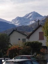
A proximité du Pic du Midi.
measurment image
Temperature :
20.0°C
Hits number :
51
Mesure UUID :
11538da1-7e0e-4942-b40d-c93f90ac5478
Manual Reporting :
No
Sensor / ID :
238193284
Sensor / Firmware version :
RiumGm
Sensor / Type :
Sensor / Tube type :
J305γβ
Smartphone / UUID :
963626a73b573742
Smartphone / Platform :
Android
Smartphone / Model :
Redmi Note 6 Pro
Smartphone / OS Version :
9
Position acurracy :
22.3
Measurement height above the ground (in meters) :
1.00
Altitude accuracy :
22.3
Mean qualification :
Ground level
Software version :
OpenRadiation app 2.3.1
Measured value :
0.161 µSv/h

Measurement_0a9c884f-7cd9-433a-b182-731f69008a8d

Measured radiation

0.122 µSv/h
geolocalisation :

45.227142333984, -0.57264315

Ground level
Hobert
Date de la mesure :
Latitude :
45.227142333984
Longitude :
-0.57264315
Altitude (M) :
9.0
Measurement time :
9 minutes 25 secondes
Distance travelled :
254.01m
Measurement speed :
Measurement Environment :
En ville city
Weather :
Tags :
Description :
Temperature :
27.0°C
Hits number :
178
Mesure UUID :
0a9c884f-7cd9-433a-b182-731f69008a8d
Manual Reporting :
No
Sensor / ID :
0a36fd4c
Sensor / Firmware version :
RiumGM BLE -b
Sensor / Type :
Sensor / Tube type :
J305γβ
Smartphone / UUID :
099DFCB7-1478-4415-9D8B-B22AC1148A94
Smartphone / Platform :
iOS
Smartphone / Model :
iPhone9,3
Smartphone / OS Version :
15.5
Position acurracy :
5.0
Measurement height above the ground (in meters) :
1.00
Altitude accuracy :
5.0
Mean qualification :
Ground level
Software version :
OpenRadiation app 2.3.4
Measured value :
0.122 µSv/h

Measurement_ff5366d7-c4fc-42dd-a3db-e71693061887

Measured radiation

2.398 µSv/h
geolocalisation :

43.576171666667, -76.13237

Ground level
Fanche
ATYPICAL MEASURE
Date de la mesure :
Latitude :
43.576171666667
Longitude :
-76.13237
Altitude (M) :
11563.0
Measurement time :
1 minutes
Distance travelled :
13706.75m
Measurement speed :
Measurement Environment :
En ville city
Weather :
Tags :
Description :
Temperature :
Hits number :
801
Mesure UUID :
ff5366d7-c4fc-42dd-a3db-e71693061887
Manual Reporting :
No
Sensor / ID :
safecast_id 3220
Sensor / Firmware version :
$BNRDD
Sensor / Type :
Sensor / Tube type :
Smartphone / UUID :
Smartphone / Platform :
Smartphone / Model :
Smartphone / OS Version :
Position acurracy :
9.0
Measurement height above the ground (in meters) :
1.00
Altitude accuracy :
9.0
Mean qualification :
Ground level
Software version :
openradiation.net/upload v0.9
Measured value :
2.398 µSv/h

Measurement_8c8725cb-db0a-4912-a315-e47f1efe1bd2

Measured radiation

0.290 µSv/h
geolocalisation :

47.24272, -1.55445

Ground level
labsciren
ATYPICAL MEASURE
Date de la mesure :
Latitude :
47.24272
Longitude :
-1.55445
Altitude (M) :
Measurement time :
1 minutes
Distance travelled :
Measurement speed :
Measurement Environment :
En ville city
Weather :
Tags :
Description :
Piscine petit port
Temperature :
Hits number :
Mesure UUID :
8c8725cb-db0a-4912-a315-e47f1efe1bd2
Manual Reporting :
Yes
Sensor / ID :
Sensor / Firmware version :
Sensor / Type :
Sensor / Tube type :
Smartphone / UUID :
Smartphone / Platform :
Smartphone / Model :
Smartphone / OS Version :
Position acurracy :
Measurement height above the ground (in meters) :
1.00
Altitude accuracy :
Mean qualification :
Ground level
Software version :
openradiation.org v1
Measured value :
0.290 µSv/h

Measurement_ff6af328-1990-4653-a7fd-8e1734406739

Measured radiation

0.123 µSv/h
geolocalisation :

35.672315, 139.759235

Ground level
Fanche
Date de la mesure :
Latitude :
35.672315
Longitude :
139.759235
Altitude (M) :
44.0
Measurement time :
1 minutes
Distance travelled :
128.74m
Measurement speed :
Measurement Environment :
En ville city
Weather :
Tags :
Description :
Temperature :
Hits number :
41
Mesure UUID :
ff6af328-1990-4653-a7fd-8e1734406739
Manual Reporting :
No
Sensor / ID :
safecast_id 2340
Sensor / Firmware version :
$BNRDD
Sensor / Type :
Sensor / Tube type :
Smartphone / UUID :
Smartphone / Platform :
Smartphone / Model :
Smartphone / OS Version :
Position acurracy :
6.0
Measurement height above the ground (in meters) :
1.00
Altitude accuracy :
6.0
Mean qualification :
Ground level
Software version :
openradiation.net/upload v0.9
Measured value :
0.123 µSv/h

Measurement_38fc0d6b-1e52-4011-8183-3c4ed09428bc

Measured radiation

0.062 µSv/h
geolocalisation :

47.3651712, 5.0230203

Ground level
suzon-21
Date de la mesure :
Latitude :
47.3651712
Longitude :
5.0230203
Altitude (M) :
326.0
Measurement time :
5 minutes
Distance travelled :
0.00m
Measurement speed :
Measurement Environment :
En ville city
Weather :
Tags :
Description :
tube J 305
Temperature :
Hits number :
82
Mesure UUID :
38fc0d6b-1e52-4011-8183-3c4ed09428bc
Manual Reporting :
Yes
Sensor / ID :
Sensor / Firmware version :
Sensor / Type :
Sensor / Tube type :
Smartphone / UUID :
40f15d6de1d2300e
Smartphone / Platform :
android
Smartphone / Model :
22011119UY
Smartphone / OS Version :
12
Position acurracy :
8.7
Measurement height above the ground (in meters) :
1.00
Altitude accuracy :
8.7
Mean qualification :
Ground level
Software version :
OpenRadiation app 3.0
Measured value :
0.062 µSv/h

Measurement_ff18b856-d993-4c98-ac5f-dc1679497140

Measured radiation

0.051 µSv/h
geolocalisation :

48.77743, 7.4380183333333

Ground level
Fanche
Date de la mesure :
Latitude :
48.77743
Longitude :
7.4380183333333
Altitude (M) :
163.0
Measurement time :
1 minutes
Distance travelled :
4966.84m
Measurement speed :
Measurement Environment :
En ville city
Weather :
Tags :
Description :
Temperature :
Hits number :
17
Mesure UUID :
ff18b856-d993-4c98-ac5f-dc1679497140
Manual Reporting :
No
Sensor / ID :
safecast_id 1223
Sensor / Firmware version :
$BNRDD
Sensor / Type :
Sensor / Tube type :
Smartphone / UUID :
Smartphone / Platform :
Smartphone / Model :
Smartphone / OS Version :
Position acurracy :
7.0
Measurement height above the ground (in meters) :
1.00
Altitude accuracy :
7.0
Mean qualification :
Ground level
Software version :
openradiation.net/upload v0.9
Measured value :
0.051 µSv/h

Measurement_ff18b856-d993-4c98-ac5f-dc1679496899

Measured radiation

0.120 µSv/h
geolocalisation :

48.696698333333, 7.6386283333333

Ground level
Fanche
Date de la mesure :
Latitude :
48.696698333333
Longitude :
7.6386283333333
Altitude (M) :
170.0
Measurement time :
1 minutes
Distance travelled :
3441.34m
Measurement speed :
Measurement Environment :
En ville city
Weather :
Tags :
Description :
Temperature :
Hits number :
40
Mesure UUID :
ff18b856-d993-4c98-ac5f-dc1679496899
Manual Reporting :
No
Sensor / ID :
safecast_id 1223
Sensor / Firmware version :
$BNRDD
Sensor / Type :
Sensor / Tube type :
Smartphone / UUID :
Smartphone / Platform :
Smartphone / Model :
Smartphone / OS Version :
Position acurracy :
7.0
Measurement height above the ground (in meters) :
1.00
Altitude accuracy :
7.0
Mean qualification :
Ground level
Software version :
openradiation.net/upload v0.9
Measured value :
0.120 µSv/h

Measurement_4fd16165-e6f6-41c4-92b9-49ff9446fb20

Measured radiation

0.092 µSv/h
geolocalisation :

43.3452209, -0.3774746

Ground level
Nala
Date de la mesure :
Latitude :
43.3452209
Longitude :
-0.3774746
Altitude (M) :
256.0
Measurement time :
3 minutes 21 secondes
Distance travelled :
46.40m
Measurement speed :
Measurement Environment :
En ville city
Weather :
Tags :
Description :
Temperature :
24.0°C
Hits number :
51
Mesure UUID :
4fd16165-e6f6-41c4-92b9-49ff9446fb20
Manual Reporting :
No
Sensor / ID :
238193284
Sensor / Firmware version :
RiumGm
Sensor / Type :
Sensor / Tube type :
J305γβ
Smartphone / UUID :
963626a73b573742
Smartphone / Platform :
Android
Smartphone / Model :
Redmi Note 6 Pro
Smartphone / OS Version :
9
Position acurracy :
17.6
Measurement height above the ground (in meters) :
1.00
Altitude accuracy :
17.6
Mean qualification :
Ground level
Software version :
OpenRadiation app 2.3.1
Measured value :
0.092 µSv/h