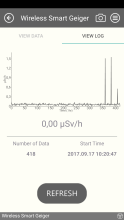


city

icone_mesure
slug
city

Measurement_d7496a8b-edea-4e70-baf6-6e9b957ead56

Measured radiation

0.550 µSv/h
geolocalisation :

48.7868297, 2.2799907

Temporary source
pduchemin
ATYPICAL MEASURE
Date de la mesure :
Latitude :
48.7868297
Longitude :
2.2799907
Altitude (M) :
111.0
Measurement time :
1 heures
Distance travelled :
Measurement speed :
Measurement Environment :
En ville city
Weather :
Tags :
Description :
measurment image
Temperature :
22.0°C
Hits number :
Mesure UUID :
d7496a8b-edea-4e70-baf6-6e9b957ead56
Manual Reporting :
Yes
Sensor / ID :
Sensor / Firmware version :
Sensor / Type :
Sensor / Tube type :
FTLAB Bluetooth Smart Geiger BSG-001
Smartphone / UUID :
Smartphone / Platform :
Smartphone / Model :
Smartphone / OS Version :
Position acurracy :
Measurement height above the ground (in meters) :
Altitude accuracy :
Mean qualification :
Temporary source
Software version :
openradiation.org v1
Measured value :
0.550 µSv/h

Measurement_9ff12004-5cfd-4c87-b804-80489a5f4d88

Measured radiation

0.080 µSv/h
geolocalisation :

46.7784736, 6.641183

Ground level
nico83
Date de la mesure :
Latitude :
46.7784736
Longitude :
6.641183
Altitude (M) :
435.0
Measurement time :
5 minutes
Distance travelled :
Measurement speed :
Measurement Environment :
En ville city
Weather :
Tags :
Description :
Mazur Instrument PRM-9000
Temperature :
20.0°C
Hits number :
28
Mesure UUID :
9ff12004-5cfd-4c87-b804-80489a5f4d88
Manual Reporting :
Yes
Sensor / ID :
nico83
Sensor / Firmware version :
Mazur Instrument PRM-9000
Sensor / Type :
Sensor / Tube type :
LND 7317 Pancake Geiger-Muller tube
Smartphone / UUID :
Smartphone / Platform :
Smartphone / Model :
Smartphone / OS Version :
Position acurracy :
Measurement height above the ground (in meters) :
1.00
Altitude accuracy :
Mean qualification :
Ground level
Software version :
openradiation.org v1
Measured value :
0.080 µSv/h

Measurement_96674e8d-bd6a-47b4-a817-95921aa2ca27

Measured radiation

0.080 µSv/h
geolocalisation :

46.774273, 6.6442696

Ground level
nico83
Date de la mesure :
Latitude :
46.774273
Longitude :
6.6442696
Altitude (M) :
435.0
Measurement time :
10 minutes
Distance travelled :
Measurement speed :
Measurement Environment :
En ville city
Weather :
Tags :
Description :
Temperature :
18.0°C
Hits number :
28
Mesure UUID :
96674e8d-bd6a-47b4-a817-95921aa2ca27
Manual Reporting :
Yes
Sensor / ID :
nico83
Sensor / Firmware version :
Sensor / Type :
Sensor / Tube type :
LND 7317 Pancake Geiger-Muller tube
Smartphone / UUID :
Smartphone / Platform :
Smartphone / Model :
Smartphone / OS Version :
Position acurracy :
Measurement height above the ground (in meters) :
0.00
Altitude accuracy :
Mean qualification :
Ground level
Software version :
openradiation.org v1
Measured value :
0.080 µSv/h