


city

icone_mesure
slug
city

Measurement_05176133-7c99-4d12-b4d2-3beb0a823aae

Measured radiation

0.227 µSv/h
geolocalisation :

42.670059910009, 9.4413260125627

Ground level
NSI-SIN_Vincensini
ATYPICAL MEASURE
Date de la mesure :
Latitude :
42.67005991001
Longitude :
9.4413260125627
Altitude (M) :
26.0
Measurement time :
2 minutes
Distance travelled :
Measurement speed :
Measurement Environment :
En ville city
Weather :
Tags :
Description :
Temperature :
23.0°C
Hits number :
57
Mesure UUID :
05176133-7c99-4d12-b4d2-3beb0a823aae
Manual Reporting :
No
Sensor / ID :
Sensor / Firmware version :
Libelium Radiation Sensor Board - North Optic Geiger-Müller Tube
Sensor / Type :
Sensor / Tube type :
North Optic Geiger-Müller Tube J305ß
Smartphone / UUID :
Smartphone / Platform :
Smartphone / Model :
Smartphone / OS Version :
Position acurracy :
Measurement height above the ground (in meters) :
3.00
Altitude accuracy :
Mean qualification :
Ground level
Software version :
Firmware_V1.0
Measured value :
0.227 µSv/h
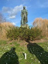
Measurement_8b952549-3324-4180-821f-f97032c2c199

Measured radiation

0.105 µSv/h
geolocalisation :

48.392416710362, 4.5280689936885

Ground level
domlo
Date de la mesure :
Latitude :
48.392416710362
Longitude :
4.5280689936885
Altitude (M) :
126.0
Measurement time :
3 minutes 20 secondes
Distance travelled :
16.50m
Measurement speed :
Measurement Environment :
En ville city
Weather :
Tags :
Description :
centre de Brienne le Chateau
measurment image
Temperature :
24.0°C
Hits number :
56
Mesure UUID :
8b952549-3324-4180-821f-f97032c2c199
Manual Reporting :
No
Sensor / ID :
751f70e7
Sensor / Firmware version :
RiumGM BLE -b
Sensor / Type :
Sensor / Tube type :
J305γβ
Smartphone / UUID :
37C525FD-5749-4F9D-AC22-87318DD67A00
Smartphone / Platform :
iOS
Smartphone / Model :
iPhone12,1
Smartphone / OS Version :
17.3.1
Position acurracy :
12.0
Measurement height above the ground (in meters) :
0.00
Altitude accuracy :
12.0
Mean qualification :
Ground level
Software version :
OpenRadiation app 2.3.4
Measured value :
0.105 µSv/h

Measurement_c44cca36-2654-4a60-b191-5c11cb0aad5a

Measured radiation

0.070 µSv/h
geolocalisation :

47.3657256, 5.0213825

Ground level
suzon-21
Date de la mesure :
Latitude :
47.3657256
Longitude :
5.0213825
Altitude (M) :
332.0
Measurement time :
5 minutes
Distance travelled :
0.00m
Measurement speed :
Measurement Environment :
En ville city
Weather :
Tags :
Description :
compteur br-9b tube j 321
Temperature :
Hits number :
Mesure UUID :
c44cca36-2654-4a60-b191-5c11cb0aad5a
Manual Reporting :
Yes
Sensor / ID :
Sensor / Firmware version :
Sensor / Type :
Sensor / Tube type :
Smartphone / UUID :
02748f5609387157
Smartphone / Platform :
Android
Smartphone / Model :
ARCHOS T96 3G_EEA
Smartphone / OS Version :
11
Position acurracy :
13.9
Measurement height above the ground (in meters) :
1.00
Altitude accuracy :
13.9
Mean qualification :
Ground level
Software version :
OpenRadiation app 2.3.5
Measured value :
0.070 µSv/h

Measurement_2d680ed2-0e3b-42b2-83c5-a045b80d3f39

Measured radiation

0.260 µSv/h
geolocalisation :

42.670059910009, 9.4413260125627

Ground level
NSI-SIN_Vincensini
ATYPICAL MEASURE
Date de la mesure :
Latitude :
42.67005991001
Longitude :
9.4413260125627
Altitude (M) :
26.0
Measurement time :
2 minutes
Distance travelled :
Measurement speed :
Measurement Environment :
En ville city
Weather :
Tags :
Description :
Temperature :
21.0°C
Hits number :
65
Mesure UUID :
2d680ed2-0e3b-42b2-83c5-a045b80d3f39
Manual Reporting :
No
Sensor / ID :
Sensor / Firmware version :
Libelium Radiation Sensor Board - North Optic Geiger-Müller Tube
Sensor / Type :
Sensor / Tube type :
North Optic Geiger-Müller Tube J305ß
Smartphone / UUID :
Smartphone / Platform :
Smartphone / Model :
Smartphone / OS Version :
Position acurracy :
Measurement height above the ground (in meters) :
3.00
Altitude accuracy :
Mean qualification :
Ground level
Software version :
Firmware_V1.0
Measured value :
0.260 µSv/h

Measurement_3d521545-96a3-45ed-a5b1-50481fa13b1c

Measured radiation

0.551 µSv/h
geolocalisation :

49.103394225286, 6.6944008413765

Ground level
Eric57
ATYPICAL MEASURE
Date de la mesure :
Latitude :
49.103394225286
Longitude :
6.6944008413765
Altitude (M) :
240.0
Measurement time :
2 minutes 7 secondes
Distance travelled :
3.42m
Measurement speed :
Measurement Environment :
En ville city
Weather :
Tags :
Description :
tests GM rium
Temperature :
13.0°C
Hits number :
151
Mesure UUID :
3d521545-96a3-45ed-a5b1-50481fa13b1c
Manual Reporting :
No
Sensor / ID :
b4011397
Sensor / Firmware version :
RiumGM BLE -b
Sensor / Type :
Sensor / Tube type :
J305γβ
Smartphone / UUID :
48DA54EA-4E32-4EAF-8F1B-713CFA612E1A
Smartphone / Platform :
iOS
Smartphone / Model :
iPhone15,5
Smartphone / OS Version :
17.4.1
Position acurracy :
5.3
Measurement height above the ground (in meters) :
1.00
Altitude accuracy :
5.3
Mean qualification :
Ground level
Software version :
OpenRadiation app 2.3.4
Measured value :
0.551 µSv/h

Measurement_96f331fa-e2cd-48d6-805a-1cda1373be35

Measured radiation

0.060 µSv/h
geolocalisation :

44.754421495334, -0.57547008155133

Ground level
rbmk17
Date de la mesure :
Latitude :
44.754421495334
Longitude :
-0.57547008155133
Altitude (M) :
31.0
Measurement time :
7 minutes 18 secondes
Distance travelled :
15.18m
Measurement speed :
Measurement Environment :
En ville city
Weather :
Tags :
Description :
Temperature :
27.0°C
Hits number :
129
Mesure UUID :
96f331fa-e2cd-48d6-805a-1cda1373be35
Manual Reporting :
No
Sensor / ID :
00201
Sensor / Firmware version :
OpengKIT71
Sensor / Type :
Sensor / Tube type :
SBM-20
Smartphone / UUID :
6B7A26D8-8D56-48AC-B3F6-5B403FCD9786
Smartphone / Platform :
iOS
Smartphone / Model :
iPhone11,8
Smartphone / OS Version :
13.5.1
Position acurracy :
31.7
Measurement height above the ground (in meters) :
1.00
Altitude accuracy :
31.7
Mean qualification :
Ground level
Software version :
OpenRadiation app 2.3.1
Measured value :
0.060 µSv/h

Measurement_10dbad4b-ca10-4846-84e6-b660377600c3

Measured radiation

0.068 µSv/h
geolocalisation :

46.3234505, -0.4587139

Ground level
ghis
Date de la mesure :
Latitude :
46.3234505
Longitude :
-0.4587139
Altitude (M) :
62.0
Measurement time :
4 minutes 9 secondes
Distance travelled :
15.35m
Measurement speed :
Measurement Environment :
En ville city
Weather :
Tags :
Description :
Temperature :
30.0°C
Hits number :
51
Mesure UUID :
10dbad4b-ca10-4846-84e6-b660377600c3
Manual Reporting :
No
Sensor / ID :
e495aa31
Sensor / Firmware version :
RiumGM BLE -b
Sensor / Type :
Sensor / Tube type :
J305γβ
Smartphone / UUID :
d1e3d7eaec6a1c93
Smartphone / Platform :
Android
Smartphone / Model :
SM-A202F
Smartphone / OS Version :
9
Position acurracy :
15.6
Measurement height above the ground (in meters) :
1.00
Altitude accuracy :
15.6
Mean qualification :
Ground level
Software version :
OpenRadiation app 2.3.3
Measured value :
0.068 µSv/h

Measurement_0dbe4a26-4eb4-46e2-940a-3c1d2f99ef7b

Measured radiation

0.191 µSv/h
geolocalisation :

43.604900655377, 1.4475246705128

Ground level
Obspm
Date de la mesure :
Latitude :
43.604900655377
Longitude :
1.4475246705128
Altitude (M) :
138.0
Measurement time :
1 minutes 45 secondes
Distance travelled :
51.24m
Measurement speed :
Measurement Environment :
En ville city
Weather :
Tags :
Description :
Temperature :
13.0°C
Hits number :
53
Mesure UUID :
0dbe4a26-4eb4-46e2-940a-3c1d2f99ef7b
Manual Reporting :
No
Sensor / ID :
4A66D58B-E26B-E308-22E9-F3BFA0950339
Sensor / Firmware version :
AtomTag v.1.0.3
Sensor / Type :
Sensor / Tube type :
SBM-20
Smartphone / UUID :
F59FED28-8DC4-4F48-8254-DB1A376486F7
Smartphone / Platform :
iOS
Smartphone / Model :
iPhone14,5
Smartphone / OS Version :
16.6.1
Position acurracy :
3.5
Measurement height above the ground (in meters) :
1.00
Altitude accuracy :
3.5
Mean qualification :
Ground level
Software version :
OpenRadiation app 2.3.4
Measured value :
0.191 µSv/h

Measurement_fffd6bfd-6437-4f29-aa7b-121680241550

Measured radiation

0.066 µSv/h
geolocalisation :

43.565565, 4.0551716666667

Ground level
Fanche
Date de la mesure :
Latitude :
43.565565
Longitude :
4.0551716666667
Altitude (M) :
22.0
Measurement time :
1 minutes 5 secondes
Distance travelled :
1616.89m
Measurement speed :
Measurement Environment :
En ville city
Weather :
Tags :
Description :
Temperature :
Hits number :
22
Mesure UUID :
fffd6bfd-6437-4f29-aa7b-121680241550
Manual Reporting :
No
Sensor / ID :
safecast_id 3289
Sensor / Firmware version :
$BNRDD
Sensor / Type :
Sensor / Tube type :
Smartphone / UUID :
Smartphone / Platform :
Smartphone / Model :
Smartphone / OS Version :
Position acurracy :
8.0
Measurement height above the ground (in meters) :
1.00
Altitude accuracy :
8.0
Mean qualification :
Ground level
Software version :
openradiation.net/upload v0.9
Measured value :
0.066 µSv/h

Measurement_ff18b856-d993-4c98-ac5f-dc1679498419

Measured radiation

0.090 µSv/h
geolocalisation :

48.94072, 6.1280933333333

Ground level
Fanche
Date de la mesure :
Latitude :
48.94072
Longitude :
6.1280933333333
Altitude (M) :
188.0
Measurement time :
1 minutes
Distance travelled :
4502.44m
Measurement speed :
Measurement Environment :
En ville city
Weather :
Tags :
Description :
Temperature :
Hits number :
30
Mesure UUID :
ff18b856-d993-4c98-ac5f-dc1679498419
Manual Reporting :
No
Sensor / ID :
safecast_id 1223
Sensor / Firmware version :
$BNRDD
Sensor / Type :
Sensor / Tube type :
Smartphone / UUID :
Smartphone / Platform :
Smartphone / Model :
Smartphone / OS Version :
Position acurracy :
8.0
Measurement height above the ground (in meters) :
1.00
Altitude accuracy :
8.0
Mean qualification :
Ground level
Software version :
openradiation.net/upload v0.9
Measured value :
0.090 µSv/h