


city

icone_mesure
slug
city

Measurement_8955718d-c0a9-40ba-acc2-41a3d1eb71e3

Measured radiation

0.133 µSv/h
geolocalisation :

52.483553684599, 13.537876855147

Ground level
Date de la mesure :
Latitude :
52.483553684599
Longitude :
13.537876855147
Altitude (M) :
38.0
Measurement time :
2 minutes 34 secondes
Distance travelled :
2.48m
Measurement speed :
Measurement Environment :
En ville city
Weather :
Tags :
Description :
Temperature :
25.0°C
Hits number :
52
Mesure UUID :
8955718d-c0a9-40ba-acc2-41a3d1eb71e3
Manual Reporting :
No
Sensor / ID :
e4fe6a99
Sensor / Firmware version :
RiumGM BLE -b
Sensor / Type :
Sensor / Tube type :
J305γβ
Smartphone / UUID :
6962FD86-B092-4B95-B5AC-77114FAEDC85
Smartphone / Platform :
iOS
Smartphone / Model :
iPhone9,3
Smartphone / OS Version :
15.5
Position acurracy :
52.3
Measurement height above the ground (in meters) :
1.00
Altitude accuracy :
52.3
Mean qualification :
Ground level
Software version :
OpenRadiation app 2.3.4
Measured value :
0.133 µSv/h
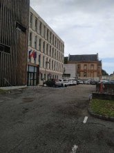
Measurement_c861930f-69e2-4023-824a-7efaf2b3d3df

Measured radiation

0.203 µSv/h
geolocalisation :

60.097168142309, 19.935166658586

Ground level
Orion44
ATYPICAL MEASURE
Date de la mesure :
Latitude :
60.097168142309
Longitude :
19.935166658586
Altitude (M) :
23.0
Measurement time :
5 minutes 1 secondes
Distance travelled :
268.61m
Measurement speed :
Measurement Environment :
En ville city
Weather :
Tags :
Description :
Temperature :
9.0°C
Hits number :
159
Mesure UUID :
c861930f-69e2-4023-824a-7efaf2b3d3df
Manual Reporting :
No
Sensor / ID :
AFD4C285-E267-0C1D-9DB9-604BA25926E4
Sensor / Firmware version :
AtomTag v.1.0.3
Sensor / Type :
Sensor / Tube type :
SBM-20
Smartphone / UUID :
9C8D5624-B9DA-4F35-8122-60FA98E821B9
Smartphone / Platform :
iOS
Smartphone / Model :
iPhone10,5
Smartphone / OS Version :
15.6.1
Position acurracy :
6.0
Measurement height above the ground (in meters) :
1.00
Altitude accuracy :
6.0
Mean qualification :
Ground level
Software version :
OpenRadiation app 2.3.4
Measured value :
0.203 µSv/h

Measurement_a065e2de-53b3-464a-9015-c9bd631432c3

Measured radiation

0.110 µSv/h
geolocalisation :

48.8586506, 2.3475694

Ground level
Date de la mesure :
Latitude :
48.8586506
Longitude :
2.3475694
Altitude (M) :
81.0
Measurement time :
2 minutes 59 secondes
Distance travelled :
0.00m
Measurement speed :
Measurement Environment :
En ville city
Weather :
Tags :
Description :
Temperature :
18.0°C
Hits number :
52
Mesure UUID :
a065e2de-53b3-464a-9015-c9bd631432c3
Manual Reporting :
No
Sensor / ID :
779465b1
Sensor / Firmware version :
RiumGM BLE -b
Sensor / Type :
Sensor / Tube type :
J305γβ
Smartphone / UUID :
abae6db197e1443b
Smartphone / Platform :
android
Smartphone / Model :
M2101K7BNY
Smartphone / OS Version :
11
Position acurracy :
6.8
Measurement height above the ground (in meters) :
1.00
Altitude accuracy :
6.8
Mean qualification :
Ground level
Software version :
OpenRadiation app 3.0
Measured value :
0.110 µSv/h

Measurement_ff075506-bbe0-4bdb-abf0-e21729687459

Measured radiation

84.611 µSv/h
geolocalisation :

48.120253333333, 16.561433333333

Ground level
Fanche
ATYPICAL MEASURE
Date de la mesure :
Latitude :
48.120253333333
Longitude :
16.561433333333
Altitude (M) :
212.0
Measurement time :
1 minutes 1 secondes
Distance travelled :
20.36m
Measurement speed :
Measurement Environment :
En ville city
Weather :
Tags :
Description :
Temperature :
Hits number :
28260
Mesure UUID :
ff075506-bbe0-4bdb-abf0-e21729687459
Manual Reporting :
No
Sensor / ID :
safecast_id 1223
Sensor / Firmware version :
$BNRDD
Sensor / Type :
Sensor / Tube type :
Smartphone / UUID :
Smartphone / Platform :
Smartphone / Model :
Smartphone / OS Version :
Position acurracy :
8.0
Measurement height above the ground (in meters) :
1.00
Altitude accuracy :
8.0
Mean qualification :
Ground level
Software version :
openradiation.net/upload v0.9
Measured value :
84.611 µSv/h

Measurement_b0804335-1a0d-4a92-88a8-7e4984b8479f

Measured radiation

0.064 µSv/h
geolocalisation :

47.4419717, -0.5292017

Ground level
Date de la mesure :
Latitude :
47.4419717
Longitude :
-0.5292017
Altitude (M) :
76.0
Measurement time :
3 minutes 34 secondes
Distance travelled :
59.76m
Measurement speed :
Measurement Environment :
En ville city
Weather :
Tags :
Description :
Temperature :
21.0°C
Hits number :
51
Mesure UUID :
b0804335-1a0d-4a92-88a8-7e4984b8479f
Manual Reporting :
No
Sensor / ID :
00080
Sensor / Firmware version :
OpengKIT72
Sensor / Type :
Sensor / Tube type :
Smartphone / UUID :
7cbca3d651dd0c6a
Smartphone / Platform :
android
Smartphone / Model :
SM-M225FV
Smartphone / OS Version :
13
Position acurracy :
4.1
Measurement height above the ground (in meters) :
0.00
Altitude accuracy :
4.1
Mean qualification :
Ground level
Software version :
OpenRadiation app 3.0
Measured value :
0.064 µSv/h

Measurement_6a5cdb34-9d7d-487c-9741-9d884440da28

Measured radiation

1.280 µSv/h
geolocalisation :

48.8183729, -3.4602701

Ground level
ghis
ATYPICAL MEASURE
Date de la mesure :
Latitude :
48.8183729
Longitude :
-3.4602701
Altitude (M) :
58.0
Measurement time :
22 secondes
Distance travelled :
1.40m
Measurement speed :
Measurement Environment :
En ville city
Weather :
Tags :
Description :
mesure entre des blocs de granite
Temperature :
Hits number :
63
Mesure UUID :
6a5cdb34-9d7d-487c-9741-9d884440da28
Manual Reporting :
No
Sensor / ID :
20:C3:8F:D1:EE:70
Sensor / Firmware version :
AtomTag v.1.0.3
Sensor / Type :
Sensor / Tube type :
SBM-20
Smartphone / UUID :
87e7ea330f6a93b0
Smartphone / Platform :
Android
Smartphone / Model :
DIG-L21HN
Smartphone / OS Version :
6.0
Position acurracy :
8.0
Measurement height above the ground (in meters) :
0.00
Altitude accuracy :
8.0
Mean qualification :
Ground level
Software version :
OpenRadiation app 2.3.1
Measured value :
1.280 µSv/h

Measurement_289df3db-47a0-4048-9e2d-b1b1b78dcf8d

Measured radiation

0.107 µSv/h
geolocalisation :

42.9610028, 1.6058277

Ground level
Nala
Date de la mesure :
Latitude :
42.9610028
Longitude :
1.6058277
Altitude (M) :
448.0
Measurement time :
2 minutes 8 secondes
Distance travelled :
6.38m
Measurement speed :
Measurement Environment :
En ville city
Weather :
Tags :
Description :
Cour DSDEN de l'Ariège.
measurment image
Temperature :
24.0°C
Hits number :
53
Mesure UUID :
289df3db-47a0-4048-9e2d-b1b1b78dcf8d
Manual Reporting :
No
Sensor / ID :
00230
Sensor / Firmware version :
OpengKIT71
Sensor / Type :
Sensor / Tube type :
SBM-20
Smartphone / UUID :
963626a73b573742
Smartphone / Platform :
Android
Smartphone / Model :
Redmi Note 6 Pro
Smartphone / OS Version :
9
Position acurracy :
43.5
Measurement height above the ground (in meters) :
1.00
Altitude accuracy :
43.5
Mean qualification :
Ground level
Software version :
OpenRadiation app 2.3.4
Measured value :
0.107 µSv/h

Measurement_ffc1a514-f5cf-464b-ae7f-b51719171364

Measured radiation

0.087 µSv/h
geolocalisation :

38.889396666667, -77.049101666667

Ground level
Fanche
Date de la mesure :
Latitude :
38.889396666667
Longitude :
-77.049101666667
Altitude (M) :
0.0
Measurement time :
1 minutes
Distance travelled :
27.15m
Measurement speed :
Measurement Environment :
En ville city
Weather :
Tags :
Description :
Temperature :
Hits number :
29
Mesure UUID :
ffc1a514-f5cf-464b-ae7f-b51719171364
Manual Reporting :
No
Sensor / ID :
safecast_id 3220
Sensor / Firmware version :
$BNRDD
Sensor / Type :
Sensor / Tube type :
Smartphone / UUID :
Smartphone / Platform :
Smartphone / Model :
Smartphone / OS Version :
Position acurracy :
8.0
Measurement height above the ground (in meters) :
1.00
Altitude accuracy :
8.0
Mean qualification :
Ground level
Software version :
openradiation.net/upload v0.9
Measured value :
0.087 µSv/h

Measurement_c26feb19-f2b1-4375-8b01-e9d3e82e1fd1

Measured radiation

0.073 µSv/h
geolocalisation :

48.8583031, 2.3470372

Ground level
Date de la mesure :
Latitude :
48.8583031
Longitude :
2.3470372
Altitude (M) :
81.0
Measurement time :
3 minutes 54 secondes
Distance travelled :
2.25m
Measurement speed :
Measurement Environment :
En ville city
Weather :
Tags :
Description :
Temperature :
19.0°C
Hits number :
50
Mesure UUID :
c26feb19-f2b1-4375-8b01-e9d3e82e1fd1
Manual Reporting :
No
Sensor / ID :
779465b1
Sensor / Firmware version :
RiumGM BLE -b
Sensor / Type :
Sensor / Tube type :
J305γβ
Smartphone / UUID :
abae6db197e1443b
Smartphone / Platform :
android
Smartphone / Model :
M2101K7BNY
Smartphone / OS Version :
11
Position acurracy :
8.9
Measurement height above the ground (in meters) :
1.00
Altitude accuracy :
8.9
Mean qualification :
Ground level
Software version :
OpenRadiation app 3.0
Measured value :
0.073 µSv/h