


city

icone_mesure
slug
city

Measurement_aecd3c5b-cea5-45dd-89c7-cf7e6d1363c9

Measured radiation

0.101 µSv/h
geolocalisation :

14.7723722, -17.409141

Ground level
RMD@
Date de la mesure :
Latitude :
14.7723722
Longitude :
-17.409141
Altitude (M) :
47.0
Measurement time :
4 minutes 21 secondes
Distance travelled :
0.00m
Measurement speed :
Measurement Environment :
En ville city
Weather :
Tags :
Description :
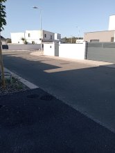
Mesure at Guediawaye
Temperature :
26.0°C
Hits number :
71
Mesure UUID :
aecd3c5b-cea5-45dd-89c7-cf7e6d1363c9
Manual Reporting :
No
Sensor / ID :
Sensor / Firmware version :
Bertin RadConnect v1.0.1969
Sensor / Type :
Sensor / Tube type :
J305γβ
Smartphone / UUID :
86bedfe6301ee87f
Smartphone / Platform :
android
Smartphone / Model :
TECNO KJ5
Smartphone / OS Version :
13
Position acurracy :
20.0
Measurement height above the ground (in meters) :
0.00
Altitude accuracy :
20.0
Mean qualification :
Ground level
Software version :
OpenRadiation app 3.1
Measured value :
0.101 µSv/h
Measurement_9e201ee2-a8f4-4251-8f8d-9de319a5beac

Measured radiation

0.093 µSv/h
geolocalisation :

51.31956, 6.586638

Ground level
PapaPlaete
Date de la mesure :
Latitude :
51.31956
Longitude :
6.586638
Altitude (M) :
36.0
Measurement time :
2 secondes
Distance travelled :
Measurement speed :
Measurement Environment :
En ville city
Weather :
Tags :
Description :
Temperature :
Hits number :
0
Mesure UUID :
9e201ee2-a8f4-4251-8f8d-9de319a5beac
Manual Reporting :
No
Sensor / ID :
52002600070000314b433056
Sensor / Firmware version :
Rad Pro 3.1.1
Sensor / Type :
Sensor / Tube type :
Smartphone / UUID :
Smartphone / Platform :
Smartphone / Model :
Smartphone / OS Version :
Position acurracy :
Measurement height above the ground (in meters) :
1.00
Altitude accuracy :
Mean qualification :
Ground level
Software version :
radpro-wifi-bridge_1.15.14
Measured value :
0.093 µSv/h

Measurement_e64377af-6373-43c3-9933-7eb7d5f48210

Measured radiation

0.302 µSv/h
geolocalisation :

51.31956, 6.586638

Ground level
PapaPlaete
ATYPICAL MEASURE
Date de la mesure :
Latitude :
51.31956
Longitude :
6.586638
Altitude (M) :
36.0
Measurement time :
9 secondes
Distance travelled :
Measurement speed :
Measurement Environment :
En ville city
Weather :
Tags :
Description :
Temperature :
Hits number :
0
Mesure UUID :
e64377af-6373-43c3-9933-7eb7d5f48210
Manual Reporting :
No
Sensor / ID :
52002600070000314b433056
Sensor / Firmware version :
Rad Pro 3.1.1
Sensor / Type :
Sensor / Tube type :
Smartphone / UUID :
Smartphone / Platform :
Smartphone / Model :
Smartphone / OS Version :
Position acurracy :
Measurement height above the ground (in meters) :
1.00
Altitude accuracy :
Mean qualification :
Ground level
Software version :
radpro-wifi-bridge_1.15.14
Measured value :
0.302 µSv/h

Measurement_0389085b-591e-48c5-8319-e239072f01ac

Measured radiation

0.190 µSv/h
geolocalisation :

51.31956, 6.586638

Ground level
PapaPlaete
Date de la mesure :
Latitude :
51.31956
Longitude :
6.586638
Altitude (M) :
36.0
Measurement time :
5 secondes
Distance travelled :
Measurement speed :
Measurement Environment :
En ville city
Weather :
Tags :
Description :
Temperature :
Hits number :
0
Mesure UUID :
0389085b-591e-48c5-8319-e239072f01ac
Manual Reporting :
No
Sensor / ID :
52002600070000314b433056
Sensor / Firmware version :
Rad Pro 3.1.1
Sensor / Type :
Sensor / Tube type :
Smartphone / UUID :
Smartphone / Platform :
Smartphone / Model :
Smartphone / OS Version :
Position acurracy :
Measurement height above the ground (in meters) :
1.00
Altitude accuracy :
Mean qualification :
Ground level
Software version :
radpro-wifi-bridge_1.15.14
Measured value :
0.190 µSv/h

Measurement_f49f46b3-f8a3-441c-8629-ab6e09af8e75

Measured radiation

0.180 µSv/h
geolocalisation :

51.31956, 6.586638

Ground level
PapaPlaete
Date de la mesure :
Latitude :
51.31956
Longitude :
6.586638
Altitude (M) :
36.0
Measurement time :
3 secondes
Distance travelled :
Measurement speed :
Measurement Environment :
En ville city
Weather :
Tags :
Description :
Temperature :
Hits number :
0
Mesure UUID :
f49f46b3-f8a3-441c-8629-ab6e09af8e75
Manual Reporting :
No
Sensor / ID :
52002600070000314b433056
Sensor / Firmware version :
Rad Pro 3.1.1
Sensor / Type :
Sensor / Tube type :
Smartphone / UUID :
Smartphone / Platform :
Smartphone / Model :
Smartphone / OS Version :
Position acurracy :
Measurement height above the ground (in meters) :
1.00
Altitude accuracy :
Mean qualification :
Ground level
Software version :
radpro-wifi-bridge_1.15.14
Measured value :
0.180 µSv/h

Measurement_fe64b290-7619-488a-b34a-4667fdd6d441

Measured radiation

0.166 µSv/h
geolocalisation :

51.31956, 6.586638

Ground level
PapaPlaete
Date de la mesure :
Latitude :
51.31956
Longitude :
6.586638
Altitude (M) :
36.0
Measurement time :
4 secondes
Distance travelled :
Measurement speed :
Measurement Environment :
En ville city
Weather :
Tags :
Description :
Temperature :
Hits number :
0
Mesure UUID :
fe64b290-7619-488a-b34a-4667fdd6d441
Manual Reporting :
No
Sensor / ID :
52002600070000314b433056
Sensor / Firmware version :
Rad Pro 3.1.1
Sensor / Type :
Sensor / Tube type :
Smartphone / UUID :
Smartphone / Platform :
Smartphone / Model :
Smartphone / OS Version :
Position acurracy :
Measurement height above the ground (in meters) :
1.00
Altitude accuracy :
Mean qualification :
Ground level
Software version :
radpro-wifi-bridge_1.15.14
Measured value :
0.166 µSv/h

Measurement_2e8d6e38-00aa-46c2-a27f-2972e17ea1bb

Measured radiation

0.191 µSv/h
geolocalisation :

51.31956, 6.586638

Ground level
PapaPlaete
Date de la mesure :
Latitude :
51.31956
Longitude :
6.586638
Altitude (M) :
36.0
Measurement time :
5 secondes
Distance travelled :
Measurement speed :
Measurement Environment :
En ville city
Weather :
Tags :
Description :
Temperature :
Hits number :
0
Mesure UUID :
2e8d6e38-00aa-46c2-a27f-2972e17ea1bb
Manual Reporting :
No
Sensor / ID :
52002600070000314b433056
Sensor / Firmware version :
Rad Pro 3.1.1
Sensor / Type :
Sensor / Tube type :
Smartphone / UUID :
Smartphone / Platform :
Smartphone / Model :
Smartphone / OS Version :
Position acurracy :
Measurement height above the ground (in meters) :
1.00
Altitude accuracy :
Mean qualification :
Ground level
Software version :
radpro-wifi-bridge_1.15.14
Measured value :
0.191 µSv/h

Measurement_b276632f-2b03-4f62-a06f-987e7bb0a049

Measured radiation

0.171 µSv/h
geolocalisation :

51.31956, 6.586638

Ground level
PapaPlaete
Date de la mesure :
Latitude :
51.31956
Longitude :
6.586638
Altitude (M) :
36.0
Measurement time :
4 secondes
Distance travelled :
Measurement speed :
Measurement Environment :
En ville city
Weather :
Tags :
Description :
Temperature :
Hits number :
0
Mesure UUID :
b276632f-2b03-4f62-a06f-987e7bb0a049
Manual Reporting :
No
Sensor / ID :
52002600070000314b433056
Sensor / Firmware version :
Rad Pro 3.1.1
Sensor / Type :
Sensor / Tube type :
Smartphone / UUID :
Smartphone / Platform :
Smartphone / Model :
Smartphone / OS Version :
Position acurracy :
Measurement height above the ground (in meters) :
1.00
Altitude accuracy :
Mean qualification :
Ground level
Software version :
radpro-wifi-bridge_1.15.14
Measured value :
0.171 µSv/h

Measurement_3d62006b-927d-4128-8ff8-a2951d3eb402

Measured radiation

0.195 µSv/h
geolocalisation :

47.3633983, 5.0234717

Ground level
suzon-21
Date de la mesure :
Latitude :
47.3633983
Longitude :
5.0234717
Altitude (M) :
329.0
Measurement time :
5 minutes 2 secondes
Distance travelled :
0.00m
Measurement speed :
Measurement Environment :
En ville city
Weather :
Tags :
Description :
Ahuy, rue des Mariottes.
measurment image
Temperature :
20.0°C
Hits number :
157
Mesure UUID :
3d62006b-927d-4128-8ff8-a2951d3eb402
Manual Reporting :
No
Sensor / ID :
00153
Sensor / Firmware version :
OpengKIT72
Sensor / Type :
Sensor / Tube type :
Smartphone / UUID :
40f15d6de1d2300e
Smartphone / Platform :
android
Smartphone / Model :
22011119UY
Smartphone / OS Version :
12
Position acurracy :
6.8
Measurement height above the ground (in meters) :
1.00
Altitude accuracy :
6.8
Mean qualification :
Ground level
Software version :
OpenRadiation app 3.1
Measured value :
0.195 µSv/h

Measurement_baa9df72-1209-4da4-bc52-2eb32e2ea773

Measured radiation

0.096 µSv/h
geolocalisation :

47.3553494, 5.034948

Ground level
suzon-21
Date de la mesure :
Latitude :
47.3553494
Longitude :
5.034948
Altitude (M) :
312.0
Measurement time :
5 minutes
Distance travelled :
0.00m
Measurement speed :
Measurement Environment :
En ville city
Weather :
Tags :
Description :
Ahuy, station Presles.
Radiacode 102 +- 17%
measurment image
Temperature :
19.0°C
Hits number :
Mesure UUID :
baa9df72-1209-4da4-bc52-2eb32e2ea773
Manual Reporting :
Yes
Sensor / ID :
Sensor / Firmware version :
Sensor / Type :
Sensor / Tube type :
Smartphone / UUID :
4eef54416c0db30e
Smartphone / Platform :
android
Smartphone / Model :
P50T_E_ROW
Smartphone / OS Version :
16
Position acurracy :
33.6
Measurement height above the ground (in meters) :
1.00
Altitude accuracy :
33.6
Mean qualification :
Ground level
Software version :
OpenRadiation app 3.1
Measured value :
0.096 µSv/h