


city

icone_mesure
slug
city

Measurement_0db2a361-edf8-48ab-b158-0a9cf10f888f

Measured radiation

0.309 µSv/h
geolocalisation :

42.670059910009, 9.4413260125627

Ground level
NSI-SIN_Vincensini
ATYPICAL MEASURE
Date de la mesure :
Latitude :
42.67005991001
Longitude :
9.4413260125627
Altitude (M) :
26.0
Measurement time :
2 minutes
Distance travelled :
Measurement speed :
Measurement Environment :
En ville city
Weather :
Tags :
Description :
Temperature :
25.0°C
Hits number :
76
Mesure UUID :
0db2a361-edf8-48ab-b158-0a9cf10f888f
Manual Reporting :
No
Sensor / ID :
Sensor / Firmware version :
Libelium Radiation Sensor Board - North Optic Geiger-Müller Tube
Sensor / Type :
Sensor / Tube type :
North Optic Geiger-Müller Tube J305ß
Smartphone / UUID :
Smartphone / Platform :
Smartphone / Model :
Smartphone / OS Version :
Position acurracy :
Measurement height above the ground (in meters) :
3.00
Altitude accuracy :
Mean qualification :
Ground level
Software version :
Firmware_V1.0
Measured value :
0.309 µSv/h
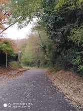

Measurement_83b868a1-c7c6-4963-b23f-261ca6a9bc87

Measured radiation

0.414 µSv/h
geolocalisation :

43.605955515609, 1.4489075507052

Ground level
Obspm
ATYPICAL MEASURE
Date de la mesure :
Latitude :
43.605955515609
Longitude :
1.4489075507052
Altitude (M) :
139.0
Measurement time :
52 secondes
Distance travelled :
74.07m
Measurement speed :
Measurement Environment :
En ville city
Weather :
Tags :
Description :
Temperature :
17.0°C
Hits number :
51
Mesure UUID :
83b868a1-c7c6-4963-b23f-261ca6a9bc87
Manual Reporting :
No
Sensor / ID :
4A66D58B-E26B-E308-22E9-F3BFA0950339
Sensor / Firmware version :
AtomTag v.1.0.3
Sensor / Type :
Sensor / Tube type :
SBM-20
Smartphone / UUID :
F59FED28-8DC4-4F48-8254-DB1A376486F7
Smartphone / Platform :
iOS
Smartphone / Model :
iPhone14,5
Smartphone / OS Version :
16.6.1
Position acurracy :
1455.5
Measurement height above the ground (in meters) :
1.00
Altitude accuracy :
1455.5
Mean qualification :
Ground level
Software version :
OpenRadiation app 2.3.4
Measured value :
0.414 µSv/h

Measurement_788de6e0-7ef8-465e-9d10-fe2691e66c30

Measured radiation

0.192 µSv/h
geolocalisation :

42.678075064905, 9.4438411016017

Ground level
giocante1
Date de la mesure :
Latitude :
42.678075064905
Longitude :
9.4438411016017
Altitude (M) :
25.0
Measurement time :
16 minutes 4 secondes
Distance travelled :
0.00m
Measurement speed :
Measurement Environment :
En ville city
Weather :
Tags :
Description :
Temperature :
22.0°C
Hits number :
441
Mesure UUID :
788de6e0-7ef8-465e-9d10-fe2691e66c30
Manual Reporting :
No
Sensor / ID :
1171483831
Sensor / Firmware version :
RiumGm
Sensor / Type :
Sensor / Tube type :
J305γβ
Smartphone / UUID :
57fcd8dae515e6ed
Smartphone / Platform :
Android
Smartphone / Model :
SM-A105FN
Smartphone / OS Version :
9
Position acurracy :
13.0
Measurement height above the ground (in meters) :
1.00
Altitude accuracy :
13.0
Mean qualification :
Ground level
Software version :
OpenRadiation app 2.3.1
Measured value :
0.192 µSv/h

Measurement_b1ec92fc-0dd2-48ab-a66c-6f580150ca8a

Measured radiation

0.357 µSv/h
geolocalisation :

42.670059910009, 9.4413260125627

Ground level
NSI-SIN_Vincensini
ATYPICAL MEASURE
Date de la mesure :
Latitude :
42.67005991001
Longitude :
9.4413260125627
Altitude (M) :
26.0
Measurement time :
1 minutes
Distance travelled :
Measurement speed :
Measurement Environment :
En ville city
Weather :
Tags :
Description :
Temperature :
23.0°C
Hits number :
44
Mesure UUID :
b1ec92fc-0dd2-48ab-a66c-6f580150ca8a
Manual Reporting :
No
Sensor / ID :
Sensor / Firmware version :
Libelium Radiation Sensor Board - North Optic Geiger-Müller Tube
Sensor / Type :
Sensor / Tube type :
Smartphone / UUID :
Smartphone / Platform :
Smartphone / Model :
Smartphone / OS Version :
Position acurracy :
Measurement height above the ground (in meters) :
3.00
Altitude accuracy :
Mean qualification :
Ground level
Software version :
Firmware_V1.0
Measured value :
0.357 µSv/h

Measurement_464330f4-b500-40c4-8af1-85c1a8b3fe0e

Measured radiation

0.158 µSv/h
geolocalisation :

43.8832017, -0.5074694

Ground level
Nala
Date de la mesure :
Latitude :
43.8832017
Longitude :
-0.5074694
Altitude (M) :
107.0
Measurement time :
2 minutes 9 secondes
Distance travelled :
19.30m
Measurement speed :
Measurement Environment :
En ville city
Weather :
Tags :
Description :
Ancien dépôt de machines SNCF de la gare de Lont de Marsan
measurment image
Temperature :
21.0°C
Hits number :
50
Mesure UUID :
464330f4-b500-40c4-8af1-85c1a8b3fe0e
Manual Reporting :
No
Sensor / ID :
238193284
Sensor / Firmware version :
RiumGm
Sensor / Type :
Sensor / Tube type :
J305γβ
Smartphone / UUID :
963626a73b573742
Smartphone / Platform :
Android
Smartphone / Model :
Redmi Note 6 Pro
Smartphone / OS Version :
9
Position acurracy :
41.1
Measurement height above the ground (in meters) :
0.00
Altitude accuracy :
41.1
Mean qualification :
Ground level
Software version :
OpenRadiation app 2.3.1
Measured value :
0.158 µSv/h

Measurement_477341e1-a688-42b8-9daf-ee933a44b6ca

Measured radiation

0.219 µSv/h
geolocalisation :

42.670059910009, 9.4413260125627

Ground level
NSI-SIN_Vincensini
ATYPICAL MEASURE
Date de la mesure :
Latitude :
42.67005991001
Longitude :
9.4413260125627
Altitude (M) :
26.0
Measurement time :
1 minutes
Distance travelled :
Measurement speed :
Measurement Environment :
En ville city
Weather :
Tags :
Description :
Temperature :
24.0°C
Hits number :
27
Mesure UUID :
477341e1-a688-42b8-9daf-ee933a44b6ca
Manual Reporting :
No
Sensor / ID :
Sensor / Firmware version :
Libelium Radiation Sensor Board - North Optic Geiger-Müller Tube
Sensor / Type :
Sensor / Tube type :
Smartphone / UUID :
Smartphone / Platform :
Smartphone / Model :
Smartphone / OS Version :
Position acurracy :
Measurement height above the ground (in meters) :
3.00
Altitude accuracy :
Mean qualification :
Ground level
Software version :
Firmware_V1.0
Measured value :
0.219 µSv/h

Measurement_5c17da7d-4616-4362-8add-19d04ee6bc62

Measured radiation

0.219 µSv/h
geolocalisation :

42.670059910009, 9.4413260125627

Ground level
NSI-SIN_Vincensini
ATYPICAL MEASURE
Date de la mesure :
Latitude :
42.67005991001
Longitude :
9.4413260125627
Altitude (M) :
26.0
Measurement time :
1 minutes
Distance travelled :
Measurement speed :
Measurement Environment :
En ville city
Weather :
Tags :
Description :
Temperature :
24.0°C
Hits number :
27
Mesure UUID :
5c17da7d-4616-4362-8add-19d04ee6bc62
Manual Reporting :
No
Sensor / ID :
Sensor / Firmware version :
Libelium Radiation Sensor Board - North Optic Geiger-Müller Tube
Sensor / Type :
Sensor / Tube type :
Smartphone / UUID :
Smartphone / Platform :
Smartphone / Model :
Smartphone / OS Version :
Position acurracy :
Measurement height above the ground (in meters) :
3.00
Altitude accuracy :
Mean qualification :
Ground level
Software version :
Firmware_V1.0
Measured value :
0.219 µSv/h

Measurement_c477044b-93b7-4e52-8724-4d3d8216f9ed

Measured radiation

0.068 µSv/h
geolocalisation :

43.6977462, 1.8142339

Ground level
Nala
Date de la mesure :
Latitude :
43.6977462
Longitude :
1.8142339
Altitude (M) :
194.0
Measurement time :
2 minutes 43 secondes
Distance travelled :
6.39m
Measurement speed :
Measurement Environment :
En ville city
Weather :
Tags :
Description :
measurment image
Temperature :
24.0°C
Hits number :
51
Mesure UUID :
c477044b-93b7-4e52-8724-4d3d8216f9ed
Manual Reporting :
No
Sensor / ID :
00230
Sensor / Firmware version :
OpengKIT71
Sensor / Type :
Sensor / Tube type :
SBM-20
Smartphone / UUID :
963626a73b573742
Smartphone / Platform :
Android
Smartphone / Model :
Redmi Note 6 Pro
Smartphone / OS Version :
9
Position acurracy :
19.3
Measurement height above the ground (in meters) :
0.00
Altitude accuracy :
19.3
Mean qualification :
Ground level
Software version :
OpenRadiation app 2.3.5
Measured value :
0.068 µSv/h

Measurement_1b072218-d9a9-4ce8-8b3a-e10850dd3d41

Measured radiation

0.236 µSv/h
geolocalisation :

42.670059910009, 9.4413260125627

Ground level
NSI-SIN_Vincensini
ATYPICAL MEASURE
Date de la mesure :
Latitude :
42.67005991001
Longitude :
9.4413260125627
Altitude (M) :
26.0
Measurement time :
1 minutes
Distance travelled :
Measurement speed :
Measurement Environment :
En ville city
Weather :
Tags :
Description :
Temperature :
24.0°C
Hits number :
29
Mesure UUID :
1b072218-d9a9-4ce8-8b3a-e10850dd3d41
Manual Reporting :
No
Sensor / ID :
Sensor / Firmware version :
Libelium Radiation Sensor Board - North Optic Geiger-Müller Tube
Sensor / Type :
Sensor / Tube type :
Smartphone / UUID :
Smartphone / Platform :
Smartphone / Model :
Smartphone / OS Version :
Position acurracy :
Measurement height above the ground (in meters) :
3.00
Altitude accuracy :
Mean qualification :
Ground level
Software version :
Firmware_V1.0
Measured value :
0.236 µSv/h

Measurement_f2c3f8ac-7571-4032-9e50-34100ab15e27

Measured radiation

0.513 µSv/h
geolocalisation :

44.113063516372, 0.85230671721456

Ground level
kaspar
ATYPICAL MEASURE
Date de la mesure :
Latitude :
44.113063516372
Longitude :
0.85230671721456
Altitude (M) :
60.0
Measurement time :
39 secondes
Distance travelled :
2.14m
Measurement speed :
Measurement Environment :
En ville city
Weather :
Tags :
Description :
golfech ville
Temperature :
25.0°C
Hits number :
56
Mesure UUID :
f2c3f8ac-7571-4032-9e50-34100ab15e27
Manual Reporting :
No
Sensor / ID :
000056
Sensor / Firmware version :
OG-CMS
Sensor / Type :
Sensor / Tube type :
SBM-20
Smartphone / UUID :
D4A1D96A-FECF-488A-A983-3A65896A6FBD
Smartphone / Platform :
iOS
Smartphone / Model :
iPhone11,2
Smartphone / OS Version :
16.1.1
Position acurracy :
6.7
Measurement height above the ground (in meters) :
1.00
Altitude accuracy :
6.7
Mean qualification :
Ground level
Software version :
OpenRadiation app 2.3.4
Measured value :
0.513 µSv/h