


city

icone_mesure
slug
city

Measurement_ffd2ec81-e8fa-4acf-a80b-2a1706789311

Measured radiation

0.332 µSv/h
geolocalisation :

48.795011666667, 2.2850716666667

Ground level
Fanche
ATYPICAL MEASURE
Date de la mesure :
Latitude :
48.795011666667
Longitude :
2.2850716666667
Altitude (M) :
124.0
Measurement time :
13 minutes 13 secondes
Distance travelled :
25.96m
Measurement speed :
Measurement Environment :
En ville city
Weather :
Tags :
Description :
Temperature :
Hits number :
111
Mesure UUID :
ffd2ec81-e8fa-4acf-a80b-2a1706789311
Manual Reporting :
No
Sensor / ID :
safecast_id 1223
Sensor / Firmware version :
$BNRDD
Sensor / Type :
Sensor / Tube type :
Smartphone / UUID :
Smartphone / Platform :
Smartphone / Model :
Smartphone / OS Version :
Position acurracy :
9.0
Measurement height above the ground (in meters) :
1.00
Altitude accuracy :
9.0
Mean qualification :
Ground level
Software version :
openradiation.net/upload v0.9
Measured value :
0.332 µSv/h
Measurement_ffd2ec81-e8fa-4acf-a80b-2a1706790675

Measured radiation

0.308 µSv/h
geolocalisation :

48.79779, 2.2821633333333

Ground level
Fanche
ATYPICAL MEASURE
Date de la mesure :
Latitude :
48.79779
Longitude :
2.2821633333333
Altitude (M) :
148.0
Measurement time :
1 minutes
Distance travelled :
83.95m
Measurement speed :
Measurement Environment :
En ville city
Weather :
Tags :
Description :
Temperature :
Hits number :
103
Mesure UUID :
ffd2ec81-e8fa-4acf-a80b-2a1706790675
Manual Reporting :
No
Sensor / ID :
safecast_id 1223
Sensor / Firmware version :
$BNRDD
Sensor / Type :
Sensor / Tube type :
Smartphone / UUID :
Smartphone / Platform :
Smartphone / Model :
Smartphone / OS Version :
Position acurracy :
7.0
Measurement height above the ground (in meters) :
1.00
Altitude accuracy :
7.0
Mean qualification :
Ground level
Software version :
openradiation.net/upload v0.9
Measured value :
0.308 µSv/h

Measurement_ffe45d1c-1473-444b-ac3e-791725365490

Measured radiation

0.317 µSv/h
geolocalisation :

52.393181666667, 10.355986666667

Ground level
Fanche
ATYPICAL MEASURE
Date de la mesure :
Latitude :
52.393181666667
Longitude :
10.355986666667
Altitude (M) :
43.0
Measurement time :
1 minutes
Distance travelled :
586.21m
Measurement speed :
Measurement Environment :
En ville city
Weather :
Tags :
Description :
Temperature :
Hits number :
106
Mesure UUID :
ffe45d1c-1473-444b-ac3e-791725365490
Manual Reporting :
No
Sensor / ID :
safecast_id 1223
Sensor / Firmware version :
$BNRDD
Sensor / Type :
Sensor / Tube type :
Smartphone / UUID :
Smartphone / Platform :
Smartphone / Model :
Smartphone / OS Version :
Position acurracy :
9.0
Measurement height above the ground (in meters) :
1.00
Altitude accuracy :
9.0
Mean qualification :
Ground level
Software version :
openradiation.net/upload v0.9
Measured value :
0.317 µSv/h

Measurement_ffe45d1c-1473-444b-ac3e-791725365490

Measured radiation

0.317 µSv/h
geolocalisation :

52.393181666667, 10.355986666667

Ground level
Fanche
ATYPICAL MEASURE
Date de la mesure :
Latitude :
52.393181666667
Longitude :
10.355986666667
Altitude (M) :
43.0
Measurement time :
1 minutes
Distance travelled :
586.21m
Measurement speed :
Measurement Environment :
En ville city
Weather :
Tags :
Description :
Temperature :
Hits number :
106
Mesure UUID :
ffe45d1c-1473-444b-ac3e-791725365490
Manual Reporting :
No
Sensor / ID :
safecast_id 1223
Sensor / Firmware version :
$BNRDD
Sensor / Type :
Sensor / Tube type :
Smartphone / UUID :
Smartphone / Platform :
Smartphone / Model :
Smartphone / OS Version :
Position acurracy :
9.0
Measurement height above the ground (in meters) :
1.00
Altitude accuracy :
9.0
Mean qualification :
Ground level
Software version :
openradiation.net/upload v0.9
Measured value :
0.317 µSv/h

Measurement_2cad517d-4bb2-49c2-b8a7-8d7c6e166427

Measured radiation

0.810 µSv/h
geolocalisation :

0, 0

Ground level
Kumamon
ATYPICAL MEASURE
Date de la mesure :
Latitude :
0
Longitude :
0
Altitude (M) :
0.0
Measurement time :
25 secondes
Distance travelled :
Measurement speed :
Measurement Environment :
En ville city
Weather :
Tags :
Description :
high grown café ,
Temperature :
27.0°C
Hits number :
50
Mesure UUID :
2cad517d-4bb2-49c2-b8a7-8d7c6e166427
Manual Reporting :
No
Sensor / ID :
F1-59
Sensor / Firmware version :
RiumGM
Sensor / Type :
Sensor / Tube type :
J305γβ
Smartphone / UUID :
Smartphone / Platform :
Android
Smartphone / Model :
Sony XQ-CC54
Smartphone / OS Version :
14.0
Position acurracy :
Measurement height above the ground (in meters) :
1.00
Altitude accuracy :
Mean qualification :
Ground level
Software version :
RiumApp 3.3.6
Measured value :
0.810 µSv/h

Measurement_2cad517d-4bb2-49c2-b8a7-8d7c6e166427

Measured radiation

0.810 µSv/h
geolocalisation :

0, 0

Ground level
Kumamon
ATYPICAL MEASURE
Date de la mesure :
Latitude :
0
Longitude :
0
Altitude (M) :
0.0
Measurement time :
25 secondes
Distance travelled :
Measurement speed :
Measurement Environment :
En ville city
Weather :
Tags :
Description :
high grown café ,
Temperature :
27.0°C
Hits number :
50
Mesure UUID :
2cad517d-4bb2-49c2-b8a7-8d7c6e166427
Manual Reporting :
No
Sensor / ID :
F1-59
Sensor / Firmware version :
RiumGM
Sensor / Type :
Sensor / Tube type :
J305γβ
Smartphone / UUID :
Smartphone / Platform :
Android
Smartphone / Model :
Sony XQ-CC54
Smartphone / OS Version :
14.0
Position acurracy :
Measurement height above the ground (in meters) :
1.00
Altitude accuracy :
Mean qualification :
Ground level
Software version :
RiumApp 3.3.6
Measured value :
0.810 µSv/h

Measurement_289ac099-7dc4-496f-8981-ef66f2536d71

Measured radiation

0.171 µSv/h
geolocalisation :

41.4998889, -5.7557908

Ground level
Atapuerca
Date de la mesure :
Latitude :
41.4998889
Longitude :
-5.7557908
Altitude (M) :
682.0
Measurement time :
2 minutes 11 secondes
Distance travelled :
1.50m
Measurement speed :
Measurement Environment :
En ville city
Weather :
Tags :
Description :
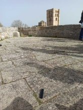
Measurement made in the Zamora castle
measurment image
Temperature :
18.0°C
Hits number :
60
Mesure UUID :
289ac099-7dc4-496f-8981-ef66f2536d71
Manual Reporting :
No
Sensor / ID :
0C:1C:57:B5:C6:31
Sensor / Firmware version :
AtomTag v.1.0.3
Sensor / Type :
Sensor / Tube type :
SBM-20
Smartphone / UUID :
008bb8e2a3f0c980
Smartphone / Platform :
Android
Smartphone / Model :
Redmi Note 8 Pro
Smartphone / OS Version :
9
Position acurracy :
2.0
Measurement height above the ground (in meters) :
1.00
Altitude accuracy :
2.0
Mean qualification :
Ground level
Software version :
OpenRadiation app 2.3.3
Measured value :
0.171 µSv/h

Measurement_3c210782-8e6f-4d1b-a490-6313ad75ea7d

Measured radiation

0.126 µSv/h
geolocalisation :

48.493682847127, 3.5016094848802

Ground level
Date de la mesure :
Latitude :
48.493682847127
Longitude :
3.5016094848803
Altitude (M) :
75.0
Measurement time :
2 minutes 47 secondes
Distance travelled :
0.00m
Measurement speed :
Measurement Environment :
En ville city
Weather :
Tags :
Description :
Temperature :
29.0°C
Hits number :
54
Mesure UUID :
3c210782-8e6f-4d1b-a490-6313ad75ea7d
Manual Reporting :
No
Sensor / ID :
129716fc
Sensor / Firmware version :
RiumGM BLE -b
Sensor / Type :
Sensor / Tube type :
J305γβ
Smartphone / UUID :
C5E1B2B2-0D2C-488F-A560-31370346AD87
Smartphone / Platform :
iOS
Smartphone / Model :
iPhone14,7
Smartphone / OS Version :
17.5.1
Position acurracy :
31.7
Measurement height above the ground (in meters) :
0.00
Altitude accuracy :
31.7
Mean qualification :
Ground level
Software version :
OpenRadiation app 2.3.4
Measured value :
0.126 µSv/h

Measurement_8c3c7492-414c-4d27-927c-1fb447418011

Measured radiation

1.060 µSv/h
geolocalisation :

48.701097, 2.125663

Ground level
Iron Kloug
ATYPICAL MEASURE
Date de la mesure :
Latitude :
48.701097
Longitude :
2.125663
Altitude (M) :
61.0
Measurement time :
5 minutes
Distance travelled :
Measurement speed :
Measurement Environment :
En ville city
Weather :
Tags :
Description :
mesure sur la stèle de granit rose à l'entrée de l'allée, menant au collège Juliette Adam à Gif sur Yvette
Mesure avec le RIUM CD 35 compteur à scintillation
Valeur moyenne : 145.59 c/s
Mesure sur 300 secondes sur la partie gauche de la stèle à 50 cm de distance
measurment image
Temperature :
7.0°C
Hits number :
43677
Mesure UUID :
8c3c7492-414c-4d27-927c-1fb447418011
Manual Reporting :
Yes
Sensor / ID :
Sensor / Firmware version :
Sensor / Type :
Sensor / Tube type :
Smartphone / UUID :
Smartphone / Platform :
Smartphone / Model :
Smartphone / OS Version :
Position acurracy :
Measurement height above the ground (in meters) :
1.00
Altitude accuracy :
Mean qualification :
Ground level
Software version :
openradiation.org v1
Measured value :
1.060 µSv/h

Measurement_7e026d8b-91a9-4423-a2e6-ac68717a2a53

Measured radiation

0.129 µSv/h
geolocalisation :

46.693612150891, -1.9264778494853

Ground level
Date de la mesure :
Latitude :
46.693612150891
Longitude :
-1.9264778494853
Altitude (M) :
-12.0
Measurement time :
3 minutes 3 secondes
Distance travelled :
157.88m
Measurement speed :
Measurement Environment :
En ville city
Weather :
rainy day Pluie
Tags :
Description :
Temperature :
22.0°C
Hits number :
60
Mesure UUID :
7e026d8b-91a9-4423-a2e6-ac68717a2a53
Manual Reporting :
No
Sensor / ID :
01dcb83d
Sensor / Firmware version :
RiumGM BLE -b
Sensor / Type :
Sensor / Tube type :
J305γβ
Smartphone / UUID :
0A59C791-B933-4AA3-B061-A09F399C3729
Smartphone / Platform :
iOS
Smartphone / Model :
iPhone8,4
Smartphone / OS Version :
14.4.2
Position acurracy :
100.0
Measurement height above the ground (in meters) :
1.00
Altitude accuracy :
100.0
Mean qualification :
Ground level
Software version :
OpenRadiation app 2.3.4
Measured value :
0.129 µSv/h