


Ground level

slug
groundlevel

Measurement_4e8d268a-ba6c-4f55-a3f2-4049c1bd0c6b

Measured radiation

137.000 µSv/h
geolocalisation :

35.7965348, 51.4234216

Ground level
ATYPICAL MEASURE
Date de la mesure :
Latitude :
35.7965348
Longitude :
51.4234216
Altitude (M) :
Measurement time :
23 secondes
Distance travelled :
Measurement speed :
Measurement Environment :
Weather :
Tags :
Description :
Temperature :
Hits number :
3
Mesure UUID :
4e8d268a-ba6c-4f55-a3f2-4049c1bd0c6b
Manual Reporting :
Yes
Sensor / ID :
Sensor / Firmware version :
Sensor / Type :
Sensor / Tube type :
Smartphone / UUID :
30232f7212338d54
Smartphone / Platform :
Android
Smartphone / Model :
GT-I9300
Smartphone / OS Version :
4.3
Position acurracy :
30.0
Measurement height above the ground (in meters) :
Altitude accuracy :
30.0
Mean qualification :
Ground level
Software version :
OpenRadiation app 1.0.0
Measured value :
137.000 µSv/h
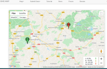
Measurement_56153555-01c2-45dc-89e7-1df741c5349f

Measured radiation

210.530 µSv/h
geolocalisation :

48.751426, 6.629642098

Ground level
pduchemin
ATYPICAL MEASURE
Date de la mesure :
Latitude :
48.751426
Longitude :
6.629642098
Altitude (M) :
Measurement time :
39 minutes 54 secondes
Distance travelled :
Measurement speed :
Measurement Environment :
Weather :
Tags :
Description :
https://www.gmcmap.com/historyData.asp?Param_ID=35944252687
measurment image
Temperature :
Hits number :
Mesure UUID :
56153555-01c2-45dc-89e7-1df741c5349f
Manual Reporting :
Yes
Sensor / ID :
Sensor / Firmware version :
Sensor / Type :
Sensor / Tube type :
Smartphone / UUID :
Smartphone / Platform :
Smartphone / Model :
Smartphone / OS Version :
Position acurracy :
Measurement height above the ground (in meters) :
Altitude accuracy :
Mean qualification :
Ground level
Software version :
openradiation.org v1
Measured value :
210.530 µSv/h

Measurement_96674e8d-bd6a-47b4-a817-95921aa2ca27

Measured radiation

0.080 µSv/h
geolocalisation :

46.774273, 6.6442696

Ground level
nico83
Date de la mesure :
Latitude :
46.774273
Longitude :
6.6442696
Altitude (M) :
435.0
Measurement time :
10 minutes
Distance travelled :
Measurement speed :
Measurement Environment :
En ville city
Weather :
Tags :
Description :
Temperature :
18.0°C
Hits number :
28
Mesure UUID :
96674e8d-bd6a-47b4-a817-95921aa2ca27
Manual Reporting :
Yes
Sensor / ID :
nico83
Sensor / Firmware version :
Sensor / Type :
Sensor / Tube type :
LND 7317 Pancake Geiger-Muller tube
Smartphone / UUID :
Smartphone / Platform :
Smartphone / Model :
Smartphone / OS Version :
Position acurracy :
Measurement height above the ground (in meters) :
0.00
Altitude accuracy :
Mean qualification :
Ground level
Software version :
openradiation.org v1
Measured value :
0.080 µSv/h

Measurement_eebb3c4b-4041-4b0e-b350-3b356077e101

Measured radiation

121.000 µSv/h
geolocalisation :

36.925743371045, 50.642423629761

Ground level
AEPN
ATYPICAL MEASURE
Date de la mesure :
Latitude :
36.925743371045
Longitude :
50.642423629761
Altitude (M) :
Measurement time :
Distance travelled :
Measurement speed :
Measurement Environment :
À l'intérieur inside
Weather :
Tags :
Description :
Between 100 and 150 microSv/h measured (121 microSv/h on this photo) inside the kitchen of a house built with radioactive cement (radium carbonate) from the city's riverlets
measurment image
Temperature :
30.0°C
Hits number :
Mesure UUID :
eebb3c4b-4041-4b0e-b350-3b356077e101
Manual Reporting :
Yes
Sensor / ID :
Gammascout
Sensor / Firmware version :
Sensor / Type :
Sensor / Tube type :
Smartphone / UUID :
Smartphone / Platform :
Smartphone / Model :
Smartphone / OS Version :
Position acurracy :
Measurement height above the ground (in meters) :
2.00
Altitude accuracy :
Mean qualification :
Ground level
Software version :
openradiation.org v1
Measured value :
121.000 µSv/h