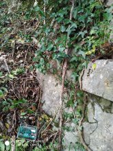


Ground level

slug
groundlevel

Measurement_e607ec61-d557-4bb4-9297-eac3b05d30f8

Measured radiation

0.107 µSv/h
geolocalisation :

43.291238279689, 5.3591322308251

Ground level
Yann29
Date de la mesure :
Latitude :
43.291238279689
Longitude :
5.3591322308251
Altitude (M) :
12.0
Measurement time :
2 minutes 40 secondes
Distance travelled :
186.35m
Measurement speed :
Measurement Environment :
En ville city
Weather :
Tags :
Description :
Temperature :
11.0°C
Hits number :
51
Mesure UUID :
e607ec61-d557-4bb4-9297-eac3b05d30f8
Manual Reporting :
No
Sensor / ID :
B915F499-BC96-9EBB-9603-1D017DA82411
Sensor / Firmware version :
AtomTag v.1.0.3
Sensor / Type :
Sensor / Tube type :
SBM-20
Smartphone / UUID :
BD2C896C-CF53-4C23-B10A-A484AFB22EE2
Smartphone / Platform :
ios
Smartphone / Model :
iPhone14,4
Smartphone / OS Version :
17.6.1
Position acurracy :
4.8
Measurement height above the ground (in meters) :
1.00
Altitude accuracy :
4.8
Mean qualification :
Ground level
Software version :
OpenRadiation app 3.0
Measured value :
0.107 µSv/h

Measurement_6b862c39-5c36-4148-9378-ae3c7eb5b78f

Measured radiation

0.132 µSv/h
geolocalisation :

37.0552199, 140.8880091

Ground level
radsafe
Date de la mesure :
Latitude :
37.0552199
Longitude :
140.8880091
Altitude (M) :
81.0
Measurement time :
2 minutes 44 secondes
Distance travelled :
0.00m
Measurement speed :
Measurement Environment :
À l'intérieur inside
Weather :
Tags :
Description :
Iwaki Washington Hotel at ICRP MC meeting
measurment image
Temperature :
22.0°C
Hits number :
55
Mesure UUID :
6b862c39-5c36-4148-9378-ae3c7eb5b78f
Manual Reporting :
No
Sensor / ID :
9a9854f2
Sensor / Firmware version :
RiumGM BLE -b
Sensor / Type :
Sensor / Tube type :
J305γβ
Smartphone / UUID :
15d43615f76f495f
Smartphone / Platform :
android
Smartphone / Model :
SM-X806N
Smartphone / OS Version :
14
Position acurracy :
13.9
Measurement height above the ground (in meters) :
1.00
Altitude accuracy :
13.9
Mean qualification :
Ground level
Software version :
OpenRadiation app 3.0
Measured value :
0.132 µSv/h

Measurement_a63b45ce-2ec1-48bd-8b20-9e5b5ec6afb7

Measured radiation

0.272 µSv/h
geolocalisation :

47.2385151, -1.5548192

Ground level
Alpharty
ATYPICAL MEASURE
Date de la mesure :
Latitude :
47.2385151
Longitude :
-1.5548192
Altitude (M) :
69.0
Measurement time :
1 minutes 15 secondes
Distance travelled :
85.99m
Measurement speed :
Measurement Environment :
En ville city
Weather :
rainy day Pluie
Tags :
Description :
Temperature :
7.0°C
Hits number :
51
Mesure UUID :
a63b45ce-2ec1-48bd-8b20-9e5b5ec6afb7
Manual Reporting :
No
Sensor / ID :
80:30:DC:4A:BB:CE
Sensor / Firmware version :
AtomTag v.1.0.3
Sensor / Type :
Sensor / Tube type :
SBM-20
Smartphone / UUID :
63eb68845b623e5e
Smartphone / Platform :
Android
Smartphone / Model :
SM-G930F
Smartphone / OS Version :
8.0.0
Position acurracy :
7.8
Measurement height above the ground (in meters) :
1.00
Altitude accuracy :
7.8
Mean qualification :
Ground level
Software version :
OpenRadiation app 2.3.4
Measured value :
0.272 µSv/h

Measurement_045f6443-0b4f-4acc-8815-186ecf1b4adb

Measured radiation

0.103 µSv/h
geolocalisation :

37.053416656609, 140.89392218791

Ground level
domlo
Date de la mesure :
Latitude :
37.053416656609
Longitude :
140.89392218791
Altitude (M) :
14.0
Measurement time :
3 minutes 5 secondes
Distance travelled :
126.60m
Measurement speed :
Measurement Environment :
En ville city
Weather :
Tags :
Description :
Temperature :
23.0°C
Hits number :
51
Mesure UUID :
045f6443-0b4f-4acc-8815-186ecf1b4adb
Manual Reporting :
No
Sensor / ID :
f7070a8b
Sensor / Firmware version :
RiumGM BLE -b
Sensor / Type :
Sensor / Tube type :
J305γβ
Smartphone / UUID :
25D6D089-B5C9-4503-94AC-843F9B493252
Smartphone / Platform :
ios
Smartphone / Model :
iPhone12,1
Smartphone / OS Version :
18.0.1
Position acurracy :
11.4
Measurement height above the ground (in meters) :
1.00
Altitude accuracy :
11.4
Mean qualification :
Ground level
Software version :
OpenRadiation app 3.0
Measured value :
0.103 µSv/h

Measurement_59e6dab4-74fa-45da-9836-909199329d56

Measured radiation

0.017 µSv/h
geolocalisation :

46.5871523, 0.3508231

Ground level
Fanche
Date de la mesure :
Latitude :
46.5871523
Longitude :
0.3508231
Altitude (M) :
124.0
Measurement time :
4 minutes 40 secondes
Distance travelled :
1068.96m
Measurement speed :
Measurement Environment :
Sur la route ontheroad
Weather :
Tags :
Description :
Temperature :
21.0°C
Hits number :
51
Mesure UUID :
59e6dab4-74fa-45da-9836-909199329d56
Manual Reporting :
No
Sensor / ID :
00163
Sensor / Firmware version :
OpengKIT71
Sensor / Type :
Sensor / Tube type :
SBM-20
Smartphone / UUID :
d404f9b3128dc3f5
Smartphone / Platform :
Android
Smartphone / Model :
SM-J330FN
Smartphone / OS Version :
8.0.0
Position acurracy :
4.0
Measurement height above the ground (in meters) :
1.00
Altitude accuracy :
4.0
Mean qualification :
Ground level
Software version :
OpenRadiation app 2.1.0
Measured value :
0.017 µSv/h

Measurement_f52a4ae5-5e90-4e17-bb93-892436b9f036

Measured radiation

0.057 µSv/h
geolocalisation :

42.9789251, 1.1230766

Ground level
MSKMPO
Date de la mesure :
Latitude :
42.9789251
Longitude :
1.1230766
Altitude (M) :
478.0
Measurement time :
3 minutes 9 secondes
Distance travelled :
5.56m
Measurement speed :
Measurement Environment :
En campagne countryside
Weather :
Tags :
Description :
Carrière de Lambege Saint-Girons 09
measurment image
Temperature :
19.0°C
Hits number :
54
Mesure UUID :
f52a4ae5-5e90-4e17-bb93-892436b9f036
Manual Reporting :
No
Sensor / ID :
000116
Sensor / Firmware version :
OG-KIT1
Sensor / Type :
Sensor / Tube type :
SBM-20
Smartphone / UUID :
a4ae3dc5297b42e4
Smartphone / Platform :
Android
Smartphone / Model :
Redmi Note 6 Pro
Smartphone / OS Version :
9
Position acurracy :
119.8
Measurement height above the ground (in meters) :
0.00
Altitude accuracy :
119.8
Mean qualification :
Ground level
Software version :
OpenRadiation app 2.3.1
Measured value :
0.057 µSv/h

Measurement_ff501aae-a5e9-41a9-a18a-6a1692865967

Measured radiation

0.204 µSv/h
geolocalisation :

43.313418333333, 11.309205

Ground level
Fanche
ATYPICAL MEASURE
Date de la mesure :
Latitude :
43.313418333333
Longitude :
11.309205
Altitude (M) :
247.0
Measurement time :
1 minutes 1 secondes
Distance travelled :
1271.49m
Measurement speed :
Measurement Environment :
Sur la route ontheroad
Weather :
Tags :
Description :
Temperature :
Hits number :
68
Mesure UUID :
ff501aae-a5e9-41a9-a18a-6a1692865967
Manual Reporting :
No
Sensor / ID :
safecast_id 2959
Sensor / Firmware version :
$BNRDD
Sensor / Type :
Sensor / Tube type :
Smartphone / UUID :
Smartphone / Platform :
Smartphone / Model :
Smartphone / OS Version :
Position acurracy :
7.0
Measurement height above the ground (in meters) :
1.00
Altitude accuracy :
7.0
Mean qualification :
Ground level
Software version :
openradiation.net/upload v0.9
Measured value :
0.204 µSv/h

Measurement_bfa47eec-b449-4411-b3d0-7f4d8b61cbe9

Measured radiation

0.259 µSv/h
geolocalisation :

41.898837692962, 12.47272517661

Ground level
Yann29
ATYPICAL MEASURE
Date de la mesure :
Latitude :
41.898837692962
Longitude :
12.47272517661
Altitude (M) :
14.0
Measurement time :
1 minutes 26 secondes
Distance travelled :
0.00m
Measurement speed :
Measurement Environment :
À l'intérieur inside
Weather :
Tags :
Description :
measurment image
Temperature :
25.0°C
Hits number :
51
Mesure UUID :
bfa47eec-b449-4411-b3d0-7f4d8b61cbe9
Manual Reporting :
No
Sensor / ID :
93677545
Sensor / Firmware version :
RiumGM BLE -b
Sensor / Type :
Sensor / Tube type :
J305γβ
Smartphone / UUID :
BD2C896C-CF53-4C23-B10A-A484AFB22EE2
Smartphone / Platform :
ios
Smartphone / Model :
iPhone14,4
Smartphone / OS Version :
17.6.1
Position acurracy :
35.0
Measurement height above the ground (in meters) :
1.00
Altitude accuracy :
35.0
Mean qualification :
Ground level
Software version :
OpenRadiation app 3.0
Measured value :
0.259 µSv/h

Measurement_08ad9b44-ed27-4de4-b626-def92ead87bd

Measured radiation

0.141 µSv/h
geolocalisation :

34.820795898642, 135.52671548579

Ground level
Date de la mesure :
Latitude :
34.820795898642
Longitude :
135.52671548579
Altitude (M) :
65.0
Measurement time :
2 minutes 21 secondes
Distance travelled :
0.00m
Measurement speed :
Measurement Environment :
À l'intérieur inside
Weather :
Tags :
Description :
Temperature :
24.0°C
Hits number :
50
Mesure UUID :
08ad9b44-ed27-4de4-b626-def92ead87bd
Manual Reporting :
No
Sensor / ID :
5a4fafdb
Sensor / Firmware version :
RiumGM BLE -b
Sensor / Type :
Sensor / Tube type :
J305γβ
Smartphone / UUID :
5E6767CF-23B8-4B88-8E98-CCF409E0D697
Smartphone / Platform :
ios
Smartphone / Model :
iPhone14,6
Smartphone / OS Version :
18.0.1
Position acurracy :
8.1
Measurement height above the ground (in meters) :
1.00
Altitude accuracy :
8.1
Mean qualification :
Ground level
Software version :
OpenRadiation app 3.0
Measured value :
0.141 µSv/h

Measurement_0dc47f3e-397a-41b4-ab99-7ec359286be5

Measured radiation

0.122 µSv/h
geolocalisation :

37.719952616093, 140.49901775896

Ground level
Elsagis
Date de la mesure :
Latitude :
37.719952616093
Longitude :
140.49901775896
Altitude (M) :
160.0
Measurement time :
5 minutes 32 secondes
Distance travelled :
3438.71m
Measurement speed :
Measurement Environment :
Sur la route ontheroad
Weather :
rainy day Pluie
Tags :
Description :
Temperature :
25.0°C
Hits number :
104
Mesure UUID :
0dc47f3e-397a-41b4-ab99-7ec359286be5
Manual Reporting :
No
Sensor / ID :
56537f24
Sensor / Firmware version :
RiumGM BLE -b
Sensor / Type :
Sensor / Tube type :
J305γβ
Smartphone / UUID :
7789B382-DDDE-4F29-8A72-13BD513F5284
Smartphone / Platform :
ios
Smartphone / Model :
iPhone12,3
Smartphone / OS Version :
17.6.1
Position acurracy :
10.2
Measurement height above the ground (in meters) :
1.00
Altitude accuracy :
10.2
Mean qualification :
Ground level
Software version :
OpenRadiation app 3.0
Measured value :
0.122 µSv/h