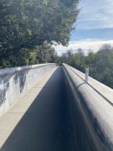


Ground level

slug
groundlevel

Measurement_f0fe2a37-4e21-4117-bc1d-56a755697cfb

Measured radiation

0.191 µSv/h
geolocalisation :

45.8057, 5.2135

Ground level
Date de la mesure :
Latitude :
45.8057
Longitude :
5.2135
Altitude (M) :
Measurement time :
Distance travelled :
Measurement speed :
Measurement Environment :
Weather :
Tags :
Description :
Temperature :
Hits number :
Mesure UUID :
f0fe2a37-4e21-4117-bc1d-56a755697cfb
Manual Reporting :
Yes
Sensor / ID :
GSR_securit1110001
Sensor / Firmware version :
RadiationD-v1.1(Cajoe)
Sensor / Type :
Sensor / Tube type :
j0305
Smartphone / UUID :
Smartphone / Platform :
Smartphone / Model :
Smartphone / OS Version :
Position acurracy :
Measurement height above the ground (in meters) :
Altitude accuracy :
Mean qualification :
Ground level
Software version :
Measured value :
0.191 µSv/h

Measurement_c46cf32d-4ab6-405b-ad32-6d4227739ba2

Measured radiation

0.062 µSv/h
geolocalisation :

45.7721, 5.1703

Ground level
Date de la mesure :
Latitude :
45.7721
Longitude :
5.1703
Altitude (M) :
Measurement time :
Distance travelled :
Measurement speed :
Measurement Environment :
Weather :
Tags :
Description :
Temperature :
Hits number :
Mesure UUID :
c46cf32d-4ab6-405b-ad32-6d4227739ba2
Manual Reporting :
Yes
Sensor / ID :
GSR_radio_02110001
Sensor / Firmware version :
RadiationD-v1.1(Cajoe)
Sensor / Type :
Sensor / Tube type :
j0305
Smartphone / UUID :
Smartphone / Platform :
Smartphone / Model :
Smartphone / OS Version :
Position acurracy :
Measurement height above the ground (in meters) :
Altitude accuracy :
Mean qualification :
Ground level
Software version :
Measured value :
0.062 µSv/h

Measurement_18201aef-4a8a-43d2-a895-1d5a0b254275

Measured radiation

2.871 µSv/h
geolocalisation :

61.2404384, 46.5419249

Ground level
Fanche
ATYPICAL MEASURE
Date de la mesure :
Latitude :
61.2404384
Longitude :
46.5419249
Altitude (M) :
0.0
Measurement time :
1 minutes 44 secondes
Distance travelled :
Measurement speed :
Measurement Environment :
Weather :
Tags :
Description :
Temperature :
Hits number :
747
Mesure UUID :
18201aef-4a8a-43d2-a895-1d5a0b254275
Manual Reporting :
No
Sensor / ID :
000115
Sensor / Firmware version :
OG-KIT1
Sensor / Type :
Sensor / Tube type :
SBM-20
Smartphone / UUID :
00D109DE-DB4A-4F5D-BD30-99D5A8896796
Smartphone / Platform :
iOS
Smartphone / Model :
iPhone8,4
Smartphone / OS Version :
12.0.1
Position acurracy :
149000.0
Measurement height above the ground (in meters) :
Altitude accuracy :
149000.0
Mean qualification :
Ground level
Software version :
OpenRadiation app 1.0.0
Measured value :
2.871 µSv/h

Measurement_fffe40b1-e183-4e4d-a243-161449776834

Measured radiation

2.362 µSv/h
geolocalisation :

59.704976666667, 107.20141833333

Ground level
Fanche
ATYPICAL MEASURE
Date de la mesure :
Latitude :
59.704976666667
Longitude :
107.20141833333
Altitude (M) :
10030.0
Measurement time :
1 minutes 1 secondes
Distance travelled :
16231.80m
Measurement speed :
Measurement Environment :
En campagne countryside
Weather :
Tags :
Description :
Temperature :
Hits number :
789
Mesure UUID :
fffe40b1-e183-4e4d-a243-161449776834
Manual Reporting :
No
Sensor / ID :
safecast_id 2344
Sensor / Firmware version :
$BNRDD
Sensor / Type :
Sensor / Tube type :
Smartphone / UUID :
Smartphone / Platform :
Smartphone / Model :
Smartphone / OS Version :
Position acurracy :
10.0
Measurement height above the ground (in meters) :
1.00
Altitude accuracy :
10.0
Mean qualification :
Ground level
Software version :
openradiation.net/upload v0.9
Measured value :
2.362 µSv/h

Measurement_69d74155-8808-43c2-b63a-f008e930843b

Measured radiation

0.572 µSv/h
geolocalisation :

45.1851864, 5.7112454

Ground level
Aime38
ATYPICAL MEASURE
Date de la mesure :
Latitude :
45.1851864
Longitude :
5.7112454
Altitude (M) :
264.0
Measurement time :
12 minutes 9 secondes
Distance travelled :
1.76m
Measurement speed :
Measurement Environment :
Weather :
Tags :
Description :
Temperature :
13.0°C
Hits number :
1161
Mesure UUID :
69d74155-8808-43c2-b63a-f008e930843b
Manual Reporting :
No
Sensor / ID :
00225
Sensor / Firmware version :
OpengKIT71
Sensor / Type :
Sensor / Tube type :
SBM-20
Smartphone / UUID :
e724ae2d7062242a
Smartphone / Platform :
Android
Smartphone / Model :
H8314
Smartphone / OS Version :
10
Position acurracy :
12.7
Measurement height above the ground (in meters) :
Altitude accuracy :
12.7
Mean qualification :
Ground level
Software version :
OpenRadiation app 2.3.1
Measured value :
0.572 µSv/h

Measurement_f4dc40d2-241b-4307-93d0-6466fb6f9e5c

Measured radiation

0.218 µSv/h
geolocalisation :

43.706410641811, 3.5598923704038

Ground level
domlo
ATYPICAL MEASURE
Date de la mesure :
Latitude :
43.706410641811
Longitude :
3.5598923704038
Altitude (M) :
62.0
Measurement time :
1 minutes 38 secondes
Distance travelled :
0.00m
Measurement speed :
Measurement Environment :
En campagne countryside
Weather :
Tags :
Description :
pont des anges
measurment image
Temperature :
20.0°C
Hits number :
50
Mesure UUID :
f4dc40d2-241b-4307-93d0-6466fb6f9e5c
Manual Reporting :
No
Sensor / ID :
41007bbe
Sensor / Firmware version :
RiumGM BLE -b
Sensor / Type :
Sensor / Tube type :
J305γβ
Smartphone / UUID :
F2F0E7EB-7961-450A-A274-5E99CBD951C1
Smartphone / Platform :
ios
Smartphone / Model :
iPhone12,1
Smartphone / OS Version :
18.1.1
Position acurracy :
11.6
Measurement height above the ground (in meters) :
1.00
Altitude accuracy :
11.6
Mean qualification :
Ground level
Software version :
OpenRadiation app 3.0
Measured value :
0.218 µSv/h

Measurement_2cbf4ed5-af5a-10b0-1d47-d3b3e6e845ef

Measured radiation

0.098 µSv/h
geolocalisation :

50.672861, 3.204542

Ground level
renichuss
Date de la mesure :
Latitude :
50.672861
Longitude :
3.204542
Altitude (M) :
42.0
Measurement time :
10 minutes
Distance travelled :
0.00m
Measurement speed :
Measurement Environment :
À l'intérieur inside
Weather :
Tags :
Description :
Temperature :
Hits number :
235
Mesure UUID :
2cbf4ed5-af5a-10b0-1d47-d3b3e6e845ef
Manual Reporting :
No
Sensor / ID :
b183cbc2-e56f-4308-862a-3fd17716e5b1
Sensor / Firmware version :
RadMon v1.6
Sensor / Type :
Sensor / Tube type :
SBM-20
Smartphone / UUID :
Smartphone / Platform :
Smartphone / Model :
Smartphone / OS Version :
Position acurracy :
20.0
Measurement height above the ground (in meters) :
1.00
Altitude accuracy :
20.0
Mean qualification :
Ground level
Software version :
RadMon v1.6-backport1.8-2025-a38d
Measured value :
0.098 µSv/h

Measurement_d691c067-cc28-ab9d-a448-01320e799c60

Measured radiation

0.096 µSv/h
geolocalisation :

50.672861, 3.204542

Ground level
renichuss
Date de la mesure :
Latitude :
50.672861
Longitude :
3.204542
Altitude (M) :
42.0
Measurement time :
10 minutes
Distance travelled :
0.00m
Measurement speed :
Measurement Environment :
À l'intérieur inside
Weather :
Tags :
Description :
Temperature :
Hits number :
232
Mesure UUID :
d691c067-cc28-ab9d-a448-01320e799c60
Manual Reporting :
No
Sensor / ID :
b183cbc2-e56f-4308-862a-3fd17716e5b1
Sensor / Firmware version :
RadMon v1.6
Sensor / Type :
Sensor / Tube type :
SBM-20
Smartphone / UUID :
Smartphone / Platform :
Smartphone / Model :
Smartphone / OS Version :
Position acurracy :
20.0
Measurement height above the ground (in meters) :
1.00
Altitude accuracy :
20.0
Mean qualification :
Ground level
Software version :
RadMon v1.6-backport1.8-2025-a38d
Measured value :
0.096 µSv/h

Measurement_ffcecb70-1cb6-421d-a3ed-4f1683806350

Measured radiation

0.210 µSv/h
geolocalisation :

47.252095, 4.5560966666667

Ground level
Fanche
ATYPICAL MEASURE
Date de la mesure :
Latitude :
47.252095
Longitude :
4.5560966666667
Altitude (M) :
404.0
Measurement time :
1 minutes
Distance travelled :
1867.48m
Measurement speed :
Measurement Environment :
Sur la route ontheroad
Weather :
rainy day Pluie
Tags :
Description :
Temperature :
Hits number :
70
Mesure UUID :
ffcecb70-1cb6-421d-a3ed-4f1683806350
Manual Reporting :
No
Sensor / ID :
safecast_id 3220
Sensor / Firmware version :
$BNRDD
Sensor / Type :
Sensor / Tube type :
Smartphone / UUID :
Smartphone / Platform :
Smartphone / Model :
Smartphone / OS Version :
Position acurracy :
10.0
Measurement height above the ground (in meters) :
1.00
Altitude accuracy :
10.0
Mean qualification :
Ground level
Software version :
openradiation.net/upload v0.9
Measured value :
0.210 µSv/h

Measurement_ffe5ff7f-50d0-4c09-ac85-6c1683727768

Measured radiation

0.201 µSv/h
geolocalisation :

47.288311666667, 4.5073366666667

Ground level
Fanche
ATYPICAL MEASURE
Date de la mesure :
Latitude :
47.288311666667
Longitude :
4.5073366666667
Altitude (M) :
352.0
Measurement time :
1 minutes
Distance travelled :
2103.26m
Measurement speed :
Measurement Environment :
Sur la route ontheroad
Weather :
rainy day Pluie
Tags :
Description :
Temperature :
Hits number :
67
Mesure UUID :
ffe5ff7f-50d0-4c09-ac85-6c1683727768
Manual Reporting :
No
Sensor / ID :
safecast_id 3220
Sensor / Firmware version :
$BNRDD
Sensor / Type :
Sensor / Tube type :
Smartphone / UUID :
Smartphone / Platform :
Smartphone / Model :
Smartphone / OS Version :
Position acurracy :
8.0
Measurement height above the ground (in meters) :
1.00
Altitude accuracy :
8.0
Mean qualification :
Ground level
Software version :
openradiation.net/upload v0.9
Measured value :
0.201 µSv/h