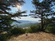


Ground level

slug
groundlevel

Measurement_090bfd0d-9331-4927-a089-21b9d9220caa

Measured radiation

0.184 µSv/h
geolocalisation :

42.7032074, 9.4467886

Ground level
giocante_1
Date de la mesure :
Latitude :
42.7032074
Longitude :
9.4467886
Altitude (M) :
-11.0
Measurement time :
6 minutes 29 secondes
Distance travelled :
176.21m
Measurement speed :
Measurement Environment :
À l'intérieur inside
Weather :
Tags :
Description :
Temperature :
19.0°C
Hits number :
172
Mesure UUID :
090bfd0d-9331-4927-a089-21b9d9220caa
Manual Reporting :
No
Sensor / ID :
e4e9c4df
Sensor / Firmware version :
RiumGM BLE -b
Sensor / Type :
Sensor / Tube type :
J305γβ
Smartphone / UUID :
25eac9e9f708ad66
Smartphone / Platform :
android
Smartphone / Model :
SM-S901B
Smartphone / OS Version :
14
Position acurracy :
20.0
Measurement height above the ground (in meters) :
1.00
Altitude accuracy :
20.0
Mean qualification :
Ground level
Software version :
OpenRadiation app 3.0
Measured value :
0.184 µSv/h

Measurement_c5717986-c116-4be3-986c-3d99c7ff4c0d

Measured radiation

0.076 µSv/h
geolocalisation :

47.5532119, 4.8350431

Ground level
Fanche
Date de la mesure :
Latitude :
47.5532119
Longitude :
4.8350431
Altitude (M) :
450.0
Measurement time :
2 minutes 32 secondes
Distance travelled :
885.22m
Measurement speed :
Measurement Environment :
Sur la route ontheroad
Weather :
rainy day Pluie
Tags :
Description :
Temperature :
30.0°C
Hits number :
51
Mesure UUID :
c5717986-c116-4be3-986c-3d99c7ff4c0d
Manual Reporting :
No
Sensor / ID :
00151
Sensor / Firmware version :
OpengKIT71
Sensor / Type :
Sensor / Tube type :
SBM-20
Smartphone / UUID :
d404f9b3128dc3f5
Smartphone / Platform :
Android
Smartphone / Model :
SM-J330FN
Smartphone / OS Version :
8.0.0
Position acurracy :
2.3
Measurement height above the ground (in meters) :
1.00
Altitude accuracy :
2.3
Mean qualification :
Ground level
Software version :
OpenRadiation app 2.3.1
Measured value :
0.076 µSv/h

Measurement_5d8c2e87-2756-4e3f-a3ff-a1e5b2939453

Measured radiation

0.035 µSv/h
geolocalisation :

44.841186492493, -0.60158891077366

Ground level
Yann29
Date de la mesure :
Latitude :
44.841186492493
Longitude :
-0.60158891077366
Altitude (M) :
43.0
Measurement time :
10 minutes 24 secondes
Distance travelled :
0.00m
Measurement speed :
Measurement Environment :
À l'intérieur inside
Weather :
Tags :
Description :
Temperature :
25.0°C
Hits number :
110
Mesure UUID :
5d8c2e87-2756-4e3f-a3ff-a1e5b2939453
Manual Reporting :
No
Sensor / ID :
Sensor / Firmware version :
OpengKIT72
Sensor / Type :
Sensor / Tube type :
Smartphone / UUID :
ECD4A24E-D8E9-4EA4-B33D-59F462068F44
Smartphone / Platform :
ios
Smartphone / Model :
iPhone14,4
Smartphone / OS Version :
18.3.1
Position acurracy :
17.5
Measurement height above the ground (in meters) :
1.00
Altitude accuracy :
17.5
Mean qualification :
Ground level
Software version :
OpenRadiation app 3.0
Measured value :
0.035 µSv/h

Measurement_ff8484b0-872d-487b-af8b-b21664542811

Measured radiation

0.102 µSv/h
geolocalisation :

48.819125, 2.3278433333333

Ground level
Fanche
Date de la mesure :
Latitude :
48.819125
Longitude :
2.3278433333333
Altitude (M) :
176.0
Measurement time :
5 minutes 16 secondes
Distance travelled :
141.17m
Measurement speed :
Measurement Environment :
En ville city
Weather :
Tags :
Description :
Temperature :
Hits number :
34
Mesure UUID :
ff8484b0-872d-487b-af8b-b21664542811
Manual Reporting :
No
Sensor / ID :
safecast_id 3220
Sensor / Firmware version :
$BNRDD
Sensor / Type :
Sensor / Tube type :
Smartphone / UUID :
Smartphone / Platform :
Smartphone / Model :
Smartphone / OS Version :
Position acurracy :
4.0
Measurement height above the ground (in meters) :
1.00
Altitude accuracy :
4.0
Mean qualification :
Ground level
Software version :
openradiation.net/upload v0.9
Measured value :
0.102 µSv/h

Measurement_40c5992e-18a9-4c87-a2d6-69b628614d6a

Measured radiation

0.057 µSv/h
geolocalisation :

43.967657002264, 3.0002821643846

Ground level
domlo
Date de la mesure :
Latitude :
43.967657002264
Longitude :
3.0002821643846
Altitude (M) :
778.0
Measurement time :
3 minutes 59 secondes
Distance travelled :
0.00m
Measurement speed :
Measurement Environment :
En campagne countryside
Weather :
Tags :
Description :
Combalou
measurment image
Temperature :
37.0°C
Hits number :
68
Mesure UUID :
40c5992e-18a9-4c87-a2d6-69b628614d6a
Manual Reporting :
No
Sensor / ID :
00164
Sensor / Firmware version :
OpengKIT71
Sensor / Type :
Sensor / Tube type :
SBM-20
Smartphone / UUID :
37C525FD-5749-4F9D-AC22-87318DD67A00
Smartphone / Platform :
iOS
Smartphone / Model :
iPhone12,1
Smartphone / OS Version :
15.6
Position acurracy :
20.8
Measurement height above the ground (in meters) :
0.00
Altitude accuracy :
20.8
Mean qualification :
Ground level
Software version :
OpenRadiation app 2.3.4
Measured value :
0.057 µSv/h

Measurement_9b677daa-1853-46b0-b0cb-99fac4bd66a6

Measured radiation

0.080 µSv/h
geolocalisation :

45.145290610423, -0.64438831061185

Ground level
Xavier CLIN-B
Date de la mesure :
Latitude :
45.145290610423
Longitude :
-0.64438831061185
Altitude (M) :
15.0
Measurement time :
5 minutes 17 secondes
Distance travelled :
8.11m
Measurement speed :
Measurement Environment :
En ville city
Weather :
Tags :
Description :
Temperature :
37.0°C
Hits number :
109
Mesure UUID :
9b677daa-1853-46b0-b0cb-99fac4bd66a6
Manual Reporting :
No
Sensor / ID :
00184
Sensor / Firmware version :
OpengKIT71
Sensor / Type :
Sensor / Tube type :
SBM-20
Smartphone / UUID :
E0E54D9E-88DC-47E3-88C9-5D26780EF8F6
Smartphone / Platform :
iOS
Smartphone / Model :
iPhone8,1
Smartphone / OS Version :
13.6.1
Position acurracy :
5.0
Measurement height above the ground (in meters) :
0.00
Altitude accuracy :
5.0
Mean qualification :
Ground level
Software version :
OpenRadiation app 2.3.3
Measured value :
0.080 µSv/h

Measurement_ea2b538d-7327-4ca0-a102-ca7479c09ff8

Measured radiation

0.104 µSv/h
geolocalisation :

45.143357282546, -0.64628614112795

Ground level
Date de la mesure :
Latitude :
45.143357282546
Longitude :
-0.64628614112795
Altitude (M) :
-5.0
Measurement time :
15 minutes 37 secondes
Distance travelled :
19.64m
Measurement speed :
Measurement Environment :
À l'intérieur inside
Weather :
Tags :
Description :
Temperature :
21.0°C
Hits number :
261
Mesure UUID :
ea2b538d-7327-4ca0-a102-ca7479c09ff8
Manual Reporting :
No
Sensor / ID :
b8cfaadf
Sensor / Firmware version :
RiumGM BLE -b
Sensor / Type :
Sensor / Tube type :
J305γβ
Smartphone / UUID :
E3E0E197-803E-45BA-AAC3-058F095198F2
Smartphone / Platform :
ios
Smartphone / Model :
iPhone14,7
Smartphone / OS Version :
17.6.1
Position acurracy :
39.4
Measurement height above the ground (in meters) :
1.00
Altitude accuracy :
39.4
Mean qualification :
Ground level
Software version :
OpenRadiation app 3.0
Measured value :
0.104 µSv/h

Measurement_ffb5933f-de01-4b6c-a2d5-321648826368

Measured radiation

0.093 µSv/h
geolocalisation :

48.865223333333, 1.7906066666667

Ground level
Fanche
Date de la mesure :
Latitude :
48.865223333333
Longitude :
1.7906066666667
Altitude (M) :
162.0
Measurement time :
1 minutes 1 secondes
Distance travelled :
583.87m
Measurement speed :
Measurement Environment :
Sur la route ontheroad
Weather :
rainy day Pluie
Tags :
Description :
Temperature :
Hits number :
31
Mesure UUID :
ffb5933f-de01-4b6c-a2d5-321648826368
Manual Reporting :
No
Sensor / ID :
safecast_id 3220
Sensor / Firmware version :
$BNRDD
Sensor / Type :
Sensor / Tube type :
Smartphone / UUID :
Smartphone / Platform :
Smartphone / Model :
Smartphone / OS Version :
Position acurracy :
7.0
Measurement height above the ground (in meters) :
1.00
Altitude accuracy :
7.0
Mean qualification :
Ground level
Software version :
openradiation.net/upload v0.9
Measured value :
0.093 µSv/h

Measurement_ff10833a-376c-4873-ab9a-d41575017583

Measured radiation

5.780 µSv/h
geolocalisation :

42.30642, 9.1489733333333

Ground level
Ginou
ATYPICAL MEASURE
Date de la mesure :
Latitude :
42.30642
Longitude :
9.1489733333333
Altitude (M) :
469.0
Measurement time :
1 minutes
Distance travelled :
15.94m
Measurement speed :
Measurement Environment :
En ville city
Weather :
Tags :
Description :
mesure en ville
Temperature :
Hits number :
1929
Mesure UUID :
ff10833a-376c-4873-ab9a-d41575017583
Manual Reporting :
No
Sensor / ID :
safecast_id 1087
Sensor / Firmware version :
$BNRDD
Sensor / Type :
Sensor / Tube type :
Smartphone / UUID :
Smartphone / Platform :
Smartphone / Model :
Smartphone / OS Version :
Position acurracy :
5.0
Measurement height above the ground (in meters) :
1.00
Altitude accuracy :
5.0
Mean qualification :
Ground level
Software version :
openradiation.net/upload v0.7
Measured value :
5.780 µSv/h

Measurement_1f3ccb91-4e01-4eda-a7a5-c15c3a95de47

Measured radiation

0.223 µSv/h
geolocalisation :

47.58743899854, 2.8080287556846

Ground level
Hobert
ATYPICAL MEASURE
Date de la mesure :
Latitude :
47.58743899854
Longitude :
2.8080287556846
Altitude (M) :
156.0
Measurement time :
1 minutes 38 secondes
Distance travelled :
2244.92m
Measurement speed :
Measurement Environment :
Sur la route ontheroad
Weather :
Tags :
Description :
Temperature :
17.0°C
Hits number :
51
Mesure UUID :
1f3ccb91-4e01-4eda-a7a5-c15c3a95de47
Manual Reporting :
No
Sensor / ID :
57063ce3
Sensor / Firmware version :
RiumGM BLE -b
Sensor / Type :
Sensor / Tube type :
J305γβ
Smartphone / UUID :
099DFCB7-1478-4415-9D8B-B22AC1148A94
Smartphone / Platform :
ios
Smartphone / Model :
iPhone9,3
Smartphone / OS Version :
15.8.3
Position acurracy :
8.0
Measurement height above the ground (in meters) :
1.00
Altitude accuracy :
8.0
Mean qualification :
Ground level
Software version :
OpenRadiation app 3.0
Measured value :
0.223 µSv/h