


city

icone_mesure
slug
city

Measurement_ffb764a5-85ef-4a29-a5a5-8b1749020008

Measured radiation

0.347 µSv/h
geolocalisation :

48.810108333333, 2.2977216666667

Ground level
Fanche
ATYPICAL MEASURE
Date de la mesure :
Latitude :
48.810108333333
Longitude :
2.2977216666667
Altitude (M) :
104.0
Measurement time :
1 minutes
Distance travelled :
116.01m
Measurement speed :
Measurement Environment :
En ville city
Weather :
Tags :
Description :
Temperature :
Hits number :
116
Mesure UUID :
ffb764a5-85ef-4a29-a5a5-8b1749020008
Manual Reporting :
No
Sensor / ID :
safecast_id 1223
Sensor / Firmware version :
$BNRDD
Sensor / Type :
Sensor / Tube type :
Smartphone / UUID :
Smartphone / Platform :
Smartphone / Model :
Smartphone / OS Version :
Position acurracy :
11.0
Measurement height above the ground (in meters) :
1.00
Altitude accuracy :
11.0
Mean qualification :
Ground level
Software version :
openradiation.net/upload v0.9
Measured value :
0.347 µSv/h
Measurement_ffb764a5-85ef-4a29-a5a5-8b1749020008

Measured radiation

0.347 µSv/h
geolocalisation :

48.810108333333, 2.2977216666667

Ground level
Fanche
ATYPICAL MEASURE
Date de la mesure :
Latitude :
48.810108333333
Longitude :
2.2977216666667
Altitude (M) :
104.0
Measurement time :
1 minutes
Distance travelled :
116.01m
Measurement speed :
Measurement Environment :
En ville city
Weather :
Tags :
Description :
Temperature :
Hits number :
116
Mesure UUID :
ffb764a5-85ef-4a29-a5a5-8b1749020008
Manual Reporting :
No
Sensor / ID :
safecast_id 1223
Sensor / Firmware version :
$BNRDD
Sensor / Type :
Sensor / Tube type :
Smartphone / UUID :
Smartphone / Platform :
Smartphone / Model :
Smartphone / OS Version :
Position acurracy :
11.0
Measurement height above the ground (in meters) :
1.00
Altitude accuracy :
11.0
Mean qualification :
Ground level
Software version :
openradiation.net/upload v0.9
Measured value :
0.347 µSv/h

Measurement_ffb764a5-85ef-4a29-a5a5-8b1749020068

Measured radiation

0.323 µSv/h
geolocalisation :

48.810505, 2.299185

Ground level
Fanche
ATYPICAL MEASURE
Date de la mesure :
Latitude :
48.810505
Longitude :
2.299185
Altitude (M) :
106.0
Measurement time :
1 minutes
Distance travelled :
82.43m
Measurement speed :
Measurement Environment :
En ville city
Weather :
Tags :
Description :
Temperature :
Hits number :
108
Mesure UUID :
ffb764a5-85ef-4a29-a5a5-8b1749020068
Manual Reporting :
No
Sensor / ID :
safecast_id 1223
Sensor / Firmware version :
$BNRDD
Sensor / Type :
Sensor / Tube type :
Smartphone / UUID :
Smartphone / Platform :
Smartphone / Model :
Smartphone / OS Version :
Position acurracy :
10.0
Measurement height above the ground (in meters) :
1.00
Altitude accuracy :
10.0
Mean qualification :
Ground level
Software version :
openradiation.net/upload v0.9
Measured value :
0.323 µSv/h

Measurement_ffb764a5-85ef-4a29-a5a5-8b1749020068

Measured radiation

0.323 µSv/h
geolocalisation :

48.810505, 2.299185

Ground level
Fanche
ATYPICAL MEASURE
Date de la mesure :
Latitude :
48.810505
Longitude :
2.299185
Altitude (M) :
106.0
Measurement time :
1 minutes
Distance travelled :
82.43m
Measurement speed :
Measurement Environment :
En ville city
Weather :
Tags :
Description :
Temperature :
Hits number :
108
Mesure UUID :
ffb764a5-85ef-4a29-a5a5-8b1749020068
Manual Reporting :
No
Sensor / ID :
safecast_id 1223
Sensor / Firmware version :
$BNRDD
Sensor / Type :
Sensor / Tube type :
Smartphone / UUID :
Smartphone / Platform :
Smartphone / Model :
Smartphone / OS Version :
Position acurracy :
10.0
Measurement height above the ground (in meters) :
1.00
Altitude accuracy :
10.0
Mean qualification :
Ground level
Software version :
openradiation.net/upload v0.9
Measured value :
0.323 µSv/h

Measurement_c18f5db9-ff3c-4dac-ab56-e34c85bdd427

Measured radiation

0.123 µSv/h
geolocalisation :

53.345554872822, -6.2638963353804

Ground level
domlo
Date de la mesure :
Latitude :
53.345554872822
Longitude :
-6.2638963353804
Altitude (M) :
8.0
Measurement time :
6 minutes 19 secondes
Distance travelled :
183.39m
Measurement speed :
Measurement Environment :
En ville city
Weather :
Tags :
Description :
Temperature :
26.0°C
Hits number :
120
Mesure UUID :
c18f5db9-ff3c-4dac-ab56-e34c85bdd427
Manual Reporting :
No
Sensor / ID :
751f70e7
Sensor / Firmware version :
RiumGM BLE -b
Sensor / Type :
Sensor / Tube type :
J305γβ
Smartphone / UUID :
37C525FD-5749-4F9D-AC22-87318DD67A00
Smartphone / Platform :
iOS
Smartphone / Model :
iPhone12,1
Smartphone / OS Version :
16.6.1
Position acurracy :
35.0
Measurement height above the ground (in meters) :
1.00
Altitude accuracy :
35.0
Mean qualification :
Ground level
Software version :
OpenRadiation app 2.3.4
Measured value :
0.123 µSv/h

Measurement_ff9ee6b9-183c-48ff-acdf-fa1679746290

Measured radiation

0.290 µSv/h
geolocalisation :

48.844661666667, 2.2931666666667

Ground level
Fanche
ATYPICAL MEASURE
Date de la mesure :
Latitude :
48.844661666667
Longitude :
2.2931666666667
Altitude (M) :
52.0
Measurement time :
1 minutes
Distance travelled :
64.03m
Measurement speed :
Measurement Environment :
En ville city
Weather :
Tags :
Description :
Temperature :
Hits number :
97
Mesure UUID :
ff9ee6b9-183c-48ff-acdf-fa1679746290
Manual Reporting :
No
Sensor / ID :
safecast_id 1223
Sensor / Firmware version :
$BNRDD
Sensor / Type :
Sensor / Tube type :
Smartphone / UUID :
Smartphone / Platform :
Smartphone / Model :
Smartphone / OS Version :
Position acurracy :
7.0
Measurement height above the ground (in meters) :
1.00
Altitude accuracy :
7.0
Mean qualification :
Ground level
Software version :
openradiation.net/upload v0.9
Measured value :
0.290 µSv/h

Measurement_f0edf1f3-d332-48f4-91c9-792f2eaf0b05

Measured radiation

0.120 µSv/h
geolocalisation :

47.1993959, -1.5732702

Ground level
labsciren
Date de la mesure :
Latitude :
47.1993959
Longitude :
-1.5732702
Altitude (M) :
53.0
Measurement time :
2 minutes 53 secondes
Distance travelled :
379.58m
Measurement speed :
Measurement Environment :
En ville city
Weather :
Tags :
Description :
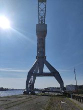
devant la grue grise
measurment image
Temperature :
28.0°C
Hits number :
54
Mesure UUID :
f0edf1f3-d332-48f4-91c9-792f2eaf0b05
Manual Reporting :
No
Sensor / ID :
7c805ac0
Sensor / Firmware version :
RiumGM BLE -b
Sensor / Type :
Sensor / Tube type :
J305γβ
Smartphone / UUID :
20735809be10aad8
Smartphone / Platform :
Android
Smartphone / Model :
M2007J20CG
Smartphone / OS Version :
12
Position acurracy :
5.9
Measurement height above the ground (in meters) :
1.00
Altitude accuracy :
5.9
Mean qualification :
Ground level
Software version :
OpenRadiation app 2.3.4
Measured value :
0.120 µSv/h

Measurement_505b8f12-40a0-4a92-8e85-a94670bda0bc

Measured radiation

0.172 µSv/h
geolocalisation :

47.200905, -1.5856782

Ground level
labsciren
Date de la mesure :
Latitude :
47.200905
Longitude :
-1.5856782
Altitude (M) :
85.0
Measurement time :
2 minutes
Distance travelled :
0.00m
Measurement speed :
Measurement Environment :
En ville city
Weather :
Tags :
Description :
Temperature :
32.0°C
Hits number :
50
Mesure UUID :
505b8f12-40a0-4a92-8e85-a94670bda0bc
Manual Reporting :
No
Sensor / ID :
590993b1
Sensor / Firmware version :
RiumGM BLE -b
Sensor / Type :
Sensor / Tube type :
J305γβ
Smartphone / UUID :
165cefbabc65b11e
Smartphone / Platform :
android
Smartphone / Model :
SM-A217F
Smartphone / OS Version :
12
Position acurracy :
12.5
Measurement height above the ground (in meters) :
1.00
Altitude accuracy :
12.5
Mean qualification :
Ground level
Software version :
OpenRadiation app 3.0
Measured value :
0.172 µSv/h

Measurement_ff1500aa-23af-487a-a606-9d1701187869

Measured radiation

2.195 µSv/h
geolocalisation :

42.163768333333, 62.980905

Ground level
Fanche
ATYPICAL MEASURE
Date de la mesure :
Latitude :
42.163768333333
Longitude :
62.980905
Altitude (M) :
10690.0
Measurement time :
1 minutes
Distance travelled :
15483.30m
Measurement speed :
Measurement Environment :
En ville city
Weather :
Tags :
Description :
Temperature :
Hits number :
733
Mesure UUID :
ff1500aa-23af-487a-a606-9d1701187869
Manual Reporting :
No
Sensor / ID :
safecast_id 3220
Sensor / Firmware version :
$BNRDD
Sensor / Type :
Sensor / Tube type :
Smartphone / UUID :
Smartphone / Platform :
Smartphone / Model :
Smartphone / OS Version :
Position acurracy :
6.0
Measurement height above the ground (in meters) :
1.00
Altitude accuracy :
6.0
Mean qualification :
Ground level
Software version :
openradiation.net/upload v0.9
Measured value :
2.195 µSv/h

Measurement_d80aebdd-1182-4e6d-a083-fb34220ebc71

Measured radiation

0.094 µSv/h
geolocalisation :

45.505226103507, -73.584967547924

Ground level
Hobert
Date de la mesure :
Latitude :
45.505226103507
Longitude :
-73.584967547924
Altitude (M) :
82.0
Measurement time :
3 minutes 17 secondes
Distance travelled :
41.11m
Measurement speed :
Measurement Environment :
En ville city
Weather :
Tags :
Description :
Temperature :
27.0°C
Hits number :
51
Mesure UUID :
d80aebdd-1182-4e6d-a083-fb34220ebc71
Manual Reporting :
No
Sensor / ID :
57063ce3
Sensor / Firmware version :
RiumGM BLE -b
Sensor / Type :
Sensor / Tube type :
J305γβ
Smartphone / UUID :
099DFCB7-1478-4415-9D8B-B22AC1148A94
Smartphone / Platform :
ios
Smartphone / Model :
iPhone9,3
Smartphone / OS Version :
15.8.4
Position acurracy :
32.0
Measurement height above the ground (in meters) :
1.00
Altitude accuracy :
32.0
Mean qualification :
Ground level
Software version :
OpenRadiation app 3.0
Measured value :
0.094 µSv/h